TopoQuest Logo
Do you find TopoQuest useful?
Help keep TopoQuest running and adding new maps/features by donating!
Bitcoin:  19c7KJd3qBynnjoSw5npx9KScwjBe4ifkT
Litecoin:  LXs6TkuXGGXo1vDsWCkWVdjQX94eUKd6ui
Home View Maps Find Maps Find Places Resources & Links


Jersey, Georgia Topographic Map

USGS Map Title: Jersey, GA
USGS Map MRC: 33083F7
DRG (GeoTIFF) Download: o33083f7.tif


Neighboring USGS Topographic Map Quads:


  Loganville, GA  
33083G8
 

  Between, GA  
33083G7
 

  Monroe, GA  
33083G6
 

  Milstead, GA  
33083F8
 

  Jersey, GA  
33083F7
 

  Social Circle, GA  
33083F6
 

  Porterdale, GA  
33083E8
 

  Covington, GA  
33083E7
 

  Mansfield, GA  
33083E6


Map MRC Location:

N34°
W84°
N34°
W83°
H8 H7 H6 H5 H4 H3 H2 H1
G8 G7 G6 G5 G4 G3 G2 G1
F8 F7 F6 F5 F4 F3 F2 F1
E8 E7 E6 E5 E4 E3 E2 E1
D8 D7 D6 D5 D4 D3 D2 D1
C8 C7 C6 C5 C4 C3 C2 C1
B8 B7 B6 B5 B4 B3 B2 B1
A8 A7 A6 A5 A4 A3 A2 A1
N33°
W84°
N33°
W83°

Jersey, GA USGS 1:24K Topographic Map Preview:
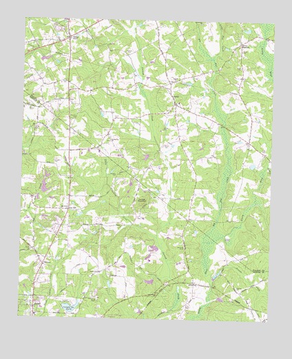
Jersey, GA USGS Topographic Map
Click on map above to begin viewing in our Map Viewer.

This topographic map contains these locations and features:
Feature Name Type Latitude Longitude GNIS ID View Map
Airport GrovePopulated PlaceN33.6471°W83.8449°1673411View Map
AlcovyPopulated PlaceN33.6398°W83.7868°326153View Map
Alcovy AirportAirportN33.6742°W83.7641°2625401View Map
Alcovy ChurchChurchN33.6551°W83.7924°354274View Map
Alcovy ChurchChurchN33.7412°W83.7663°342648View Map
Alcovy MountainPopulated PlaceN33.7407°W83.7663°331011View Map
Andrew HallBuildingN33.6301°W83.8730°1673416View Map
Bailey Family CemeteryCemeteryN33.7043°W83.8691°310723View Map
Big Flat CreekStreamN33.6579°W83.7824°311383View Map
Brewer CemeteryCemeteryN33.7374°W83.7657°311755View Map
BriarpatchPopulated PlaceN33.6321°W83.8193°1673431View Map
Brodnax CemeteryCemeteryN33.6857°W83.8271°311822View Map
Brown Family CemeteryCemeteryN33.6978°W83.8036°311861View Map
Byrd CemeteryCemeteryN33.7121°W83.8701°312131View Map
Calhoun DamDamN33.7318°W83.8582°337501View Map
Calhoun LakeReservoirN33.7319°W83.8578°337502View Map
Carter Family CemeteryCemeteryN33.7251°W83.8541°312374View Map
Cedar RidgePopulated PlaceN33.6279°W83.8741°1673441View Map
Chapman Family CemeteryCemeteryN33.6385°W83.7664°312569View Map
City of JerseyCivilN33.7177°W83.8000°2404804View Map
City of OxfordCivilN33.6277°W83.8721°2404453View Map
City of Walnut GroveCivilN33.7454°W83.8503°2405665View Map
Colley CemeteryCemeteryN33.6304°W83.7913°312840View Map
Cook Family CemeteryCemeteryN33.6443°W83.8355°312915View Map
Cornish Creek ReservoirReservoirN33.6501°W83.8016°1675502View Map
Cornish MountainSummitN33.6734°W83.8138°313002View Map
Cornish Mountain ChurchChurchN33.6996°W83.8305°355324View Map
Covington Municipal AirportAirportN33.6343°W83.8531°351728View Map
Covington ReservoirReservoirN33.6294°W83.8492°313048View Map
Covington Reservoir DamDamN33.6296°W83.8530°337388View Map
Dally Family CemeteryCemeteryN33.6965°W83.7551°313267View Map
DeKalb Technical College Covington CampusSchoolN33.6303°W83.8245°2546327View Map
DialtownPopulated PlaceN33.6473°W83.8632°331544View Map
Dover Church CemeteryCemeteryN33.6535°W83.8696°313600View Map
Ellington CemeteryCemeteryN33.6907°W83.8585°313917View Map
Essex VillagePopulated PlaceN33.6379°W83.8527°1673465View Map
Flint HillPopulated PlaceN33.6704°W83.8510°355843View Map
Flint Hill CemeteryCemeteryN33.7090°W83.8488°355844View Map
Forrester CemeteryCemeteryN33.7362°W83.8226°314281View Map
Greenwood AcresPopulated PlaceN33.6626°W83.8574°1673492View Map
Harris Family CemeteryCemeteryN33.7087°W83.8280°315187View Map
Hazelbrand AcresPopulated PlaceN33.6315°W83.7916°1673496View Map
Hinton ShoalsBarN33.6593°W83.7730°315461View Map
Hodges DamDamN33.7468°W83.7616°337511View Map
Hodges LakeReservoirN33.7464°W83.7629°337512View Map
Holiness ChurchChurchN33.7251°W83.7988°315536View Map
JerseyPopulated PlaceN33.7157°W83.7988°356336View Map
Jersey Christian AcademySchoolN33.7175°W83.7993°2545913View Map
Jersey DivisionCivilN33.7408°W83.8138°1936338View Map
Jersey Methodist ChurchChurchN33.7148°W83.7980°342680View Map
Jersey Volunteer Fire DepartmentBuildingN33.7178°W83.7995°2604936View Map
Liberty Hill ChurchChurchN33.7490°W83.7857°316839View Map
Little Bethel ChurchChurchN33.6351°W83.8060°316953View Map
Little Cornish CreekStreamN33.6593°W83.8063°316998View Map
Little Flat CreekStreamN33.7343°W83.7793°317068View Map
Lower Williams LakeReservoirN33.6671°W83.8062°337387View Map
Lower Williams Lake DamDamN33.6501°W83.8016°337386View Map
Macedonia Baptist CemeteryCemeteryN33.6709°W83.8552°1673521View Map
Macedonia ChurchChurchN33.6709°W83.8549°317563View Map
Meadow ViewPopulated PlaceN33.6432°W83.8535°1673530View Map
Mobley CemeteryCemeteryN33.7049°W83.8043°318365View Map
Mount Zion ChurchChurchN33.6998°W83.7952°342709View Map
Mount Zion ChurchChurchN33.6340°W83.8677°1673540View Map
Mountain CreekStreamN33.7323°W83.7507°319065View Map
Murphy HillsPopulated PlaceN33.6426°W83.8646°1673541View Map
Naked CreekStreamN33.6898°W83.7518°319195View Map
Newton County Sheriff's OfficeBuildingN33.6287°W83.8312°2733729View Map
North Newton Volunteer Fire Department Station 8BuildingN33.6718°W83.8510°2604565View Map
Oxford Town CemeteryCemeteryN33.6323°W83.8680°1673570View Map
Palmer - Stone Elementary SchoolSchoolN33.6264°W83.8667°1673571View Map
Pine Top HillPopulated PlaceN33.6357°W83.8377°1673573View Map
Poole Farm AirportAirportN33.6800°W83.8531°351872View Map
Richland CreekStreamN33.6907°W83.7516°321579View Map
River CovePopulated PlaceN33.6293°W83.7716°1673584View Map
Sardis Baptist CemeteryCemeteryN33.6883°W83.8512°1673601View Map
Sardis ChurchChurchN33.6890°W83.8513°322548View Map
Shephard DamDamN33.6934°W83.8116°338611View Map
Shephard LakeReservoirN33.6930°W83.8127°338612View Map
Simms ChapelChurchN33.6332°W83.8377°323010View Map
Stone LeaPopulated PlaceN33.6862°W83.8591°1673620View Map
Stone Lea LakeReservoirN33.6734°W83.8582°337382View Map
Stone Lea Lake DamDamN33.6734°W83.8582°337381View Map
Stone Lea Lake DamDamN33.6801°W83.8632°337383View Map
Strouds CreekStreamN33.6398°W83.7785°323695View Map
Sunset StripAirportN33.7343°W83.8188°351808View Map
Upper Williams LakeReservoirN33.6511°W83.8108°337385View Map
Upper Williams Lake DamDamN33.6518°W83.8099°337384View Map
Wallace LakeReservoirN33.6409°W83.8095°342289View Map
Wallace Lake DamDamN33.6418°W83.8082°342288View Map
Walnut GrovePopulated PlaceN33.7426°W83.8524°333357View Map
Walnut Grove Elementary SchoolSchoolN33.7279°W83.8542°2545996View Map
Walnut Grove Post OfficePost OfficeN33.7429°W83.8524°1705262View Map
Walnut Grove Town HallBuildingN33.7426°W83.8524°1705263View Map
Walton County Fire Rescue Department Station 10BuildingN33.7070°W83.7762°2604594View Map
Walton County Fire Rescue Department Station 3BuildingN33.7425°W83.8530°2604937View Map
Whitley DamDamN33.6884°W83.7582°338826View Map
Whitley LakeReservoirN33.6897°W83.7592°338827View Map

Note: Coordinates in the location and feature list above are referenced to NAD83 datum.


Copyright (C) 2008-2025 Ryan Niemi / Sunset Dynamics ... All Rights Reserved