TopoQuest Logo
Do you find TopoQuest useful?
Help keep TopoQuest running and adding new maps/features by donating!
Bitcoin:  19c7KJd3qBynnjoSw5npx9KScwjBe4ifkT
Litecoin:  LXs6TkuXGGXo1vDsWCkWVdjQX94eUKd6ui
Home View Maps Find Maps Find Places Resources & Links


Milton, New Hampshire Topographic Map

USGS Map Title: Milton, NH
USGS Map MRC: 43070D8
DRG (GeoTIFF) Download: o43070d8.tif


Neighboring USGS Topographic Map Quads:


  Sanbornville, NH  
43071E1
 

  Great East Lake, ME  
43070E8
 

  Mousam Lake, ME  
43070E7
 

  Farmington, NH  
43071D1
 

  Milton, NH  
43070D8
 

  Sanford, ME  
43070D7
 

  Baxter Lake, NH  
43071C1
 

  Rochester, NH  
43070C8
 

  Somersworth, NH  
43070C7


Map MRC Location:

N44°
W71°
N44°
W70°
H8 H7 H6 H5 H4 H3 H2 H1
G8 G7 G6 G5 G4 G3 G2 G1
F8 F7 F6 F5 F4 F3 F2 F1
E8 E7 E6 E5 E4 E3 E2 E1
D8 D7 D6 D5 D4 D3 D2 D1
C8 C7 C6 C5 C4 C3 C2 C1
B8 B7 B6 B5 B4 B3 B2 B1
A8 A7 A6 A5 A4 A3 A2 A1
N43°
W71°
N43°
W70°

Milton, NH USGS 1:24K Topographic Map Preview:
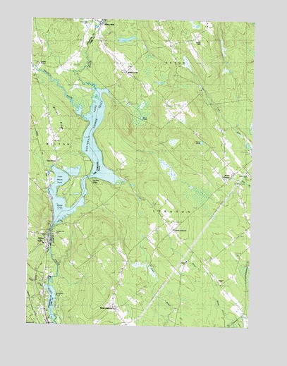
Milton, NH USGS Topographic Map
Click on map above to begin viewing in our Map Viewer.

This topographic map contains these locations and features:
Feature Name Type Latitude Longitude GNIS ID View Map
Black PondLakeN43.4599°W70.9372°562492View Map
Branch RiverStreamN43.4681°W70.9801°865763View Map
Bridge Street DamDamN43.4567°W70.9478°1774007View Map
Center LebanonPopulated PlaceN43.4148°W70.9173°563758View Map
Fernald ShorePopulated PlaceN43.4340°W70.9576°566109View Map
Forest Grove CemeteryCemeteryN43.4376°W70.8766°566384View Map
Great BrookStreamN43.3909°W70.9892°865174View Map
Hurd HillSummitN43.4929°W70.9042°568490View Map
Laskey CornerPopulated PlaceN43.4809°W70.9953°867953View Map
Lebanon Area LibraryBuildingN43.4146°W70.9176°1910986View Map
Lebanon Elementary SchoolSchoolN43.4017°W70.9102°1910988View Map
Maple Stone SchoolSchoolN43.4999°W70.9351°2738045View Map
Martha Sawyer Community LibraryBuildingN43.4032°W70.9086°2738475View Map
Miller BrookStreamN43.4976°W70.9651°868454View Map
Miller CornerPopulated PlaceN43.4790°W70.9459°571370View Map
MiltonPopulated PlaceN43.4098°W70.9884°868471View Map
Milton Census Designated PlaceCensusN43.4036°W70.9898°2629728View Map
Milton Elementary SchoolSchoolN43.4103°W70.9904°1914845View Map
Milton Fire Rescue Station 1BuildingN43.4078°W70.9880°2605184View Map
Milton Learning CenterSchoolN43.4090°W70.9887°2499372View Map
Milton Leather Board DamDamN43.4084°W70.9862°1775323View Map
Milton Mills CemeteryCemeteryN43.4979°W70.9674°868473View Map
Milton Mills Post OfficePost OfficeN43.4998°W70.9603°1914846View Map
Milton Police DepartmentBuildingN43.4406°W70.9835°2752955View Map
Milton PondLakeN43.4367°W70.9566°868474View Map
Milton Post OfficePost OfficeN43.4341°W70.9885°1914847View Map
Milton RidgeRidgeN43.4592°W70.9820°868475View Map
Milton Three PondsReservoirN43.4284°W70.9672°1775330View Map
Milton Three Ponds DamDamN43.4134°W70.9862°1775329View Map
Mousam River ReservoirReservoirN43.4567°W70.9478°1774008View Map
New Hampshire Farm MuseumBuildingN43.4217°W70.9884°1914856View Map
Nisbitt PondLakeN43.4502°W70.9031°572181View Map
North LebanonPopulated PlaceN43.4379°W70.8842°572356View Map
North Lebanon Second Baptist ChurchChurchN43.4379°W70.8848°1911050View Map
Northeast PondLakeN43.4409°W70.9606°572453View Map
Northeast PondLakeN43.4484°W70.9653°868825View Map
Nute High School and Middle SchoolSchoolN43.4087°W70.9911°1914865View Map
Potters Place Adult Park CampgroundLocaleN43.4476°W70.8767°1911106View Map
Prospect Hill CemeteryCemeteryN43.4123°W70.9837°869375View Map
Prospect Hill CemeteryCemeteryN43.4120°W70.9845°573840View Map
Salmon Falls River ReservoirReservoirN43.4084°W70.9862°1775324View Map
Spaulding DamDamN43.3801°W70.9828°1775453View Map
Spaulding PondReservoirN43.3790°W70.9834°575984View Map
Stewarts FieldParkN43.3931°W70.8909°1911204View Map
Town HousePopulated PlaceN43.4412°W70.9848°870481View Map
Town House PondLakeN43.4348°W70.9809°870482View Map
Town of LebanonCivilN43.4033°W70.9115°582550View Map
West LebanonPopulated PlaceN43.3823°W70.9506°578168View Map
West Lebanon Historic DistrictParkN43.3817°W70.9506°1911267View Map

Note: Coordinates in the location and feature list above are referenced to NAD83 datum.


Copyright (C) 2008-2025 Ryan Niemi / Sunset Dynamics ... All Rights Reserved