TopoQuest Logo
Do you find TopoQuest useful?
Help keep TopoQuest running and adding new maps/features by donating!
Bitcoin:  19c7KJd3qBynnjoSw5npx9KScwjBe4ifkT
Litecoin:  LXs6TkuXGGXo1vDsWCkWVdjQX94eUKd6ui
Home View Maps Find Maps Find Places Resources & Links


Mina, Nevada Topographic Map

USGS Map Title: Mina, NV
USGS Map MRC: 38118D1
DRG (GeoTIFF) Download: o38118d1.tif


Neighboring USGS Topographic Map Quads:


  Luning, NV  
38118E2
 

  Sunrise Flat, NV  
38118E1
 

  Stewart Spring, NV  
38117E8
 

  Black Dyke Mountain, NV  
38118D2
 

  Mina, NV  
38118D1
 

  Bettles Well, NV  
38117D8
 

  Camp Douglas, NV  
38118C2
 

  Sodaville, NV  
38118C1
 

  Eddyville, NV  
38117C8


Map MRC Location:

N39°
W119°
N39°
W118°
H8 H7 H6 H5 H4 H3 H2 H1
G8 G7 G6 G5 G4 G3 G2 G1
F8 F7 F6 F5 F4 F3 F2 F1
E8 E7 E6 E5 E4 E3 E2 E1
D8 D7 D6 D5 D4 D3 D2 D1
C8 C7 C6 C5 C4 C3 C2 C1
B8 B7 B6 B5 B4 B3 B2 B1
A8 A7 A6 A5 A4 A3 A2 A1
N38°
W119°
N38°
W118°

Mina, NV USGS 1:24K Topographic Map Preview:
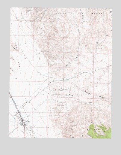
Mina, NV USGS Topographic Map
Click on map above to begin viewing in our Map Viewer.

This topographic map contains these locations and features:
Feature Name Type Latitude Longitude GNIS ID View Map
Cinnabar CanyonValleyN38.4310°W118.0601°849779View Map
Dunlap CanyonValleyN38.4146°W118.0773°840221View Map
Fagans SpringSpringN38.4739°W118.0084°855034View Map
Llama MountainSummitN38.3752°W118.0498°841749View Map
Mac CanyonValleyN38.3827°W118.0621°841894View Map
Malapie HillSummitN38.4355°W118.0598°847883View Map
MinaPopulated PlaceN38.3905°W118.1087°842148View Map
Mina AirportAirportN38.3819°W118.1000°864090View Map
Mina CemeteryCemeteryN38.3960°W118.1165°842149View Map
Mina Census Designated PlaceCensusN38.3898°W118.1116°2583941View Map
Mina Elementary SchoolSchoolN38.3919°W118.1129°855275View Map
Mina Post OfficePost OfficeN38.3912°W118.1126°864764View Map
Mina Volunteer Fire DepartmentBuildingN38.3910°W118.1084°2581345View Map
New York CanyonValleyN38.4858°W118.1032°842456View Map
Nun MineMineN38.4971°W118.1035°842571View Map
Pine Tree MineMineN38.3774°W118.0123°842840View Map
Southern Pacific SpringSpringN38.4217°W118.0618°843903View Map
Tule SpringSpringN38.4158°W118.0643°847862View Map
Volcano CanyonValleyN38.4380°W118.0776°848673View Map

Note: Coordinates in the location and feature list above are referenced to NAD83 datum.


Copyright (C) 2008-2024 Ryan Niemi / Sunset Dynamics ... All Rights Reserved