TopoQuest Logo
Do you find TopoQuest useful?
Help keep TopoQuest running and adding new maps/features by donating!
Bitcoin:  19c7KJd3qBynnjoSw5npx9KScwjBe4ifkT
Litecoin:  LXs6TkuXGGXo1vDsWCkWVdjQX94eUKd6ui
Home View Maps Find Maps Find Places Resources & Links


Mineral City, Ohio Topographic Map

USGS Map Title: Mineral City, OH
USGS Map MRC: 40081E3
DRG (GeoTIFF) Download: o40081e3.tif


Neighboring USGS Topographic Map Quads:


  Bolivar, OH  
40081F4
 

  Waynesburg, OH  
40081F3
 

  Malvern, OH  
40081F2
 

  Dover, OH  
40081E4
 

  Mineral City, OH  
40081E3
 

  Dellroy, OH  
40081E2
 

  New Philadelphia, OH  
40081D4
 

  Uhrichsville, OH  
40081D3
 

  Bowerston, OH  
40081D2


Map MRC Location:

N41°
W82°
N41°
W81°
H8 H7 H6 H5 H4 H3 H2 H1
G8 G7 G6 G5 G4 G3 G2 G1
F8 F7 F6 F5 F4 F3 F2 F1
E8 E7 E6 E5 E4 E3 E2 E1
D8 D7 D6 D5 D4 D3 D2 D1
C8 C7 C6 C5 C4 C3 C2 C1
B8 B7 B6 B5 B4 B3 B2 B1
A8 A7 A6 A5 A4 A3 A2 A1
N40°
W82°
N40°
W81°

Mineral City, OH USGS 1:24K Topographic Map Preview:
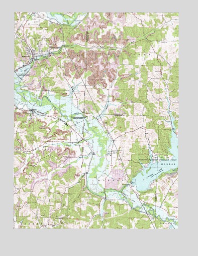
Mineral City, OH USGS Topographic Map
Click on map above to begin viewing in our Map Viewer.

This topographic map contains these locations and features:
Feature Name Type Latitude Longitude GNIS ID View Map
Atwood DamDamN40.5267°W81.2848°1077630View Map
Atwood Lake ParkParkN40.5423°W81.2659°1037530View Map
Atwood Marina WestLocaleN40.5356°W81.2751°1960700View Map
BarrickPopulated PlaceN40.5328°W81.2523°1064383View Map
Beggar RunStreamN40.5609°W81.3173°1060856View Map
Blue Ribbon FarmLocaleN40.5297°W81.3539°2543888View Map
Browns RunStreamN40.5312°W81.3162°1038392View Map
Buck HollowValleyN40.5240°W81.3204°1038458View Map
Center ValleyValleyN40.5487°W81.3301°1038944View Map
Deep Springs CemeteryCemeteryN40.5579°W81.2550°1039645View Map
Dog RunStreamN40.5417°W81.3071°1039735View Map
Dog Run School (historical)SchoolN40.5212°W81.3490°1054243View Map
Dolly Varden School (historical)SchoolN40.5484°W81.3171°1054244View Map
DutchtownPopulated PlaceN40.6167°W81.3679°1062457View Map
Egypt (historical)Populated PlaceN40.5084°W81.3726°1054248View Map
Fairfield Township Volunteer Fire DepartmentBuildingN40.5671°W81.3599°2549565View Map
German CemeteryCemeteryN40.6098°W81.3526°1040831View Map
Glens Cottage AreaPopulated PlaceN40.5223°W81.2712°1960701View Map
Harmony CemeteryCemeteryN40.6083°W81.2627°1041338View Map
Holmes ChurchChurchN40.5062°W81.3390°1041679View Map
Holmes Methodist Episcopal CemeteryCemeteryN40.5056°W81.3393°1963829View Map
Indian ForkStreamN40.5217°W81.2946°1066761View Map
JohnstonPopulated PlaceN40.5453°W81.3696°1064916View Map
LindentreePopulated PlaceN40.6051°W81.3009°1064999View Map
Lindentree CemeteryCemeteryN40.6097°W81.3013°1061143View Map
Lindentree Post Office (historical)Post OfficeN40.6056°W81.3012°1083278View Map
Little Fraction School (historical)SchoolN40.5487°W81.2721°1054270View Map
Mineral - Sandy Ambulance DistrictBuildingN40.6009°W81.3598°2550903View Map
Mineral CityPopulated PlaceN40.6012°W81.3612°1057850View Map
Mineral City Catholic CemeteryCemeteryN40.6020°W81.3540°1963836View Map
Mineral City CemeteryCemeteryN40.6028°W81.3590°1963837View Map
Mineral City Elementary SchoolSchoolN40.6034°W81.3607°1054273View Map
Mineral City Volunteer Fire DepartmentBuildingN40.6011°W81.3602°2549566View Map
Mount TaborPopulated PlaceN40.5201°W81.3732°1067244View Map
Mount Tabor CemeteryCemeteryN40.5228°W81.3707°1048349View Map
New CumberlandPopulated PlaceN40.5387°W81.3001°1054278View Map
New Cumberland Elementary SchoolSchoolN40.5423°W81.3012°1054279View Map
New Cumberland Post Office (historical)Post OfficeN40.5390°W81.2998°2062080View Map
North Shore Cottage AreaPopulated PlaceN40.5331°W81.2807°1960702View Map
Pleasant Valley CemeteryCemeteryN40.5797°W81.3313°1044594View Map
Robertson School (historical)SchoolN40.5570°W81.3040°1054295View Map
Saint Matthews CemeteryCemeteryN40.5356°W81.3593°1963855View Map
Saint Matthews ChurchChurchN40.5359°W81.3587°1045699View Map
SomerdalePopulated PlaceN40.5665°W81.3607°1046427View Map
Somerdale CemeteryCemeteryN40.5651°W81.3615°1963866View Map
Spring ValleyValleyN40.5381°W81.2698°1046577View Map
Sunset ValleyPopulated PlaceN40.5320°W81.2532°1052409View Map
Tall Timber LakeReservoirN40.5042°W81.3688°1079371View Map
Tall Tinber Lake DamDamN40.5034°W81.3698°1079370View Map
Township of FairfieldCivilN40.5436°W81.3741°1087054View Map
Township of RoseCivilN40.6078°W81.2623°1085835View Map
Township of SandyCivilN40.6171°W81.3653°1087065View Map
Township of WarrenCivilN40.5223°W81.3016°1087068View Map
Tunnel School (historical)SchoolN40.6159°W81.3298°1054337View Map
Village of Mineral CityCivilN40.6018°W81.3610°2399371View Map
Walnut Grove School (historical)SchoolN40.5884°W81.3376°1054342View Map
Zion CemeteryCemeteryN40.5207°W81.2525°1048254View Map

Note: Coordinates in the location and feature list above are referenced to NAD83 datum.


Copyright (C) 2008-2025 Ryan Niemi / Sunset Dynamics ... All Rights Reserved