TopoQuest Logo
Do you find TopoQuest useful?
Help keep TopoQuest running and adding new maps/features by donating!
Bitcoin:  19c7KJd3qBynnjoSw5npx9KScwjBe4ifkT
Litecoin:  LXs6TkuXGGXo1vDsWCkWVdjQX94eUKd6ui
Home View Maps Find Maps Find Places Resources & Links


Mineral Point, Wisconsin Topographic Map

USGS Map Title: Mineral Point, WI
USGS Map MRC: 42090G2
DRG (GeoTIFF) Download: o42090g2.tif


Neighboring USGS Topographic Map Quads:


  Linden, WI  
42090H3
 

  Dodgeville, WI  
42090H2
 

  Jonesdale, WI  
42090H1
 

  Mifflin, WI  
42090G3
 

  Mineral Point, WI  
42090G2
 

  Waldwick, WI  
42090G1
 

  Belmont, WI  
42090F3
 

  Calamine, WI  
42090F2
 

  Darlington, WI  
42090F1


Map MRC Location:

N43°
W91°
N43°
W90°
H8 H7 H6 H5 H4 H3 H2 H1
G8 G7 G6 G5 G4 G3 G2 G1
F8 F7 F6 F5 F4 F3 F2 F1
E8 E7 E6 E5 E4 E3 E2 E1
D8 D7 D6 D5 D4 D3 D2 D1
C8 C7 C6 C5 C4 C3 C2 C1
B8 B7 B6 B5 B4 B3 B2 B1
A8 A7 A6 A5 A4 A3 A2 A1
N42°
W91°
N42°
W90°

Mineral Point, WI USGS 1:24K Topographic Map Preview:
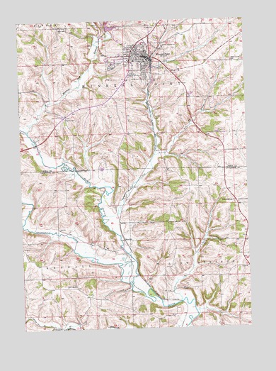
Mineral Point, WI USGS Topographic Map
Click on map above to begin viewing in our Map Viewer.

This topographic map contains these locations and features:
Feature Name Type Latitude Longitude GNIS ID View Map
Brewery CreekStreamN42.8203°W90.1760°1562178View Map
Burr Oak SchoolSchoolN42.7672°W90.2254°1562450View Map
Burr Oak SchoolSchoolN42.8722°W90.2262°1561194View Map
City of Mineral PointCivilN42.8624°W90.1829°1583725View Map
Cottage Inn BranchStreamN42.7506°W90.2335°1563424View Map
First United Methodist ChurchChurchN42.8617°W90.1848°1837769View Map
Furnace CreekStreamN42.7953°W90.2043°1565371View Map
Graceland CemeteryCemeteryN42.8575°W90.1946°1565697View Map
Hutchinson DamDamN42.8150°W90.2051°1792607View Map
Jim Benson FieldAirportN42.8523°W90.1274°2444182View Map
Ludden Lake 2WP1659 DamDamN42.8717°W90.2001°1791794View Map
Mineral PointPopulated PlaceN42.8600°W90.1798°1569549View Map
Mineral Point BranchStreamN42.7681°W90.1912°1569550View Map
Mineral Point Elementary SchoolSchoolN42.8574°W90.1841°1837772View Map
Mineral Point Fire DepartmentBuildingN42.8610°W90.1811°2698133View Map
Mineral Point High SchoolSchoolN42.8638°W90.1960°2715860View Map
Mineral Point High School Alternative ProgramSchoolN42.8580°W90.1880°2715659View Map
Mineral Point Middle SchoolSchoolN42.8640°W90.1959°2715717View Map
Mineral Point Police DepartmentBuildingN42.8612°W90.1814°2759941View Map
Mineral Point Rescue Squad Ambulance ServiceBuildingN42.8546°W90.1894°2698287View Map
Mineral Point Wastewater Treatment FacilityLocaleN42.8517°W90.1758°2709376View Map
Oak Park SchoolSchoolN42.8356°W90.2243°1570670View Map
Parkinson SchoolSchoolN42.8006°W90.1301°1571054View Map
Rock BranchStreamN42.8203°W90.1757°1572422View Map
Saint Mary's CemeteryCemeteryN42.8722°W90.1740°1573273View Map
Saint Paul CemeteryCemeteryN42.8572°W90.1893°1573422View Map
Seven Oaks SchoolSchoolN42.7931°W90.1690°1573909View Map
SlatefordPopulated PlaceN42.7856°W90.1935°1577825View Map
Soldiers Memorial ParkParkN42.8639°W90.1710°1574365View Map
Sudan BranchStreamN42.8308°W90.2460°1564358View Map
Sweet Clover SchoolSchoolN42.8583°W90.1323°1575180View Map
Town of KendallCivilN42.7542°W90.2427°1583468View Map
Town of Mineral PointCivilN42.8678°W90.1498°1583726View Map
Town of Willow SpringsCivilN42.7558°W90.1319°1584442View Map
Trinity Episcopal ChurchChurchN42.8619°W90.1846°1837784View Map
Willow Springs ChurchChurchN42.8011°W90.1318°1576797View Map

Note: Coordinates in the location and feature list above are referenced to NAD83 datum.


Copyright (C) 2008-2024 Ryan Niemi / Sunset Dynamics ... All Rights Reserved