TopoQuest Logo
Do you find TopoQuest useful?
Help keep TopoQuest running and adding new maps/features by donating!
Bitcoin:  19c7KJd3qBynnjoSw5npx9KScwjBe4ifkT
Litecoin:  LXs6TkuXGGXo1vDsWCkWVdjQX94eUKd6ui
Home View Maps Find Maps Find Places Resources & Links


Minier, Illinois Topographic Map

USGS Map Title: Minier, IL
USGS Map MRC: 40089D3
DRG (GeoTIFF) Download: o40089d3.tif


Neighboring USGS Topographic Map Quads:


  Morton, IL  
40089E4
 

  Mackinaw, IL  
40089E3
 

  Danvers, IL  
40089E2
 

  Hopedale, IL  
40089D4
 

  Minier, IL  
40089D3
 

  Stanford, IL  
40089D2
 

  Emden, IL  
40089C4
 

  Armington, IL  
40089C3
 

  McLean, IL  
40089C2


Map MRC Location:

N41°
W90°
N41°
W89°
H8 H7 H6 H5 H4 H3 H2 H1
G8 G7 G6 G5 G4 G3 G2 G1
F8 F7 F6 F5 F4 F3 F2 F1
E8 E7 E6 E5 E4 E3 E2 E1
D8 D7 D6 D5 D4 D3 D2 D1
C8 C7 C6 C5 C4 C3 C2 C1
B8 B7 B6 B5 B4 B3 B2 B1
A8 A7 A6 A5 A4 A3 A2 A1
N40°
W90°
N40°
W89°

Minier, IL USGS 1:24K Topographic Map Preview:
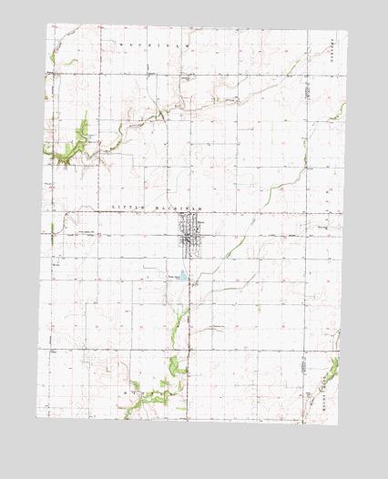
Minier, IL USGS Topographic Map
Click on map above to begin viewing in our Map Viewer.

This topographic map contains these locations and features:
Feature Name Type Latitude Longitude GNIS ID View Map
Broadway CemeteryCemeteryN40.4056°W89.3030°1747443View Map
Camp CemeteryCemeteryN40.3841°W89.2627°405439View Map
FravertPopulated PlaceN40.4489°W89.3706°422712View Map
Gaines CemeteryCemeteryN40.4625°W89.3524°408841View Map
Good Shepherd Lutheran ChurchChurchN40.4298°W89.3129°1821593View Map
Greenwood CemeteryCemeteryN40.4843°W89.3157°409461View Map
H A Peine Memorial LibraryBuildingN40.4348°W89.3145°1821592View Map
Illinois Valley Parachute Club AirportAirportN40.4337°W89.3518°427543View Map
Liberty Baptist ChurchChurchN40.4364°W89.3131°1821595View Map
Little Mackinaw Fire Protection DistrictBuildingN40.4339°W89.3141°2640486View Map
MindalePopulated PlaceN40.4259°W89.3698°422988View Map
MinierPopulated PlaceN40.4337°W89.3131°413652View Map
Minier Assembly of God ChurchChurchN40.4275°W89.3129°1821597View Map
Minier CemeteryCemeteryN40.4350°W89.3023°1821598View Map
Minier Christian ChurchChurchN40.4334°W89.3109°1821599View Map
Minier Post OfficePost OfficeN40.4327°W89.3156°2788882View Map
Minier Rescue Squad Ambulance ServiceBuildingN40.4339°W89.3140°2673874View Map
Minier-Armington Elementary SchoolSchoolN40.4364°W89.3104°1821600View Map
Saint John United Church of ChristChurchN40.4359°W89.3118°1821605View Map
SutterPopulated PlaceN40.3967°W89.3695°423225View Map
TazewellPopulated PlaceN40.4845°W89.3326°423234View Map
Township of Little MackinawCivilN40.4412°W89.3231°429265View Map
Village of MinierCivilN40.4336°W89.3144°2399375View Map
WalnutPopulated PlaceN40.4839°W89.3715°423282View Map
Whitten BranchStreamN40.4745°W89.3184°421115View Map

Note: Coordinates in the location and feature list above are referenced to NAD83 datum.


Copyright (C) 2008-2025 Ryan Niemi / Sunset Dynamics ... All Rights Reserved