TopoQuest Logo
Do you find TopoQuest useful?
Help keep TopoQuest running and adding new maps/features by donating!
Bitcoin:  19c7KJd3qBynnjoSw5npx9KScwjBe4ifkT
Litecoin:  LXs6TkuXGGXo1vDsWCkWVdjQX94eUKd6ui
Home View Maps Find Maps Find Places Resources & Links


Minneapolis North, Kansas Topographic Map

USGS Map Title: Minneapolis North, KS
USGS Map MRC: 39097B6
DRG (GeoTIFF) Download: o39097b6.tif


Neighboring USGS Topographic Map Quads:


  Glasco, KS  
39097C7
 

  Aurora SW, KS  
39097C6
 

  Lamar, KS  
39097C5
 

  Tescott NE, KS  
39097B7
 

  Minneapolis North, KS  
39097B6
 

  Wells, KS  
39097B5
 

  Tescott SE, KS  
39097A7
 

  Minneapolis South, KS  
39097A6
 

  Bennington, KS  
39097A5


Map MRC Location:

N40°
W98°
N40°
W97°
H8 H7 H6 H5 H4 H3 H2 H1
G8 G7 G6 G5 G4 G3 G2 G1
F8 F7 F6 F5 F4 F3 F2 F1
E8 E7 E6 E5 E4 E3 E2 E1
D8 D7 D6 D5 D4 D3 D2 D1
C8 C7 C6 C5 C4 C3 C2 C1
B8 B7 B6 B5 B4 B3 B2 B1
A8 A7 A6 A5 A4 A3 A2 A1
N39°
W98°
N39°
W97°

Minneapolis North, KS USGS 1:24K Topographic Map Preview:
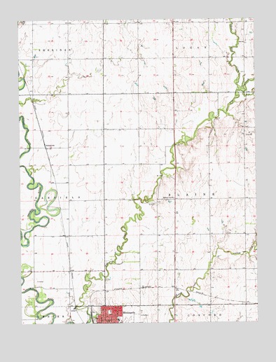
Minneapolis North, KS USGS Topographic Map
Click on map above to begin viewing in our Map Viewer.

This topographic map contains these locations and features:
Feature Name Type Latitude Longitude GNIS ID View Map
AlfmilPopulated PlaceN39.1319°W97.7223°484775View Map
Baldock Farm Airport (historical)AirportN39.2458°W97.6503°481424View Map
Community Bible ChurchChurchN39.1317°W97.7019°2690445View Map
Hall CemeteryCemeteryN39.2406°W97.6305°2739686View Map
Hall Wesleyan ChurchChurchN39.2398°W97.6309°476279View Map
Highway View SchoolSchoolN39.1764°W97.6689°476280View Map
Kansas Department of Transportation District 2BuildingN39.1317°W97.7007°2693144View Map
Minneapolis Free Methodist ChurchChurchN39.1306°W97.6997°2689976View Map
Minneapolis High SchoolSchoolN39.1266°W97.6990°480333View Map
Minneapolis Public LibraryBuildingN39.1255°W97.7041°2694718View Map
New Beginnings Christian FellowshipChurchN39.1325°W97.7042°2690464View Map
Ottawa CountyCivilN39.1325°W97.6502°485035View Map
Ottawa County Health CenterHospitalN39.1296°W97.7037°2499128View Map
Ottawa County Health DepartmentBuildingN39.1296°W97.7033°2695046View Map
SumnervillePopulated PlaceN39.1975°W97.7364°484774View Map
Township of BlaineCivilN39.1758°W97.6498°476283View Map
West Pipe CreekStreamN39.2206°W97.6339°475996View Map

Note: Coordinates in the location and feature list above are referenced to NAD83 datum.


Copyright (C) 2008-2024 Ryan Niemi / Sunset Dynamics ... All Rights Reserved