TopoQuest Logo
Do you find TopoQuest useful?
Help keep TopoQuest running and adding new maps/features by donating!
Bitcoin:  19c7KJd3qBynnjoSw5npx9KScwjBe4ifkT
Litecoin:  LXs6TkuXGGXo1vDsWCkWVdjQX94eUKd6ui
Home View Maps Find Maps Find Places Resources & Links


Beaverdam, Ohio Topographic Map

USGS Map Title: Beaverdam, OH
USGS Map MRC: 40083G8
DRG (GeoTIFF) Download: o40083g8.tif


Neighboring USGS Topographic Map Quads:


  Columbus Grove, OH  
40084H1
 

  Bluffton, OH  
40083H8
 

  Rawson, OH  
40083H7
 

  Cairo, OH  
40084G1
 

  Beaverdam, OH  
40083G8
 

  Ada, OH  
40083G7
 

  Lima, OH  
40084F1
 

  Harrod, OH  
40083F8
 

  Alger, OH  
40083F7


Map MRC Location:

N41°
W84°
N41°
W83°
H8 H7 H6 H5 H4 H3 H2 H1
G8 G7 G6 G5 G4 G3 G2 G1
F8 F7 F6 F5 F4 F3 F2 F1
E8 E7 E6 E5 E4 E3 E2 E1
D8 D7 D6 D5 D4 D3 D2 D1
C8 C7 C6 C5 C4 C3 C2 C1
B8 B7 B6 B5 B4 B3 B2 B1
A8 A7 A6 A5 A4 A3 A2 A1
N40°
W84°
N40°
W83°

Beaverdam, OH USGS 1:24K Topographic Map Preview:
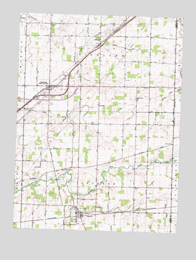
Beaverdam, OH USGS Topographic Map
Click on map above to begin viewing in our Map Viewer.

This topographic map contains these locations and features:
Feature Name Type Latitude Longitude GNIS ID View Map
Allen East High SchoolSchoolN40.7595°W83.9522°1049734View Map
Allen East Primary SchoolSchoolN40.7601°W83.9522°1049733View Map
Beaver Dam StationPopulated PlaceN40.8328°W83.9763°1048503View Map
BeaverdamPopulated PlaceN40.8334°W83.9766°1058166View Map
Beaverdam - Richland Fire DepartmentBuildingN40.8327°W83.9760°2550201View Map
Beaverdam CemeteryCemeteryN40.8325°W83.9697°1699304View Map
Beaverdam Post OfficePost OfficeN40.8334°W83.9749°1957969View Map
Candler CemeteryCemeteryN40.7920°W83.8791°1038792View Map
Cotner DitchCanalN40.8120°W83.9472°1039387View Map
County Line ChurchChurchN40.8014°W83.8805°1039407View Map
Davis CemeteryCemeteryN40.8120°W83.9436°1039603View Map
Desenberg School (historical)SchoolN40.7762°W83.8986°1049735View Map
Desenburg CemeteryCemeteryN40.7756°W83.9081°1039680View Map
Emmanuel ChurchChurchN40.8609°W83.9394°1040195View Map
Evick CemeteryCemeteryN40.7914°W83.8960°1040288View Map
Gratz CemeteryCemeteryN40.8584°W83.9383°1041075View Map
Hall CemeteryCemeteryN40.7842°W83.9619°1699310View Map
Hog CreekStreamN40.7709°W83.9558°1066038View Map
Huber DitchCanalN40.8195°W83.9302°1041844View Map
Huber School (historical)SchoolN40.8626°W83.8877°1049736View Map
Interchange 134CrossingN40.8276°W83.9758°1080279View Map
Interchange 135CrossingN40.8331°W83.9611°1080280View Map
LafayettePopulated PlaceN40.7603°W83.9486°1056388View Map
Lafayette CemeteryCemeteryN40.7625°W83.9533°1700849View Map
Lafayette Jackson Township Fire DepartmentBuildingN40.7595°W83.9464°2549509View Map
LaFayette Post OfficePost OfficeN40.7612°W83.9472°1957985View Map
Liberty ChapelChurchN40.7851°W83.9622°1042511View Map
Liberty Chapel CemeteryCemeteryN40.7845°W83.9619°1700850View Map
Little Hog CreekStreamN40.7709°W83.9558°1042627View Map
Marsh RunStreamN40.8573°W83.9494°1043014View Map
May DitchCanalN40.8378°W83.9616°1043066View Map
Mud RunStreamN40.7651°W83.9080°1043707View Map
Pleasant Hill CemeteryCemeteryN40.8271°W83.9084°1699319View Map
Pleasant Hill ChurchChurchN40.8273°W83.9088°1044560View Map
Stratton GreenhousesBuildingN40.8347°W83.9178°2582420View Map
Township of JacksonCivilN40.7754°W83.9370°1085693View Map
Township of RichlandCivilN40.8696°W83.9377°1085698View Map
Village of BeaverdamCivilN40.8328°W83.9738°2398061View Map
Village of LafayetteCivilN40.7589°W83.9499°2398373View Map
West Point CemeteryCemeteryN40.8114°W83.9436°1047794View Map
Woodlawn CemeteryCemeteryN40.8392°W83.9627°1048090View Map

Note: Coordinates in the location and feature list above are referenced to NAD83 datum.


Copyright (C) 2008-2025 Ryan Niemi / Sunset Dynamics ... All Rights Reserved