TopoQuest Logo
Do you find TopoQuest useful?
Help keep TopoQuest running and adding new maps/features by donating!
Bitcoin:  19c7KJd3qBynnjoSw5npx9KScwjBe4ifkT
Litecoin:  LXs6TkuXGGXo1vDsWCkWVdjQX94eUKd6ui
Home View Maps Find Maps Find Places Resources & Links


Columbus Grove, Ohio Topographic Map

USGS Map Title: Columbus Grove, OH
USGS Map MRC: 40084H1
DRG (GeoTIFF) Download: o40084h1.tif


Neighboring USGS Topographic Map Quads:


  Miller City, OH  
41084A2
 

  Ottawa, OH  
41084A1
 

  Leipsic, OH  
41083A8
 

  Kalida, OH  
40084H2
 

  Columbus Grove, OH  
40084H1
 

  Bluffton, OH  
40083H8
 

  Elida, OH  
40084G2
 

  Cairo, OH  
40084G1
 

  Beaverdam, OH  
40083G8


Map MRC Location:

N41°
W85°
N41°
W84°
H8 H7 H6 H5 H4 H3 H2 H1
G8 G7 G6 G5 G4 G3 G2 G1
F8 F7 F6 F5 F4 F3 F2 F1
E8 E7 E6 E5 E4 E3 E2 E1
D8 D7 D6 D5 D4 D3 D2 D1
C8 C7 C6 C5 C4 C3 C2 C1
B8 B7 B6 B5 B4 B3 B2 B1
A8 A7 A6 A5 A4 A3 A2 A1
N40°
W85°
N40°
W84°

Columbus Grove, OH USGS 1:24K Topographic Map Preview:
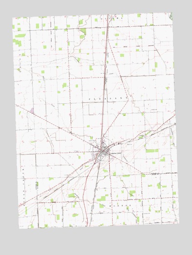
Columbus Grove, OH USGS Topographic Map
Click on map above to begin viewing in our Map Viewer.

This topographic map contains these locations and features:
Feature Name Type Latitude Longitude GNIS ID View Map
Bogart CemeteryCemeteryN40.9228°W84.0386°1038171View Map
Bowers Mobile Home ParkPopulated PlaceN40.9147°W84.0603°2648358View Map
Campbell CemeteryCemeteryN40.8817°W84.0274°1038780View Map
Columbus GrovePopulated PlaceN40.9195°W84.0569°1056830View Map
Columbus Grove Elementary SchoolSchoolN40.9217°W84.0569°1069984View Map
Columbus Grove Emergency Medical ServicesBuildingN40.9164°W84.0597°2550772View Map
Columbus Grove Fire Department Station 2BuildingN40.9192°W84.0562°2550396View Map
Columbus Grove High SchoolSchoolN40.9217°W84.0561°1050110View Map
Columbus Grove Middle SchoolSchoolN40.9217°W84.0555°1069985View Map
Columbus Grove Police DepartmentBuildingN40.9192°W84.0562°2733062View Map
Columbus Grove Post OfficePost OfficeN40.9195°W84.0574°2043361View Map
Columbus Grove Volunteer Fire Department Station 20BuildingN40.9197°W84.0594°2550288View Map
Do Well Mobile VillagePopulated PlaceN40.9150°W84.0508°2648347View Map
Gettman Trailer ParkPopulated PlaceN40.9264°W84.0569°2648355View Map
Little Cranberry CreekStreamN40.8942°W84.0388°1042655View Map
Lugibill's GreenhouseBuildingN40.9244°W84.0575°2582424View Map
Macks HeliportAirportN40.9281°W84.0577°1082623View Map
Ridge FarmsLocaleN40.9500°W84.1142°2564642View Map
Ridge Road Trailer ParkPopulated PlaceN40.9358°W84.0047°2648364View Map
Saint Anthony Catholic ChurchChurchN40.9214°W84.0633°1062507View Map
Saint Anthony CemeteryCemeteryN40.9198°W84.0752°1045385View Map
Saint Anthony of Padua SchoolSchoolN40.9217°W84.0638°1062508View Map
Saint John United Methodist ChurchChurchN40.9209°W84.0555°1069988View Map
Sycamore CreekStreamN40.8998°W84.0872°1066230View Map
Township of PleasantCivilN40.9487°W84.0530°1086867View Map
Truro CemeteryCemeteryN40.9056°W84.0847°1047182View Map
Village of Columbus GroveCivilN40.9190°W84.0595°2398606View Map
Windmill Swine FarmLocaleN40.9206°W84.1042°2564643View Map
Wisely CemeteryCemeteryN40.9431°W84.0187°1048020View Map

Note: Coordinates in the location and feature list above are referenced to NAD83 datum.


Copyright (C) 2008-2025 Ryan Niemi / Sunset Dynamics ... All Rights Reserved