TopoQuest Logo
Do you find TopoQuest useful?
Help keep TopoQuest running and adding new maps/features by donating!
Bitcoin:  19c7KJd3qBynnjoSw5npx9KScwjBe4ifkT
Litecoin:  LXs6TkuXGGXo1vDsWCkWVdjQX94eUKd6ui
Home View Maps Find Maps Find Places Resources & Links


Mission Creek, Montana Topographic Map

USGS Map Title: Mission Creek, MT
USGS Map MRC: 46107A5
DRG (GeoTIFF) Download: o46107a5.tif


Neighboring USGS Topographic Map Quads:


  Coal Bank Creek, MT  
46107B6
 

  Custer, MT  
46107B5
 

  Bighorn, MT  
46107B4
 

  Waco, MT  
46107A6
 

  Mission Creek, MT  
46107A5
 

  Marsh Coulee, MT  
46107A4
 

  Lemon Ranch, MT  
45107H6
 

  Foster, MT  
45107H5
 

  Dudley Spring, MT  
45107H4


Map MRC Location:

N47°
W108°
N47°
W107°
H8 H7 H6 H5 H4 H3 H2 H1
G8 G7 G6 G5 G4 G3 G2 G1
F8 F7 F6 F5 F4 F3 F2 F1
E8 E7 E6 E5 E4 E3 E2 E1
D8 D7 D6 D5 D4 D3 D2 D1
C8 C7 C6 C5 C4 C3 C2 C1
B8 B7 B6 B5 B4 B3 B2 B1
A8 A7 A6 A5 A4 A3 A2 A1
N46°
W108°
N46°
W107°

Mission Creek, MT USGS 1:24K Topographic Map Preview:
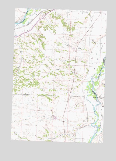
Mission Creek, MT USGS Topographic Map
Click on map above to begin viewing in our Map Viewer.

This topographic map contains these locations and features:
Feature Name Type Latitude Longitude GNIS ID View Map
03N34E08BADB01 WellWellN46.0267°W107.5209°813798View Map
03N34E18DC__01 WellWellN46.0017°W107.5367°813730View Map
03N34E18DC__02 WellWellN46.0017°W107.5367°813731View Map
04N34E17CDDB01 WellWellN46.0878°W107.5204°813951View Map
Andresen CouleeValleyN46.0605°W107.5281°768255View Map
Cubbison CouleeValleyN46.0844°W107.5120°770364View Map
Eckman CouleeValleyN46.0447°W107.5109°771129View Map
Fighting SpringSpringN46.0969°W107.5195°799842View Map
Fighting Spring CouleeValleyN46.0953°W107.5106°771347View Map
Greene CouleeValleyN46.0628°W107.5034°771973View Map
Mission BottomBendN46.0236°W107.5042°774279View Map
Mission CreekStreamN46.0269°W107.5131°774286View Map
North Fork Mission CreekStreamN46.0230°W107.5651°774785View Map
Sand CreekStreamN46.1080°W107.6190°776180View Map
Sorrel Horse CreekStreamN46.0164°W107.5162°776745View Map
South Fork Mission CreekStreamN46.0230°W107.5651°776852View Map
Steele RanchLocaleN46.1208°W107.6140°777186View Map
Wolfe RanchLocaleN46.0353°W107.5037°778659View Map

Note: Coordinates in the location and feature list above are referenced to NAD83 datum.


Copyright (C) 2008-2025 Ryan Niemi / Sunset Dynamics ... All Rights Reserved