TopoQuest Logo
Do you find TopoQuest useful?
Help keep TopoQuest running and adding new maps/features by donating!
Bitcoin:  19c7KJd3qBynnjoSw5npx9KScwjBe4ifkT
Litecoin:  LXs6TkuXGGXo1vDsWCkWVdjQX94eUKd6ui
Home View Maps Find Maps Find Places Resources & Links


Bighorn, Montana Topographic Map

USGS Map Title: Bighorn, MT
USGS Map MRC: 46107B4
DRG (GeoTIFF) Download: o46107b4.tif


Neighboring USGS Topographic Map Quads:


  Devils Kitchen, MT  
46107C5
 

  Rancher Cemetery, MT  
46107C4
 

  Myers, MT  
46107C3
 

  Custer, MT  
46107B5
 

  Bighorn, MT  
46107B4
 

  Eldering Ranch, MT  
46107B3
 

  Mission Creek, MT  
46107A5
 

  Marsh Coulee, MT  
46107A4
 

  Hope Ranch, MT  
46107A3


Map MRC Location:

N47°
W108°
N47°
W107°
H8 H7 H6 H5 H4 H3 H2 H1
G8 G7 G6 G5 G4 G3 G2 G1
F8 F7 F6 F5 F4 F3 F2 F1
E8 E7 E6 E5 E4 E3 E2 E1
D8 D7 D6 D5 D4 D3 D2 D1
C8 C7 C6 C5 C4 C3 C2 C1
B8 B7 B6 B5 B4 B3 B2 B1
A8 A7 A6 A5 A4 A3 A2 A1
N46°
W108°
N46°
W107°

Bighorn, MT USGS 1:24K Topographic Map Preview:
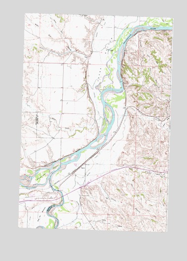
Bighorn, MT USGS Topographic Map
Click on map above to begin viewing in our Map Viewer.

This topographic map contains these locations and features:
Feature Name Type Latitude Longitude GNIS ID View Map
05N34E05DBDA01 WellWellN46.2117°W107.4845°814606View Map
05N34E11B___01 WellWellN46.2033°W107.4401°814569View Map
05N34E21BACD01 WellWellN46.1742°W107.4806°814396View Map
05N34E27A___01 WellWellN46.1600°W107.4506°814300View Map
06N34E25C___01 WellWellN46.2380°W107.4201°814725View Map
Allen CreekStreamN46.1903°W107.4381°768208View Map
Ash Coulee School (historical)SchoolN46.2108°W107.4445°1721552View Map
Big HornLocaleN46.1617°W107.4487°1721521View Map
Big Horn Post (historical)LocaleN46.1483°W107.4595°1721520View Map
Big Horn School (historical)SchoolN46.1630°W107.4456°1721536View Map
BighornPopulated PlaceN46.1617°W107.4487°802033View Map
Bighorn Post OfficePost OfficeN46.1615°W107.4485°1721594View Map
Bighorn RiverStreamN46.1550°W107.4745°779903View Map
Bighorn Tullock DitchCanalN46.1650°W107.4370°768845View Map
Cutoff CreekStreamN46.1611°W107.4240°770411View Map
East Fork Fortysix CreekStreamN46.2269°W107.3934°768056View Map
Edwards CreekStreamN46.2303°W107.4409°771143View Map
Edwards Creek School (historical)SchoolN46.2222°W107.4534°1721551View Map
Etchetah (historical)Populated PlaceN46.2036°W107.4409°1721515View Map
Etchetah Post Office (historical)Post OfficeN46.2036°W107.4409°1721596View Map
Etchetah School (historical)SchoolN46.2175°W107.4403°1721550View Map
Fort Benton (historical)LocaleN46.1717°W107.4423°1721514View Map
Fort Cass (historical)LocaleN46.1689°W107.4492°1721513View Map
Fort Manuel Lisa (historical)LocaleN46.1617°W107.4595°1721512View Map
Fort PeaseLocaleN46.2300°W107.4290°794941View Map
Fortysix CreekStreamN46.2419°W107.4001°771530View Map
Government IslandIslandN46.1569°W107.4781°771887View Map
Guys BluffsCliffN46.2417°W107.3762°1721502View Map
Interchange 53CrossingN46.1511°W107.4451°1721581View Map
Jacobs CouleeValleyN46.1864°W107.3815°772781View Map
Kurtzville (historical)Populated PlaceN46.1617°W107.4487°1721508View Map
Manuel Lisa Fishing Access SiteLocaleN46.1455°W107.4715°1744450View Map
Middle Fork Edwards CreekStreamN46.2358°W107.4665°774161View Map
North Fork Edwards CreekStreamN46.2358°W107.4662°774747View Map
Pasco CouleeValleyN46.1267°W107.4442°775099View Map
Petes CouleeValleyN46.1547°W107.4359°775183View Map
Rancher (historical)LocaleN46.2417°W107.3992°1721506View Map
South Fork Edwards CreekStreamN46.2292°W107.4598°776825View Map
Tullock CreekStreamN46.1467°W107.4637°777799View Map
Unknown CreekStreamN46.2072°W107.4145°777913View Map
West Fork Fortysix CreekStreamN46.2269°W107.3934°778242View Map

Note: Coordinates in the location and feature list above are referenced to NAD83 datum.


Copyright (C) 2008-2025 Ryan Niemi / Sunset Dynamics ... All Rights Reserved