TopoQuest Logo
Do you find TopoQuest useful?
Help keep TopoQuest running and adding new maps/features by donating!
Bitcoin:  19c7KJd3qBynnjoSw5npx9KScwjBe4ifkT
Litecoin:  LXs6TkuXGGXo1vDsWCkWVdjQX94eUKd6ui
Home View Maps Find Maps Find Places Resources & Links


Mitchellville, Missouri Topographic Map

USGS Map Title: Mitchellville, MO
USGS Map MRC: 40094B1
DRG (GeoTIFF) Download: o40094b1.tif


Neighboring USGS Topographic Map Quads:


  New Hampton, MO  
40094C2
 

  Bethany, MO  
40094C1
 

  Gardner, MO  
40093C8
 

  Matkins, MO  
40094B2
 

  Mitchellville, MO  
40094B1
 

  Gilman City West, MO  
40093B8
 

  Pattonsburg, MO  
40094A2
 

  Coffey, MO  
40094A1
 

  Jameson, MO  
40093A8


Map MRC Location:

N41°
W95°
N41°
W94°
H8 H7 H6 H5 H4 H3 H2 H1
G8 G7 G6 G5 G4 G3 G2 G1
F8 F7 F6 F5 F4 F3 F2 F1
E8 E7 E6 E5 E4 E3 E2 E1
D8 D7 D6 D5 D4 D3 D2 D1
C8 C7 C6 C5 C4 C3 C2 C1
B8 B7 B6 B5 B4 B3 B2 B1
A8 A7 A6 A5 A4 A3 A2 A1
N40°
W95°
N40°
W94°

Mitchellville, MO USGS 1:24K Topographic Map Preview:
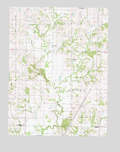
Mitchellville, MO USGS Topographic Map
Click on map above to begin viewing in our Map Viewer.

This topographic map contains these locations and features:
Feature Name Type Latitude Longitude GNIS ID View Map
Brady School (historical)SchoolN40.2469°W94.0727°714622View Map
BridgeportPopulated PlaceN40.1561°W94.0652°740029View Map
Bridgeport ChurchChurchN40.1567°W94.0652°714699View Map
Brush Oak SchoolSchoolN40.1919°W94.0177°714875View Map
Crabapple BranchStreamN40.1939°W94.0752°716441View Map
Fleenor BranchStreamN40.2078°W94.0786°718007View Map
Flint BranchStreamN40.2219°W94.0841°718024View Map
Happy Valley Post OfficePost OfficeN40.1556°W94.0647°759654View Map
Herald BranchStreamN40.1322°W94.0313°719392View Map
Hickory Grove School (historical)SchoolN40.1492°W94.0366°719476View Map
Jack Oak SchoolSchoolN40.1886°W94.0527°720195View Map
Maize SchoolSchoolN40.1828°W94.0841°730139View Map
Miracle Hills RanchLocaleN40.1986°W94.0458°741733View Map
MitchellvillePopulated PlaceN40.2119°W94.0716°738031View Map
Mitchellville ChurchChurchN40.2106°W94.0736°722497View Map
Mitchellville School (historical)SchoolN40.2217°W94.0650°722498View Map
Mount Olive CemeteryCemeteryN40.2308°W94.0872°722804View Map
Nelson LakeReservoirN40.2473°W94.1123°761902View Map
Nelson Lake DamDamN40.2467°W94.1136°761901View Map
Nobel BranchStreamN40.1297°W94.0822°723392View Map
Pleasant RidgePopulated PlaceN40.1706°W94.0144°739613View Map
Pleasant Ridge CemeteryCemeteryN40.1758°W94.0277°724582View Map
Pleasant Ridge SchoolSchoolN40.1708°W94.0161°724600View Map
Polecat CreekStreamN40.1722°W94.0616°724707View Map
Poor Tom BranchStreamN40.1828°W94.0466°724746View Map
Rice Town School (historical)SchoolN40.1447°W94.1211°725249View Map
Shiloh School (historical)SchoolN40.2219°W94.0930°726381View Map
Township of CypressCivilN40.1709°W94.0467°766718View Map
Union School (historical)SchoolN40.1419°W94.0088°747005View Map
WildwoodPopulated PlaceN40.1856°W94.0855°738032View Map
Woodland School (historical)SchoolN40.2219°W94.0180°729106View Map
Youngs SchoolSchoolN40.1542°W94.0847°729214View Map

Note: Coordinates in the location and feature list above are referenced to NAD83 datum.


Copyright (C) 2008-2024 Ryan Niemi / Sunset Dynamics ... All Rights Reserved