TopoQuest Logo
Do you find TopoQuest useful?
Help keep TopoQuest running and adding new maps/features by donating!
Bitcoin:  19c7KJd3qBynnjoSw5npx9KScwjBe4ifkT
Litecoin:  LXs6TkuXGGXo1vDsWCkWVdjQX94eUKd6ui
Home View Maps Find Maps Find Places Resources & Links


Mittie, Louisiana Topographic Map

USGS Map Title: Mittie, LA
USGS Map MRC: 30092F8
DRG (GeoTIFF) Download: o30092f8.tif


Neighboring USGS Topographic Map Quads:


  Sugartown, LA  
30093G1
 

  Grant, LA  
30092G8
 

  Elizabeth, LA  
30092G7
 

  Dry Creek, LA  
30093F1
 

  Mittie, LA  
30092F8
 

  Pine Chapel, LA  
30092F7
 

  Reeves, LA  
30093E1
 

  Le Blanc, LA  
30092E8
 

  Oberlin, LA  
30092E7


Map MRC Location:

N31°
W93°
N31°
W92°
H8 H7 H6 H5 H4 H3 H2 H1
G8 G7 G6 G5 G4 G3 G2 G1
F8 F7 F6 F5 F4 F3 F2 F1
E8 E7 E6 E5 E4 E3 E2 E1
D8 D7 D6 D5 D4 D3 D2 D1
C8 C7 C6 C5 C4 C3 C2 C1
B8 B7 B6 B5 B4 B3 B2 B1
A8 A7 A6 A5 A4 A3 A2 A1
N30°
W93°
N30°
W92°

Mittie, LA USGS 1:24K Topographic Map Preview:
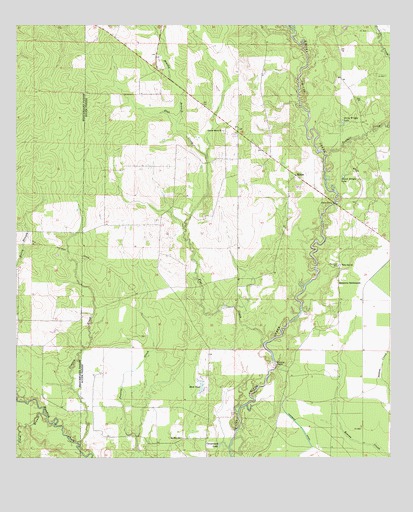
Mittie, LA USGS Topographic Map
Click on map above to begin viewing in our Map Viewer.

This topographic map contains these locations and features:
Feature Name Type Latitude Longitude GNIS ID View Map
Allen Parish Fire Protection District 3BuildingN30.6773°W92.9265°2691695View Map
Bird PondLakeN30.6464°W92.9383°553667View Map
Brushy BranchStreamN30.7221°W92.9465°533465View Map
Carpenters LakeLakeN30.6289°W92.9325°553902View Map
Cherry GrovePopulated PlaceN30.7196°W92.9260°545437View Map
Cherry Grove ChurchChurchN30.7196°W92.9313°533905View Map
Coles BranchStreamN30.6380°W92.9910°534040View Map
Cowpen CreekStreamN30.6294°W92.9799°534219View Map
Flat CreekStreamN30.6583°W92.9171°534986View Map
Isaiah Wright LakeLakeN30.7065°W92.8909°554843View Map
Jerry Wright LakeLakeN30.7220°W92.8910°554872View Map
MittiePopulated PlaceN30.7069°W92.9068°543479View Map
Mittie Post OfficePost OfficeN30.7066°W92.9065°1630171View Map
Mount Fair ChurchChurchN30.6308°W92.9454°537316View Map
North Mittie Gas FieldOilfieldN30.7363°W92.9190°545459View Map
Parish Governing Authority District 4CivilN30.7107°W92.8786°1929996View Map
Simmons CemeteryCemeteryN30.6807°W92.8924°539382View Map
Simmons SettlementPopulated PlaceN30.6763°W92.8921°556050View Map
Tenmile CreekStreamN30.7130°W92.8957°556218View Map
Twin Oak ChurchChurchN30.6808°W92.8915°540067View Map

Note: Coordinates in the location and feature list above are referenced to NAD83 datum.


Copyright (C) 2008-2024 Ryan Niemi / Sunset Dynamics ... All Rights Reserved