TopoQuest Logo
Do you find TopoQuest useful?
Help keep TopoQuest running and adding new maps/features by donating!
Bitcoin:  19c7KJd3qBynnjoSw5npx9KScwjBe4ifkT
Litecoin:  LXs6TkuXGGXo1vDsWCkWVdjQX94eUKd6ui
Home View Maps Find Maps Find Places Resources & Links


Grant, Louisiana Topographic Map

USGS Map Title: Grant, LA
USGS Map MRC: 30092G8
DRG (GeoTIFF) Download: o30092g8.tif


Neighboring USGS Topographic Map Quads:


  Sugrue, LA  
30093H1
 

  Pitkin, LA  
30092H8
 

  Steep Gully, LA  
30092H7
 

  Sugartown, LA  
30093G1
 

  Grant, LA  
30092G8
 

  Elizabeth, LA  
30092G7
 

  Dry Creek, LA  
30093F1
 

  Mittie, LA  
30092F8
 

  Pine Chapel, LA  
30092F7


Map MRC Location:

N31°
W93°
N31°
W92°
H8 H7 H6 H5 H4 H3 H2 H1
G8 G7 G6 G5 G4 G3 G2 G1
F8 F7 F6 F5 F4 F3 F2 F1
E8 E7 E6 E5 E4 E3 E2 E1
D8 D7 D6 D5 D4 D3 D2 D1
C8 C7 C6 C5 C4 C3 C2 C1
B8 B7 B6 B5 B4 B3 B2 B1
A8 A7 A6 A5 A4 A3 A2 A1
N30°
W93°
N30°
W92°

Grant, LA USGS 1:24K Topographic Map Preview:
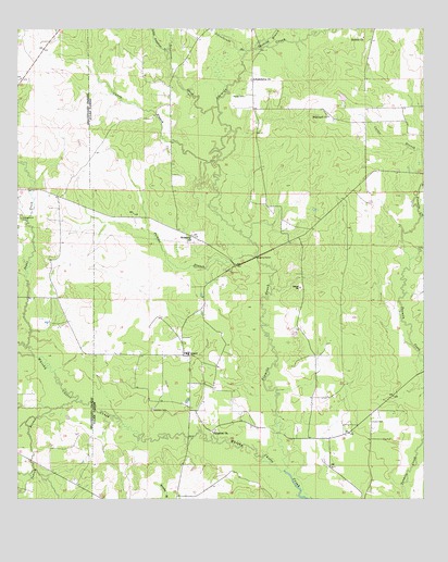
Grant, LA USGS Topographic Map
Click on map above to begin viewing in our Map Viewer.

This topographic map contains these locations and features:
Feature Name Type Latitude Longitude GNIS ID View Map
Arkadelphia ChurchChurchN30.8624°W92.9271°532211View Map
Campground CemeteryCemeteryN30.8249°W92.9990°545432View Map
Caney BranchStreamN30.8399°W92.9385°547187View Map
Fairview High SchoolSchoolN30.7890°W92.9483°545445View Map
Gaskins BranchStreamN30.8699°W92.9263°547388View Map
GrantPopulated PlaceN30.7885°W92.9485°543254View Map
Grant Post OfficePost OfficeN30.7883°W92.9490°1630163View Map
Hamilton CemeteryCemeteryN30.7744°W92.9585°535505View Map
Hopewell ChurchChurchN30.8519°W92.9043°535789View Map
Horton CemeteryCemeteryN30.7710°W92.8910°535820View Map
Indian BranchStreamN30.7769°W92.9824°535915View Map
Little Soapstone CreekStreamN30.8694°W92.9538°547613View Map
Martin CemeteryCemeteryN30.8574°W92.9299°536914View Map
Memorial ChurchChurchN30.8202°W92.9465°545453View Map
Palestine ChurchChurchN30.7683°W92.9402°537940View Map
Perkins BranchStreamN30.8146°W92.9260°555622View Map
ReidsPopulated PlaceN30.8544°W92.8932°545471View Map
Schoolhouse BranchStreamN30.8694°W92.9290°547979View Map
Sixmile ChurchChurchN30.8732°W92.8938°539404View Map
Sixmile CreekStreamN30.7580°W92.9179°556055View Map
Soapstone CreekStreamN30.8546°W92.9379°548006View Map
Sugar CreekStreamN30.7908°W92.9968°548045View Map
TenmilePopulated PlaceN30.7663°W92.9043°545474View Map
Ward FourCivilN30.7563°W92.9260°544889View Map

Note: Coordinates in the location and feature list above are referenced to NAD83 datum.


Copyright (C) 2008-2025 Ryan Niemi / Sunset Dynamics ... All Rights Reserved