TopoQuest Logo
Do you find TopoQuest useful?
Help keep TopoQuest running and adding new maps/features by donating!
Bitcoin:  19c7KJd3qBynnjoSw5npx9KScwjBe4ifkT
Litecoin:  LXs6TkuXGGXo1vDsWCkWVdjQX94eUKd6ui
Home View Maps Find Maps Find Places Resources & Links


Bechtel Butte, Idaho Topographic Map

USGS Map Title: Bechtel Butte, ID
USGS Map MRC: 46116H3
DRG (GeoTIFF) Download: o46116h3.tif


Neighboring USGS Topographic Map Quads:


  Fernwood, ID  
47116A4
 

  Clarkia, ID  
47116A3
 

  Merry Creek, ID  
47116A2
 

  Abes Knob, ID  
46116H4
 

  Bechtel Butte, ID  
46116H3
 

  Anthony Peak, ID  
46116H2
 

  Bovill, ID  
46116G4
 

  McGary Butte, ID  
46116G3
 

  Elk River, ID  
46116G2


Map MRC Location:

N47°
W117°
N47°
W116°
H8 H7 H6 H5 H4 H3 H2 H1
G8 G7 G6 G5 G4 G3 G2 G1
F8 F7 F6 F5 F4 F3 F2 F1
E8 E7 E6 E5 E4 E3 E2 E1
D8 D7 D6 D5 D4 D3 D2 D1
C8 C7 C6 C5 C4 C3 C2 C1
B8 B7 B6 B5 B4 B3 B2 B1
A8 A7 A6 A5 A4 A3 A2 A1
N46°
W117°
N46°
W116°

Bechtel Butte, ID USGS 1:24K Topographic Map Preview:
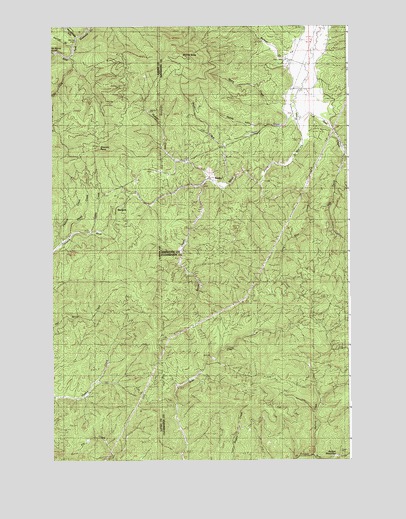
Bechtel Butte, ID USGS Topographic Map
Click on map above to begin viewing in our Map Viewer.

This topographic map contains these locations and features:
Feature Name Type Latitude Longitude GNIS ID View Map
Badger MeadowsFlatN46.8757°W116.2571°376835View Map
Bechtel ButteSummitN46.9916°W116.3229°396094View Map
Bechtel CreekStreamN46.9880°W116.2685°377298View Map
Cat Spur CreekStreamN46.9732°W116.2704°379036View Map
Caterpillar HillSummitN46.8757°W116.3715°399456View Map
Emerald Creek Garnet AreaAreaN46.9924°W116.3732°393997View Map
Garnet GulchValleyN46.9941°W116.3677°382207View Map
Head CreekStreamN46.9388°W116.3679°383015View Map
Hidden CreekStreamN46.9557°W116.3085°383140View Map
KeelerPopulated PlaceN46.9571°W116.3079°396731View Map
Keeler CreekStreamN46.9538°W116.3127°384115View Map
Lamb CreekStreamN46.9407°W116.3585°384394View Map
Little East Fork Emerald CreekStreamN46.9907°W116.3677°384816View Map
Log CreekStreamN46.9627°W116.2521°385966View Map
Long Slim CreekStreamN46.9543°W116.2877°386081View Map
Mallory CreekStreamN46.8763°W116.2663°386412View Map
Mazie CreekStreamN46.9777°W116.2735°386564View Map
Pasture CreekStreamN46.9374°W116.3713°388254View Map
SherwinPopulated PlaceN46.9477°W116.3479°397156View Map
Sherwin PointSummitN46.9649°W116.3568°390316View Map
Sherwin StationLocaleN46.9480°W116.3471°396016View Map
Wood CreekStreamN46.9560°W116.2979°393653View Map

Note: Coordinates in the location and feature list above are referenced to NAD83 datum.


Copyright (C) 2008-2025 Ryan Niemi / Sunset Dynamics ... All Rights Reserved