TopoQuest Logo
Do you find TopoQuest useful?
Help keep TopoQuest running and adding new maps/features by donating!
Bitcoin:  19c7KJd3qBynnjoSw5npx9KScwjBe4ifkT
Litecoin:  LXs6TkuXGGXo1vDsWCkWVdjQX94eUKd6ui
Home View Maps Find Maps Find Places Resources & Links


Merry Creek, Idaho Topographic Map

USGS Map Title: Merry Creek, ID
USGS Map MRC: 47116A2
DRG (GeoTIFF) Download: o47116a2.tif


Neighboring USGS Topographic Map Quads:


  Crystal Peak, ID  
47116B3
 

  Huckleberry Mountain, ID  
47116B2
 

  Marble Mountain, ID  
47116B1
 

  Clarkia, ID  
47116A3
 

  Merry Creek, ID  
47116A2
 

  Grandmother Mountain, ID  
47116A1
 

  Bechtel Butte, ID  
46116H3
 

  Anthony Peak, ID  
46116H2
 

  Grice Ridge, ID  
46116H1


Map MRC Location:

N48°
W117°
N48°
W116°
H8 H7 H6 H5 H4 H3 H2 H1
G8 G7 G6 G5 G4 G3 G2 G1
F8 F7 F6 F5 F4 F3 F2 F1
E8 E7 E6 E5 E4 E3 E2 E1
D8 D7 D6 D5 D4 D3 D2 D1
C8 C7 C6 C5 C4 C3 C2 C1
B8 B7 B6 B5 B4 B3 B2 B1
A8 A7 A6 A5 A4 A3 A2 A1
N47°
W117°
N47°
W116°

Merry Creek, ID USGS 1:24K Topographic Map Preview:
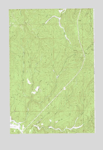
Merry Creek, ID USGS Topographic Map
Click on map above to begin viewing in our Map Viewer.

This topographic map contains these locations and features:
Feature Name Type Latitude Longitude GNIS ID View Map
Ashenfelter CreekStreamN47.0388°W116.2168°376743View Map
Corbett CreekStreamN47.0332°W116.2179°379734View Map
Davies PassGapN47.0830°W116.1554°380269View Map
Dutch CreekStreamN47.0010°W116.2324°380956View Map
Flewsie CreekStreamN47.0055°W116.1932°381861View Map
Gold Center CreekStreamN47.0041°W116.1699°382354View Map
Gramp CreekStreamN47.0052°W116.1574°382497View Map
Hobo Cedar GroveWoodsN47.0910°W116.1271°399068View Map
Hobo PassGapN47.0796°W116.1396°383231View Map
Lines CreekStreamN47.1152°W116.1757°384699View Map
Mann CreekStreamN47.0552°W116.1804°386428View Map
Merry CreekStreamN47.0096°W116.2368°396881View Map
Merry Creek Access AreaLocaleN47.0099°W116.2365°401603View Map
Norton CreekStreamN47.1246°W116.1660°387865View Map
Swan PeakSummitN47.1132°W116.1471°391729View Map
The InclineSlopeN47.1019°W116.2065°393932View Map
Titley CreekStreamN47.0071°W116.2121°392193View Map
Two Bit CreekStreamN47.0057°W116.1896°392550View Map
West Fork Merry CreekStreamN47.0349°W116.2177°393145View Map
Windy CreekStreamN47.0138°W116.1299°393579View Map

Note: Coordinates in the location and feature list above are referenced to NAD83 datum.


Copyright (C) 2008-2025 Ryan Niemi / Sunset Dynamics ... All Rights Reserved