TopoQuest Logo
Do you find TopoQuest useful?
Help keep TopoQuest running and adding new maps/features by donating!
Bitcoin:  19c7KJd3qBynnjoSw5npx9KScwjBe4ifkT
Litecoin:  LXs6TkuXGGXo1vDsWCkWVdjQX94eUKd6ui
Home View Maps Find Maps Find Places Resources & Links


Montague Butte, Montana Topographic Map

USGS Map Title: Montague Butte, MT
USGS Map MRC: 46105D1
DRG (GeoTIFF) Download: o46105d1.tif


Neighboring USGS Topographic Map Quads:


  Flat Top Butte SW, MT  
46105E2
 

  Little Whitney Creek, MT  
46105E1
 

  Loony Hollow, MT  
46104E8
 

  Hogan Creek, MT  
46105D2
 

  Montague Butte, MT  
46105D1
 

  Bracket Butte, MT  
46104D8
 

  Red Knob, MT  
46105C2
 

  Knowlton, MT  
46105C1
 

  Foundation Spring, MT  
46104C8


Map MRC Location:

N47°
W106°
N47°
W105°
H8 H7 H6 H5 H4 H3 H2 H1
G8 G7 G6 G5 G4 G3 G2 G1
F8 F7 F6 F5 F4 F3 F2 F1
E8 E7 E6 E5 E4 E3 E2 E1
D8 D7 D6 D5 D4 D3 D2 D1
C8 C7 C6 C5 C4 C3 C2 C1
B8 B7 B6 B5 B4 B3 B2 B1
A8 A7 A6 A5 A4 A3 A2 A1
N46°
W106°
N46°
W105°

Montague Butte, MT USGS 1:24K Topographic Map Preview:
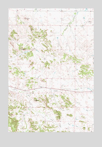
Montague Butte, MT USGS Topographic Map
Click on map above to begin viewing in our Map Viewer.

This topographic map contains these locations and features:
Feature Name Type Latitude Longitude GNIS ID View Map
07N53E04AD__01 WellWellN46.3947°W105.0955°815999View Map
07N54E08CA__01 WellWellN46.3750°W105.0005°815850View Map
08N53E15ADDA01 WellWellN46.4517°W105.0703°816335View Map
08N53E23CD__01 WellWellN46.4319°W105.0633°816238View Map
08N53E24BA__01 WellWellN46.4428°W105.0375°816292View Map
08N53E27DABC01 WellWellN46.4203°W105.0744°816156View Map
08N54E08AC__01 WellWellN46.4628°W105.0036°816378View Map
08N54E30DB__01 WellWellN46.4250°W105.0005°816194View Map
08N55E33AABA02 WellWellN46.4139°W105.0944°816118View Map
09N53E29CC__01 WellWellN46.4983°W105.0894°816534View Map
After the Roundup Historical MarkerParkN46.4200°W105.0747°1721484View Map
Archdale CreekStreamN46.4125°W105.0978°768327View Map
Ford Post Office (historical)Post OfficeN46.4750°W105.0011°1716883View Map
Henry Woods MountainSummitN46.3919°W105.0505°772344View Map
Leland Number 1 DamDamN46.4917°W105.0155°796908View Map
Locate Rest AreaLocaleN46.4206°W105.0747°1721483View Map
Long Prong Locate CreekStreamN46.4031°W105.0928°773652View Map
Montague ButteSummitN46.4069°W105.0858°774342View Map
North Fork Locate CreekStreamN46.3814°W105.0477°774775View Map
Rattlesnake ButteSummitN46.4583°W105.1019°775572View Map
Twin ButtesSummitN46.4894°W105.1008°777839View Map

Note: Coordinates in the location and feature list above are referenced to NAD83 datum.


Copyright (C) 2008-2025 Ryan Niemi / Sunset Dynamics ... All Rights Reserved