TopoQuest Logo
Do you find TopoQuest useful?
Help keep TopoQuest running and adding new maps/features by donating!
Bitcoin:  19c7KJd3qBynnjoSw5npx9KScwjBe4ifkT
Litecoin:  LXs6TkuXGGXo1vDsWCkWVdjQX94eUKd6ui
Home View Maps Find Maps Find Places Resources & Links


Knowlton, Montana Topographic Map

USGS Map Title: Knowlton, MT
USGS Map MRC: 46105C1
DRG (GeoTIFF) Download: o46105c1.tif


Neighboring USGS Topographic Map Quads:


  Hogan Creek, MT  
46105D2
 

  Montague Butte, MT  
46105D1
 

  Bracket Butte, MT  
46104D8
 

  Red Knob, MT  
46105C2
 

  Knowlton, MT  
46105C1
 

  Foundation Spring, MT  
46104C8
 

  Pennock Creek, MT  
46105B2
 

  Tepee Butte NE, MT  
46105B1
 

  Hooky Dam, MT  
46104B8


Map MRC Location:

N47°
W106°
N47°
W105°
H8 H7 H6 H5 H4 H3 H2 H1
G8 G7 G6 G5 G4 G3 G2 G1
F8 F7 F6 F5 F4 F3 F2 F1
E8 E7 E6 E5 E4 E3 E2 E1
D8 D7 D6 D5 D4 D3 D2 D1
C8 C7 C6 C5 C4 C3 C2 C1
B8 B7 B6 B5 B4 B3 B2 B1
A8 A7 A6 A5 A4 A3 A2 A1
N46°
W106°
N46°
W105°

Knowlton, MT USGS 1:24K Topographic Map Preview:
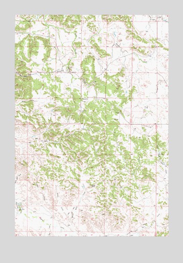
Knowlton, MT USGS Topographic Map
Click on map above to begin viewing in our Map Viewer.

This topographic map contains these locations and features:
Feature Name Type Latitude Longitude GNIS ID View Map
06N53E19AA__01 WellWellN46.2647°W105.1175°814917View Map
07N53E16DBAD01 WellWellN46.3631°W105.0980°815744View Map
07N53E16DBDA01 WellWellN46.3628°W105.0991°815740View Map
07N53E16DBDA02 WellWellN46.3628°W105.0991°815741View Map
07N53E23DDCA01 WellWellN46.3436°W105.0547°815611View Map
07N53E23DDCD01 WellWellN46.3428°W105.0544°815602View Map
07N53E26CC__01 WellWellN46.3300°W105.0694°815502View Map
07N53E35BBCA01 WellWellN46.3258°W105.0700°815469View Map
07N54E17ACCB01 WellWellN46.3583°W105.0091°815706View Map
07N54E17CBCD01 WellWellN46.3583°W105.0122°815707View Map
07N54E18BDC_01 WellWellN46.3150°W105.0236°815376View Map
07N54E20ABDC01 WellWellN46.3539°W105.0066°815659View Map
07N54E28A___02 WellWellN46.3611°W105.0077°815723View Map
07N56E26ABDA01 WellWellN46.3397°W105.0586°815580View Map
Cedar CreekStreamN46.2633°W105.1122°769704View Map
Dry CouleeValleyN46.3403°W105.0008°770761View Map
Foxey CreekStreamN46.2583°W105.0816°771595View Map
George ParkParkN46.3278°W105.0716°771739View Map
Gilman RanchLocaleN46.2650°W105.1222°771777View Map
KnowltonPopulated PlaceN46.3436°W105.0880°773109View Map
Knowlton CemeteryCemeteryN46.3209°W105.0716°773110View Map
Knowlton Post Office (historical)Post OfficeN46.3439°W105.0880°1716861View Map
Knowlton SchoolSchoolN46.3433°W105.0864°1716909View Map
Rock CreekStreamN46.2564°W105.0978°775846View Map
White KnobSummitN46.2786°W105.0639°778392View Map
White Knob CreekStreamN46.2522°W105.0808°778393View Map

Note: Coordinates in the location and feature list above are referenced to NAD83 datum.


Copyright (C) 2008-2024 Ryan Niemi / Sunset Dynamics ... All Rights Reserved