TopoQuest Logo
Do you find TopoQuest useful?
Help keep TopoQuest running and adding new maps/features by donating!
Bitcoin:  19c7KJd3qBynnjoSw5npx9KScwjBe4ifkT
Litecoin:  LXs6TkuXGGXo1vDsWCkWVdjQX94eUKd6ui
Home View Maps Find Maps Find Places Resources & Links


Monticello South, Utah Topographic Map

USGS Map Title: Monticello South, UT
USGS Map MRC: 37109G3
DRG (GeoTIFF) Download: o37109g3.tif


Neighboring USGS Topographic Map Quads:


  Monticello Lake, UT  
37109H4
 

  Monticello North, UT  
37109H3
 

  Eastland NW, UT  
37109H2
 

  Abajo Peak, UT  
37109G4
 

  Monticello South, UT  
37109G3
 

  Eastland, UT  
37109G2
 

  Blanding North, UT  
37109F4
 

  Devil Mesa, UT  
37109F3
 

  Horsehead Point, UT  
37109F2


Map MRC Location:

N38°
W110°
N38°
W109°
H8 H7 H6 H5 H4 H3 H2 H1
G8 G7 G6 G5 G4 G3 G2 G1
F8 F7 F6 F5 F4 F3 F2 F1
E8 E7 E6 E5 E4 E3 E2 E1
D8 D7 D6 D5 D4 D3 D2 D1
C8 C7 C6 C5 C4 C3 C2 C1
B8 B7 B6 B5 B4 B3 B2 B1
A8 A7 A6 A5 A4 A3 A2 A1
N37°
W110°
N37°
W109°

Monticello South, UT USGS 1:24K Topographic Map Preview:
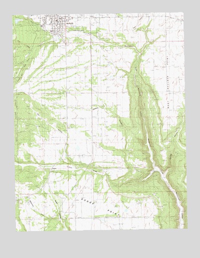
Monticello South, UT USGS Topographic Map
Click on map above to begin viewing in our Map Viewer.

This topographic map contains these locations and features:
Feature Name Type Latitude Longitude GNIS ID View Map
Baker Ranger StationLocaleN37.8697°W109.3579°1438339View Map
Boulder CanyonValleyN37.7792°W109.2671°1439020View Map
Boulder CreekStreamN37.7800°W109.2673°1450262View Map
Bull HollowValleyN37.7881°W109.3340°1439268View Map
City of MonticelloCivilN37.8684°W109.3383°2411149View Map
Dodge PointCliffN37.7572°W109.3098°1440492View Map
Halfway HollowValleyN37.7983°W109.2773°1448455View Map
Lloyds LakeReservoirN37.8493°W109.3511°1448615View Map
MonticelloPopulated PlaceN37.8714°W109.3429°1443568View Map
Monticello City CemeteryCemeteryN37.8683°W109.3307°1448682View Map
Monticello City Number One DamDamN37.8717°W109.3690°1447659View Map
Monticello City Number One ReservoirReservoirN37.8723°W109.3710°1447658View Map
Monticello District Ranger OfficeLocaleN37.8722°W109.3365°1453023View Map
Monticello Fire DepartmentBuildingN37.8708°W109.3444°2627159View Map
Monticello Golf CourseLocaleN37.8597°W109.3482°1453024View Map
Monticello High SchoolSchoolN37.8706°W109.3472°1448683View Map
Monticello Police DepartmentBuildingN37.8729°W109.3413°2730332View Map
Monticello Post OfficePost OfficeN37.8700°W109.3426°1455402View Map
North CreekStreamN37.8611°W109.3437°1443873View Map
Pole CreekStreamN37.8544°W109.3590°1444538View Map
Saint Josephs Catholic ChurchChurchN37.8647°W109.3426°1449315View Map
San Juan Community ChurchChurchN37.8664°W109.3390°1449328View Map
San Juan County Sheriff's OfficeBuildingN37.8688°W109.3422°2730414View Map
San Juan Emergency Medical Services - MonticelloBuildingN37.8715°W109.3444°2768480View Map
San Juan HospitalHospitalN37.8744°W109.3497°1448965View Map
San Juan Hospital HeliportAirportN37.8717°W109.3423°1448966View Map
Shingle Mill DrawValleyN37.8480°W109.3654°1449000View Map
South CreekStreamN37.8605°W109.3429°1445808View Map
The Church of Jesus Christ of Latter Day SaintsChurchN37.8700°W109.3360°1450731View Map
The Church of Jesus Christ of Latter Day SaintsChurchN37.8675°W109.3426°1449548View Map
United States Forest Service Fire Station - Monticello OfficeBuildingN37.8724°W109.3350°2768500View Map
Utah Highway Patrol Section 13 Monticello OfficeBuildingN37.8688°W109.3424°2730453View Map
Vega CreekStreamN37.8514°W109.2826°1446917View Map
VerdurePopulated PlaceN37.7858°W109.3487°1446923View Map
Verdure CemeteryCemeteryN37.7838°W109.3459°2769380View Map
Verdure CreekStreamN37.7842°W109.2721°1446924View Map
West Boulder PointCliffN37.8244°W109.2596°1447112View Map
Westerner Trailer ParkPopulated PlaceN37.8625°W109.3423°1449177View Map
Whipstock DrawValleyN37.7564°W109.3432°1449181View Map

Note: Coordinates in the location and feature list above are referenced to NAD83 datum.


Copyright (C) 2008-2025 Ryan Niemi / Sunset Dynamics ... All Rights Reserved