TopoQuest Logo
Do you find TopoQuest useful?
Help keep TopoQuest running and adding new maps/features by donating!
Bitcoin:  19c7KJd3qBynnjoSw5npx9KScwjBe4ifkT
Litecoin:  LXs6TkuXGGXo1vDsWCkWVdjQX94eUKd6ui
Home View Maps Find Maps Find Places Resources & Links


Morgan City SW, Louisiana Topographic Map

USGS Map Title: Morgan City SW, LA
USGS Map MRC: 29091E2
DRG (GeoTIFF) Download: o29091e2.tif


Neighboring USGS Topographic Map Quads:


  Patterson, LA  
29091F3
 

  Morgan City, LA  
29091F2
 

  Amelia, LA  
29091F1
 

  Lake Salve, LA  
29091E3
 

  Morgan City SW, LA  
29091E2
 

  Morgan City SE, LA  
29091E1
 

  Point au Fer NE, LA  
29091D3
 

  Plumb Bayou, LA  
29091D2


Map MRC Location:

N30°
W92°
N30°
W91°
H8 H7 H6 H5 H4 H3 H2 H1
G8 G7 G6 G5 G4 G3 G2 G1
F8 F7 F6 F5 F4 F3 F2 F1
E8 E7 E6 E5 E4 E3 E2 E1
D8 D7 D6 D5 D4 D3 D2 D1
C8 C7 C6 C5 C4 C3 C2 C1
B8 B7 B6 B5 B4 B3 B2 B1
A8 A7 A6 A5 A4 A3 A2 A1
N29°
W92°
N29°
W91°

Morgan City SW, LA USGS 1:24K Topographic Map Preview:
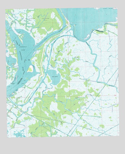
Morgan City SW, LA USGS Topographic Map
Click on map above to begin viewing in our Map Viewer.

This topographic map contains these locations and features:
Feature Name Type Latitude Longitude GNIS ID View Map
Avoca Island CutoffBayN29.5543°W91.2103°532256View Map
Bayou LawrenceStreamN29.6230°W91.1507°560002View Map
Bayou ShafferBayN29.5985°W91.2000°560081View Map
Big Horn BayouBayN29.5294°W91.2234°533078View Map
Blackbird BayouBayN29.5736°W91.1646°533193View Map
Cutoff BayouBayN29.5271°W91.2488°534322View Map
Dry Horn BayouBayN29.5247°W91.2018°534622View Map
East BendBendN29.5477°W91.2284°534698View Map
Hackberry BayouBayN29.5094°W91.2425°535473View Map
Hackberry BayouStreamN29.5194°W91.2379°535474View Map
Halfway BayouBayN29.6119°W91.2129°560932View Map
Honey BayouBayN29.6087°W91.2387°560993View Map
Honey IslandIslandN29.6180°W91.2476°560995View Map
Lake GaschaBayN29.5582°W91.1964°554513View Map
Little Bayou PenchantBayN29.5834°W91.1898°536491View Map
Little Horn BayouBayN29.5241°W91.1783°536560View Map
Lower PassBayN29.5479°W91.2015°536771View Map
Partridge BayouBayN29.5356°W91.1481°537986View Map
Sweetbay LakeBayN29.5884°W91.2291°1628319View Map
Sweetbay Lake Oil and Gas FieldOilfieldN29.5858°W91.2454°1628320View Map
Sword BayouBayN29.5457°W91.2075°539773View Map
Sword PointCapeN29.5755°W91.2229°539774View Map
Towhead BayouBayN29.5799°W91.2055°539972View Map

Note: Coordinates in the location and feature list above are referenced to NAD83 datum.


Copyright (C) 2008-2024 Ryan Niemi / Sunset Dynamics ... All Rights Reserved