TopoQuest Logo
Do you find TopoQuest useful?
Help keep TopoQuest running and adding new maps/features by donating!
Bitcoin:  19c7KJd3qBynnjoSw5npx9KScwjBe4ifkT
Litecoin:  LXs6TkuXGGXo1vDsWCkWVdjQX94eUKd6ui
Home View Maps Find Maps Find Places Resources & Links


Amelia, Louisiana Topographic Map

USGS Map Title: Amelia, LA
USGS Map MRC: 29091F1
DRG (GeoTIFF) Download: o29091f1.tif


Neighboring USGS Topographic Map Quads:


  Napoleonville SW, LA  
29091G2
 

  Grassy Lake, LA  
29091G1
 

  Labadieville, LA  
29090G8
 

  Morgan City, LA  
29091F2
 

  Amelia, LA  
29091F1
 

  Gibson, LA  
29090F8
 

  Morgan City SW, LA  
29091E2
 

  Morgan City SE, LA  
29091E1
 

  Bayou Cocodrie, LA  
29090E8


Map MRC Location:

N30°
W92°
N30°
W91°
H8 H7 H6 H5 H4 H3 H2 H1
G8 G7 G6 G5 G4 G3 G2 G1
F8 F7 F6 F5 F4 F3 F2 F1
E8 E7 E6 E5 E4 E3 E2 E1
D8 D7 D6 D5 D4 D3 D2 D1
C8 C7 C6 C5 C4 C3 C2 C1
B8 B7 B6 B5 B4 B3 B2 B1
A8 A7 A6 A5 A4 A3 A2 A1
N29°
W92°
N29°
W91°

Amelia, LA USGS 1:24K Topographic Map Preview:
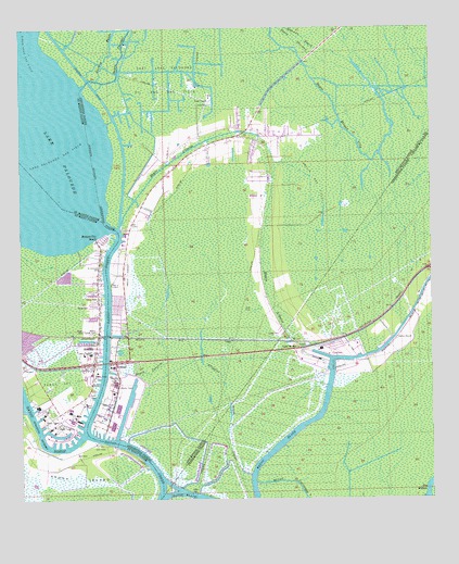
Amelia, LA USGS Topographic Map
Click on map above to begin viewing in our Map Viewer.

This topographic map contains these locations and features:
Feature Name Type Latitude Longitude GNIS ID View Map
Alligator BayouStreamN29.6277°W91.0765°532122View Map
AmeliaPopulated PlaceN29.6663°W91.1020°559772View Map
Amelia AirportAirportN29.6852°W91.0929°552866View Map
Amelia Base HeliportAirportN29.6683°W91.0968°1632602View Map
Amelia Census Designated PlaceCensusN29.6646°W91.1072°2402644View Map
Amelia Gas FieldOilfieldN29.7083°W91.0362°532151View Map
Amelia Post OfficePost OfficeN29.6616°W91.1054°1631658View Map
Amelia Volunteer Fire DepartmentBuildingN29.6650°W91.1028°2332493View Map
Arco Morgan City HeliportAirportN29.6422°W91.1020°1632601View Map
Assumption Parish Library Bayou L'Ourse BranchBuildingN29.7206°W91.0653°2603023View Map
Bay WallaceLakeN29.6293°W91.0004°532391View Map
Bayou BlackStreamN29.6266°W91.0820°532447View Map
Bayou Boeuf Seaplane BaseAirportN29.6835°W91.1001°1632598View Map
Bayou CarolineStreamN29.6591°W91.0987°532486View Map
Bayou CheramiStreamN29.7341°W91.1065°559903View Map
Bayou CocodrieStreamN29.6294°W91.0548°532532View Map
Bayou L'OurseStreamN29.6983°W91.0945°1629905View Map
Bayou L'Ourse Baptist ChurchChurchN29.7198°W91.0610°2600570View Map
Bayou L'Ourse Census Designated PlaceCensusN29.7174°W91.0606°2583529View Map
Bayou L'Ourse Head Start SchoolSchoolN29.7101°W91.0761°2600205View Map
Bayou L'Ourse Primary SchoolSchoolN29.7101°W91.0764°2493383View Map
Bayou L'Ourse Volunteer Fire DepartmentBuildingN29.7205°W91.0731°2332374View Map
BoeufPopulated PlaceN29.6613°W91.0962°558726View Map
East Lake Palourde Oil and Gas FieldOilfieldN29.7369°W91.0809°534725View Map
Era-Morgan City HeliportAirportN29.6458°W91.1193°1632599View Map
First Baptist Church of AmeliaChurchN29.6646°W91.1081°2601766View Map
Guitroz BayouStreamN29.7366°W91.1015°560917View Map
Holy Family ChurchChurchN29.6735°W91.1016°2601911View Map
J S Aucoin Elementary SchoolSchoolN29.6639°W91.1039°551454View Map
Lake BridgeLocaleN29.6649°W91.0407°536271View Map
Lake Palourde Base HeliportAirportN29.6933°W91.0987°1632600View Map
Lake Palourde Gas FieldOilfieldN29.7135°W91.1173°1627438View Map
Lily Boom CutoffChannelN29.6294°W91.0801°536453View Map
Milton CemeteryCemeteryN29.6696°W91.1023°1627668View Map
Morgan City BeachPopulated PlaceN29.6938°W91.1020°1627694View Map
Parish Governing Authority District 3CivilN29.7343°W91.0336°1929936View Map
Ramos Gas FieldOilfieldN29.6555°W91.1123°1628021View Map
Saint Andrew ChurchChurchN29.6640°W91.1061°2602367View Map
Saint Andrews CemeteryCemeteryN29.6866°W91.1009°1628093View Map
Saint Mary Parish Library Amelia BranchBuildingN29.6660°W91.1028°2603133View Map
Simon Pass Gas FieldOilfieldN29.7480°W91.1240°1628234View Map
UrsaPopulated PlaceN29.6674°W91.0637°543749View Map
Ward NineCivilN29.6760°W91.1040°1628623View Map
ZacarterPopulated PlaceN29.6655°W91.0298°551977View Map

Note: Coordinates in the location and feature list above are referenced to NAD83 datum.


Copyright (C) 2008-2025 Ryan Niemi / Sunset Dynamics ... All Rights Reserved