TopoQuest Logo
Do you find TopoQuest useful?
Help keep TopoQuest running and adding new maps/features by donating!
Bitcoin:  19c7KJd3qBynnjoSw5npx9KScwjBe4ifkT
Litecoin:  LXs6TkuXGGXo1vDsWCkWVdjQX94eUKd6ui
Home View Maps Find Maps Find Places Resources & Links


Morgan Harbor, Louisiana Topographic Map

USGS Map Title: Morgan Harbor, LA
USGS Map MRC: 29089G3
DRG (GeoTIFF) Download: o29089g3.tif


Neighboring USGS Topographic Map Quads:


  Lake Eugenie, LA  
29089H4
 

  Oak Mound Bayou, LA  
29089H3
 

  Mitchell Island, LA  
29089H2
 

  Lake Eloi, LA  
29089G4
 

  Morgan Harbor, LA  
29089G3


  Lake Athanasio, LA  
29089F4
 

  Point Chicot, LA  
29089F3


Map MRC Location:

N30°
W90°
N30°
W89°
H8 H7 H6 H5 H4 H3 H2 H1
G8 G7 G6 G5 G4 G3 G2 G1
F8 F7 F6 F5 F4 F3 F2 F1
E8 E7 E6 E5 E4 E3 E2 E1
D8 D7 D6 D5 D4 D3 D2 D1
C8 C7 C6 C5 C4 C3 C2 C1
B8 B7 B6 B5 B4 B3 B2 B1
A8 A7 A6 A5 A4 A3 A2 A1
N29°
W90°
N29°
W89°

Morgan Harbor, LA USGS 1:24K Topographic Map Preview:
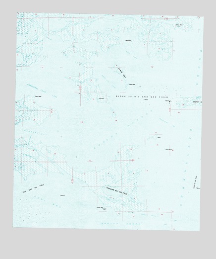
Morgan Harbor, LA USGS Topographic Map
Click on map above to begin viewing in our Map Viewer.

This topographic map contains these locations and features:
Feature Name Type Latitude Longitude GNIS ID View Map
Bayou JuliaGutN29.8683°W89.3392°559989View Map
Chandeleur Sound Block 25 Oil FieldOilfieldN29.8280°W89.2745°1629378View Map
Chicot PassChannelN29.7524°W89.2703°560417View Map
Christmas Camp LakeLakeN29.8358°W89.3648°560429View Map
Codfish PointCapeN29.7621°W89.3153°560449View Map
Dry Bread IslandIslandN29.8408°W89.3042°560659View Map
Eloi BayBayN29.7669°W89.3731°560706View Map
Jules CutoffGutN29.8613°W89.3556°1627380View Map
Martinbox BayouGutN29.8702°W89.2923°1627617View Map
Morgan HarborBayN29.8105°W89.3012°1627695View Map
Morgan Harbor PassChannelN29.8138°W89.2737°1627696View Map
Old Harry BayouGutN29.8255°W89.2570°1627825View Map
Otter BayouChannelN29.7660°W89.3070°1627842View Map
Point CahillCapeN29.8277°W89.3609°1627949View Map
Point ElizaCapeN29.8352°W89.2992°1627954View Map
Point Lydia (historical)CapeN29.7588°W89.2725°1627959View Map
Point Paulina (historical)CapeN29.7972°W89.2744°1627962View Map
Rawhead Island (historical)IslandN29.8455°W89.2839°1628025View Map
Scow PassChannelN29.8696°W89.2703°1628192View Map
Skiff IslandIslandN29.8596°W89.2978°1628239View Map
Skiff LakeLakeN29.8494°W89.2978°1628240View Map
Treasure Bay PassChannelN29.8002°W89.3656°1628377View Map
Treasure Island Gas FieldOilfieldN29.7788°W89.2987°1629421View Map
Twilight HarborBayN29.7605°W89.2831°1628396View Map
White Log LakeLakeN29.8349°W89.3120°1628495View Map

Note: Coordinates in the location and feature list above are referenced to NAD83 datum.


Copyright (C) 2008-2025 Ryan Niemi / Sunset Dynamics ... All Rights Reserved