TopoQuest Logo
Do you find TopoQuest useful?
Help keep TopoQuest running and adding new maps/features by donating!
Bitcoin:  19c7KJd3qBynnjoSw5npx9KScwjBe4ifkT
Litecoin:  LXs6TkuXGGXo1vDsWCkWVdjQX94eUKd6ui
Home View Maps Find Maps Find Places Resources & Links


Mormon Mill, Texas Topographic Map

USGS Map Title: Mormon Mill, TX
USGS Map MRC: 30098F2
DRG (GeoTIFF) Download: o30098f2.tif


Neighboring USGS Topographic Map Quads:


  Council Creek, TX  
30098G3
 

  Burnet, TX  
30098G2
 

  Joppa, TX  
30098G1
 

  Longhorn Cavern, TX  
30098F3
 

  Mormon Mill, TX  
30098F2
 

  Bertram, TX  
30098F1
 

  Marble Falls, TX  
30098E3
 

  Smithwick, TX  
30098E2
 

  Travis Peak, TX  
30098E1


Map MRC Location:

N31°
W99°
N31°
W98°
H8 H7 H6 H5 H4 H3 H2 H1
G8 G7 G6 G5 G4 G3 G2 G1
F8 F7 F6 F5 F4 F3 F2 F1
E8 E7 E6 E5 E4 E3 E2 E1
D8 D7 D6 D5 D4 D3 D2 D1
C8 C7 C6 C5 C4 C3 C2 C1
B8 B7 B6 B5 B4 B3 B2 B1
A8 A7 A6 A5 A4 A3 A2 A1
N30°
W99°
N30°
W98°

Mormon Mill, TX USGS 1:24K Topographic Map Preview:
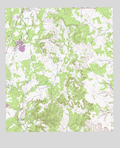
Mormon Mill, TX USGS Topographic Map
Click on map above to begin viewing in our Map Viewer.

This topographic map contains these locations and features:
Feature Name Type Latitude Longitude GNIS ID View Map
Burger HollowValleyN30.6345°W98.2249°1353317View Map
Burnet Municipal Airport Kate Craddock FieldAirportN30.7389°W98.2386°1386322View Map
Delaware CreekStreamN30.7077°W98.2375°1355884View Map
Flippin CemeteryCemeteryN30.7447°W98.2316°1357487View Map
GandyPopulated PlaceN30.7188°W98.2317°1379822View Map
Hairston CreekStreamN30.6638°W98.2289°1358629View Map
Haynie BranchStreamN30.7493°W98.2253°1358940View Map
Holland CemeteryCemeteryN30.7161°W98.2124°1359407View Map
Holland SpringsSpringN30.7085°W98.2420°1998650View Map
Honey CreekStreamN30.6771°W98.2439°1359497View Map
Magill CemeteryCemeteryN30.7405°W98.2355°1362072View Map
Mill PondLakeN30.6373°W98.2353°1362883View Map
Morman Mill CemeteryCemeteryN30.6322°W98.2324°1363152View Map
Mormon Mill Historical SiteLocaleN30.6369°W98.2339°1363151View Map
Norred CemeteryCemeteryN30.6969°W98.1841°1363973View Map
Seton Highland Lakes HospitalHospitalN30.7331°W98.2369°2718169View Map
Texas Department of Criminal Justice Ellen Halbert UnitBuildingN30.7428°W98.2471°2738619View Map

Note: Coordinates in the location and feature list above are referenced to NAD83 datum.


Copyright (C) 2008-2025 Ryan Niemi / Sunset Dynamics ... All Rights Reserved