TopoQuest Logo
Do you find TopoQuest useful?
Help keep TopoQuest running and adding new maps/features by donating!
Bitcoin:  19c7KJd3qBynnjoSw5npx9KScwjBe4ifkT
Litecoin:  LXs6TkuXGGXo1vDsWCkWVdjQX94eUKd6ui
Home View Maps Find Maps Find Places Resources & Links


Morton SE, Minnesota Topographic Map

USGS Map Title: Morton SE, MN
USGS Map MRC: 44094E7
DRG (GeoTIFF) Download: o44094e7.tif


Neighboring USGS Topographic Map Quads:


  Morton NW, MN  
44094F8
 

  Morton NE, MN  
44094F7
 

  Hector, MN  
44094F6
 

  Morton, MN  
44094E8
 

  Morton SE, MN  
44094E7
 

  Fairfax, MN  
44094E6
 

  Morgan, MN  
44094D8
 

  Morgan NE, MN  
44094D7
 

  Sleepy Eye NW, MN  
44094D6


Map MRC Location:

N45°
W95°
N45°
W94°
H8 H7 H6 H5 H4 H3 H2 H1
G8 G7 G6 G5 G4 G3 G2 G1
F8 F7 F6 F5 F4 F3 F2 F1
E8 E7 E6 E5 E4 E3 E2 E1
D8 D7 D6 D5 D4 D3 D2 D1
C8 C7 C6 C5 C4 C3 C2 C1
B8 B7 B6 B5 B4 B3 B2 B1
A8 A7 A6 A5 A4 A3 A2 A1
N44°
W95°
N44°
W94°

Morton SE, MN USGS 1:24K Topographic Map Preview:
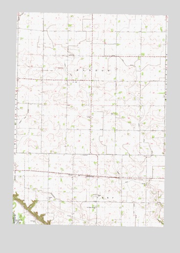
Morton SE, MN USGS Topographic Map
Click on map above to begin viewing in our Map Viewer.

This topographic map contains these locations and features:
Feature Name Type Latitude Longitude GNIS ID View Map
Central ChurchChurchN44.5180°W94.8053°641057View Map
County Ditch Number One Hundred FifteenCanalN44.5833°W94.7800°1815479View Map
County Ditch Number One Hundred FortyCanalN44.5005°W94.7739°1815477View Map
County Ditch Number One Hundred Nine ACanalN44.5514°W94.8689°1815478View Map
County Ditch Number One Hundred Six ACanalN44.5833°W94.8225°1815480View Map
Finnish CemeteryCemeteryN44.5413°W94.8197°643637View Map
Finnish ChurchChurchN44.5416°W94.8464°643640View Map
Fort Ridgely and Dale CemeteryCemeteryN44.5108°W94.8064°1815476View Map
Fort Ridgely and Dale ChurchChurchN44.5114°W94.8067°643821View Map
Franklin CemeteryCemeteryN44.5158°W94.8461°643886View Map
Gilbert Borth CemeteryCemeteryN44.5361°W94.7555°2065411View Map
Hauges CemeteryCemeteryN44.5180°W94.8053°644727View Map
Nosbush DairyLocaleN44.5089°W94.7583°2635894View Map
School Number 1LocaleN44.5147°W94.8461°659943View Map
School Number 10LocaleN44.5144°W94.8055°651325View Map
Township of BandonCivilN44.5860°W94.8127°663502View Map
Township of CampCivilN44.5056°W94.7979°663733View Map
Zion Lutheran Church (historical)ChurchN44.5664°W94.7939°654469View Map

Note: Coordinates in the location and feature list above are referenced to NAD83 datum.


Copyright (C) 2008-2025 Ryan Niemi / Sunset Dynamics ... All Rights Reserved