TopoQuest Logo
Do you find TopoQuest useful?
Help keep TopoQuest running and adding new maps/features by donating!
Bitcoin:  19c7KJd3qBynnjoSw5npx9KScwjBe4ifkT
Litecoin:  LXs6TkuXGGXo1vDsWCkWVdjQX94eUKd6ui
Home View Maps Find Maps Find Places Resources & Links


Moscow Mountain, Idaho Topographic Map

USGS Map Title: Moscow Mountain, ID
USGS Map MRC: 46116G7
DRG (GeoTIFF) Download: o46116g7.tif


Neighboring USGS Topographic Map Quads:


  Potlatch, ID  
46116H8
 

  Princeton, ID  
46116H7
 

  Harvard, ID  
46116H6
 

  Robinson Lake, ID  
46116G8
 

  Moscow Mountain, ID  
46116G7
 

  Stanford, ID  
46116G6
 

  Moscow East, ID  
46116F8
 

  Troy, ID  
46116F7
 

  Little Bear Ridge, ID  
46116F6


Map MRC Location:

N47°
W117°
N47°
W116°
H8 H7 H6 H5 H4 H3 H2 H1
G8 G7 G6 G5 G4 G3 G2 G1
F8 F7 F6 F5 F4 F3 F2 F1
E8 E7 E6 E5 E4 E3 E2 E1
D8 D7 D6 D5 D4 D3 D2 D1
C8 C7 C6 C5 C4 C3 C2 C1
B8 B7 B6 B5 B4 B3 B2 B1
A8 A7 A6 A5 A4 A3 A2 A1
N46°
W117°
N46°
W116°

Moscow Mountain, ID USGS 1:24K Topographic Map Preview:
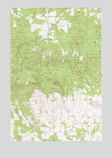
Moscow Mountain, ID USGS Topographic Map
Click on map above to begin viewing in our Map Viewer.

This topographic map contains these locations and features:
Feature Name Type Latitude Longitude GNIS ID View Map
Basalt HillSummitN46.8404°W116.7818°376995View Map
Bergs CreekStreamN46.7824°W116.7524°393901View Map
Beulah CemeteryCemeteryN46.7602°W116.7913°377419View Map
Browns MeadowFlatN46.8427°W116.7571°378293View Map
East Moscow LookoutLocaleN46.8043°W116.8396°381209View Map
East Moscow MountainSummitN46.8046°W116.8399°399026View Map
Felton CreekStreamN46.7560°W116.8165°372678View Map
Lamarack Ski AreaLocaleN46.8157°W116.8254°394065View Map
Long CreekStreamN46.8491°W116.8252°386038View Map
Moscow MountainSummitN46.8035°W116.8688°387251View Map
Moscow Mountain Picnic AreaLocaleN46.8074°W116.8421°387252View Map
Palouse RangeRangeN46.8043°W116.8535°388144View Map
Randall FlatFlatN46.7563°W116.8252°389088View Map
Randall Flat CreekStreamN46.7560°W116.8165°389089View Map
Spring Valley DamDamN46.7835°W116.7530°398754View Map
Spring Valley Recreation SiteLocaleN46.7871°W116.7549°394066View Map
Spring Valley ReservoirReservoirN46.7853°W116.7576°395981View Map
Spring Valley Reservoir Public Fishing AreaLocaleN46.7863°W116.7557°401190View Map
Troy DamDamN46.8041°W116.8113°398756View Map
Turnbow PointSummitN46.8702°W116.7843°397277View Map
University of Idaho Experimental ForestReserveN46.7982°W116.8127°399729View Map
Village of Troy ReservoirReservoirN46.8043°W116.8119°398306View Map

Note: Coordinates in the location and feature list above are referenced to NAD83 datum.


Copyright (C) 2008-2025 Ryan Niemi / Sunset Dynamics ... All Rights Reserved