TopoQuest Logo
Do you find TopoQuest useful?
Help keep TopoQuest running and adding new maps/features by donating!
Bitcoin:  19c7KJd3qBynnjoSw5npx9KScwjBe4ifkT
Litecoin:  LXs6TkuXGGXo1vDsWCkWVdjQX94eUKd6ui
Home View Maps Find Maps Find Places Resources & Links


Mound Valley, Kansas Topographic Map

USGS Map Title: Mound Valley, KS
USGS Map MRC: 37095B4
DRG (GeoTIFF) Download: o37095b4.tif


Neighboring USGS Topographic Map Quads:


  Cherryvale, KS  
37095C5
 

  Dennis, KS  
37095C4
 

  Parsons West, KS  
37095C3
 

  Liberty, KS  
37095B5
 

  Mound Valley, KS  
37095B4
 

  Altamont, KS  
37095B3
 

  Coffeyville East, KS  
37095A5
 

  Valeda, KS  
37095A4
 

  Edna, KS  
37095A3


Map MRC Location:

N38°
W96°
N38°
W95°
H8 H7 H6 H5 H4 H3 H2 H1
G8 G7 G6 G5 G4 G3 G2 G1
F8 F7 F6 F5 F4 F3 F2 F1
E8 E7 E6 E5 E4 E3 E2 E1
D8 D7 D6 D5 D4 D3 D2 D1
C8 C7 C6 C5 C4 C3 C2 C1
B8 B7 B6 B5 B4 B3 B2 B1
A8 A7 A6 A5 A4 A3 A2 A1
N37°
W96°
N37°
W95°

Mound Valley, KS USGS 1:24K Topographic Map Preview:
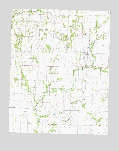
Mound Valley, KS USGS Topographic Map
Click on map above to begin viewing in our Map Viewer.

This topographic map contains these locations and features:
Feature Name Type Latitude Longitude GNIS ID View Map
Bartlett Co - Operative Association Grain Elevator Number 4LocaleN37.2094°W95.4037°2695363View Map
Bell Mound School (historical)SchoolN37.1506°W95.4941°483685View Map
City of Mound ValleyCivilN37.2068°W95.4051°2395115View Map
Cunningham School (historical)SchoolN37.2442°W95.4864°483703View Map
Dixon MoundSummitN37.2262°W95.4183°469432View Map
East Fairview School (historical)SchoolN37.2073°W95.4830°483706View Map
Elmwood School (historical)SchoolN37.1776°W95.4522°483708View Map
Enterprise School (historical)SchoolN37.1634°W95.4053°483711View Map
Excelsior School (historical)SchoolN37.2440°W95.4464°483712View Map
Globe School (historical)SchoolN37.2448°W95.4016°483716View Map
Griffith CemeteryCemeteryN37.2466°W95.4988°469431View Map
Kansas State University Southeast Agricultural Research Center Mound Valley Field OfficeLocaleN37.1878°W95.4507°485377View Map
KGGF-AM (Coffeyville)TowerN37.1495°W95.4744°481599View Map
Lost BranchStreamN37.1901°W95.4153°482758View Map
Mound ValleyPopulated PlaceN37.2053°W95.4050°469430View Map
Mound Valley CemeteryCemeteryN37.1993°W95.3995°469429View Map
Mound Valley Christian ChurchChurchN37.2046°W95.4046°2689837View Map
Mound Valley City HallBuildingN37.2050°W95.4047°2693369View Map
Mound Valley Elementary SchoolSchoolN37.2046°W95.4078°481134View Map
Mound Valley Fire DepartmentBuildingN37.2050°W95.4047°2111653View Map
Mound Valley LibraryBuildingN37.2051°W95.4047°2694859View Map
Mound Valley Lighthouse ChurchChurchN37.2155°W95.4047°2689125View Map
Mound Valley Post OfficePost OfficeN37.2052°W95.4047°2693867View Map
Mound Valley United Methodist ChurchChurchN37.2053°W95.4064°2689126View Map
Mound Valley Wastewater PlantLocaleN37.2013°W95.4123°2692078View Map
Mud CreekStreamN37.1670°W95.4522°469426View Map
PenfieldPopulated PlaceN37.1628°W95.4080°484443View Map
Penfield CemeteryCemeteryN37.1457°W95.4122°469428View Map
Richland School (historical)SchoolN37.1345°W95.4472°483756View Map
Ritchland CemeteryCemeteryN37.1340°W95.4476°469427View Map
Township of Mound ValleyCivilN37.2077°W95.4477°469442View Map
Wheatland School (historical)SchoolN37.2145°W95.4469°483781View Map
Wildcat CreekStreamN37.2484°W95.4772°469434View Map

Note: Coordinates in the location and feature list above are referenced to NAD83 datum.


Copyright (C) 2008-2024 Ryan Niemi / Sunset Dynamics ... All Rights Reserved