TopoQuest Logo
Do you find TopoQuest useful?
Help keep TopoQuest running and adding new maps/features by donating!
Bitcoin:  19c7KJd3qBynnjoSw5npx9KScwjBe4ifkT
Litecoin:  LXs6TkuXGGXo1vDsWCkWVdjQX94eUKd6ui
Home View Maps Find Maps Find Places Resources & Links


Mount Abraham, Maine Topographic Map

USGS Map Title: Mount Abraham, ME
USGS Map MRC: 44070H3
DRG (GeoTIFF) Download: o44070h3.tif


Neighboring USGS Topographic Map Quads:


  Black Nubble, ME  
45070A4
 

  Sugarloaf Mountain, ME  
45070A3
 

  Poplar Mountain, ME  
45070A2
 

  Redington, ME  
44070H4
 

  Mount Abraham, ME  
44070H3
 

  Kingfield, ME  
44070H2
 

  Madrid, ME  
44070G4
 

  Phillips, ME  
44070G3
 

  Strong, ME  
44070G2


Map MRC Location:

N45°
W71°
N45°
W70°
H8 H7 H6 H5 H4 H3 H2 H1
G8 G7 G6 G5 G4 G3 G2 G1
F8 F7 F6 F5 F4 F3 F2 F1
E8 E7 E6 E5 E4 E3 E2 E1
D8 D7 D6 D5 D4 D3 D2 D1
C8 C7 C6 C5 C4 C3 C2 C1
B8 B7 B6 B5 B4 B3 B2 B1
A8 A7 A6 A5 A4 A3 A2 A1
N44°
W71°
N44°
W70°

Mount Abraham, ME USGS 1:24K Topographic Map Preview:
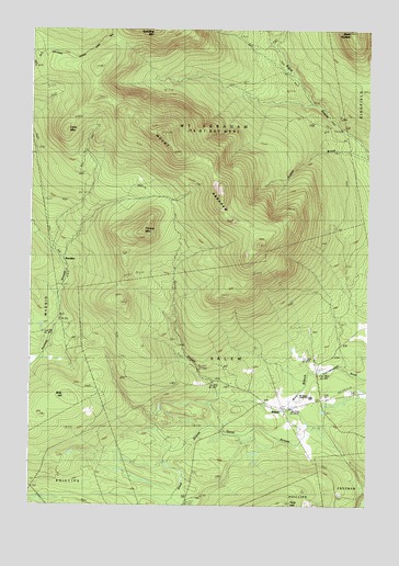
Mount Abraham, ME USGS Topographic Map
Click on map above to begin viewing in our Map Viewer.

This topographic map contains these locations and features:
Feature Name Type Latitude Longitude GNIS ID View Map
BarnjumPopulated PlaceN44.9414°W70.3651°579119View Map
Black NubbleSummitN45.0000°W70.2569°562477View Map
Blethen SchoolSchoolN44.8795°W70.3745°562575View Map
Bray HillSummitN44.9039°W70.3599°562919View Map
Farmer MountainSummitN44.9470°W70.3337°566049View Map
Lone MountainSummitN44.9739°W70.3624°570169View Map
Mount AbrahamSummitN44.9723°W70.3259°561068View Map
Mount Abram CemeteryCemeteryN44.9035°W70.2664°2736298View Map
Mount Abram Regional High SchoolSchoolN44.9037°W70.2704°1908368View Map
Mount Abram TownshipCivilN44.9744°W70.3168°2748813View Map
Norton BrookStreamN44.9659°W70.2523°572488View Map
Quick StreamStreamN44.8953°W70.2715°573935View Map
SalemPopulated PlaceN44.9006°W70.2781°574756View Map
Salem TownshipCivilN44.9122°W70.2934°2748816View Map
Unorganized Territory of East Central FranklinCivilN44.9411°W70.3518°582453View Map

Note: Coordinates in the location and feature list above are referenced to NAD83 datum.


Copyright (C) 2008-2025 Ryan Niemi / Sunset Dynamics ... All Rights Reserved