TopoQuest Logo
Do you find TopoQuest useful?
Help keep TopoQuest running and adding new maps/features by donating!
Bitcoin:  19c7KJd3qBynnjoSw5npx9KScwjBe4ifkT
Litecoin:  LXs6TkuXGGXo1vDsWCkWVdjQX94eUKd6ui
Home View Maps Find Maps Find Places Resources & Links


Kingfield, Maine Topographic Map

USGS Map Title: Kingfield, ME
USGS Map MRC: 44070H2
DRG (GeoTIFF) Download: o44070h2.tif


Neighboring USGS Topographic Map Quads:


  Sugarloaf Mountain, ME  
45070A3
 

  Poplar Mountain, ME  
45070A2
 

  Witham Mountain, ME  
45070A1
 

  Mount Abraham, ME  
44070H3
 

  Kingfield, ME  
44070H2
 

  New Portland, ME  
44070H1
 

  Phillips, ME  
44070G3
 

  Strong, ME  
44070G2
 

  New Vineyard, ME  
44070G1


Map MRC Location:

N45°
W71°
N45°
W70°
H8 H7 H6 H5 H4 H3 H2 H1
G8 G7 G6 G5 G4 G3 G2 G1
F8 F7 F6 F5 F4 F3 F2 F1
E8 E7 E6 E5 E4 E3 E2 E1
D8 D7 D6 D5 D4 D3 D2 D1
C8 C7 C6 C5 C4 C3 C2 C1
B8 B7 B6 B5 B4 B3 B2 B1
A8 A7 A6 A5 A4 A3 A2 A1
N44°
W71°
N44°
W70°

Kingfield, ME USGS 1:24K Topographic Map Preview:
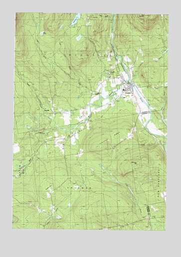
Kingfield, ME USGS Topographic Map
Click on map above to begin viewing in our Map Viewer.

This topographic map contains these locations and features:
Feature Name Type Latitude Longitude GNIS ID View Map
Alder BrookStreamN44.9614°W70.1970°561135View Map
Alder StreamStreamN44.9573°W70.1637°561151View Map
Allen CemeteryCemeteryN44.8763°W70.1728°2724977View Map
Burbank Nile CemeteryCemeteryN44.8797°W70.1499°2736275View Map
Carrabassett River ReservoirReservoirN44.9593°W70.1537°1774106View Map
Day PondLakeN44.9880°W70.2276°564840View Map
Deer Farms Camp and CampgroundLocaleN44.9789°W70.1753°1908311View Map
First Baptist ChurchChurchN44.9564°W70.1556°1908328View Map
Foster HillSummitN44.9001°W70.2173°566453View Map
Freeman RidgeRidgeN44.9270°W70.1717°566554View Map
Freeman Ridge CemeteryCemeteryN44.9226°W70.1677°2736289View Map
Freeman Ridge SchoolSchoolN44.9226°W70.1659°566557View Map
KingfieldPopulated PlaceN44.9592°W70.1540°569206View Map
Kingfield DamDamN44.9593°W70.1537°1774105View Map
Kingfield Elementary SchoolSchoolN44.9516°W70.1601°1908352View Map
Kingfield Fire DepartmentBuildingN44.9696°W70.1685°2552819View Map
Kingfield Historical HouseBuildingN44.9576°W70.1551°1908353View Map
Kingfield Historical SocietyBuildingN44.9576°W70.1551°1908354View Map
Kingfield Post OfficePost OfficeN44.9584°W70.1558°1908355View Map
Ledge BrookStreamN44.9973°W70.1695°569436View Map
North Freeman CemeteryCemeteryN44.9246°W70.2090°2736300View Map
North Freeman SchoolSchoolN44.9245°W70.2084°572337View Map
Pinnacle PondLakeN44.9657°W70.1722°573436View Map
Rapid StreamStreamN44.9331°W70.2131°574045View Map
Riverside CemeteryCemeteryN44.9599°W70.1588°2736307View Map
Soule MillPopulated PlaceN44.9434°W70.2267°579707View Map
Stanley MuseumBuildingN44.9570°W70.1565°1908432View Map
Stanley School (historical)SchoolN44.9570°W70.1565°1908433View Map
Stanley StreamStreamN44.9598°W70.1523°576247View Map
Starbird Corner CemeteryCemeteryN44.8837°W70.2192°2736312View Map
Starbird SchoolSchoolN44.8839°W70.2176°576263View Map
Sunnyside CemeteryCemeteryN44.9485°W70.1500°2736314View Map
Taylor BrookStreamN44.9245°W70.1251°576674View Map
Town of KingfieldCivilN44.9837°W70.1902°582541View Map
Tufts PondLakeN44.9967°W70.2000°577391View Map
Tufts Pond BrookStreamN44.9614°W70.1970°577392View Map
Vose MountainSummitN44.9993°W70.1437°577746View Map
Webster Free LibraryBuildingN44.9578°W70.1569°1908459View Map
Welcome HillSummitN44.9133°W70.1476°577987View Map
West Branch Carrabassett RiverStreamN44.9614°W70.1578°578041View Map

Note: Coordinates in the location and feature list above are referenced to NAD83 datum.


Copyright (C) 2008-2025 Ryan Niemi / Sunset Dynamics ... All Rights Reserved