TopoQuest Logo
Do you find TopoQuest useful?
Help keep TopoQuest running and adding new maps/features by donating!
Bitcoin:  19c7KJd3qBynnjoSw5npx9KScwjBe4ifkT
Litecoin:  LXs6TkuXGGXo1vDsWCkWVdjQX94eUKd6ui
Home View Maps Find Maps Find Places Resources & Links


Mount Aden, New Mexico Topographic Map

USGS Map Title: Mount Aden, NM
USGS Map MRC: 32107B2
DRG (GeoTIFF) Download: o32107b2.tif


Neighboring USGS Topographic Map Quads:


  Lazy E Ranch, NM  
32107C3
 

  Magdalena Gap, NM  
32107C2
 

  Sleeping Lady Hills, NM  
32107C1
 

  Cambray, NM  
32107B3
 

  Mount Aden, NM  
32107B2
 

  Aden Hills, NM  
32107B1
 

  X-7 Ranch, NM  
32107A3
 

  Mount Aden SW, NM  
32107A2
 

  Aden Crater, NM  
32107A1


Map MRC Location:

N33°
W108°
N33°
W107°
H8 H7 H6 H5 H4 H3 H2 H1
G8 G7 G6 G5 G4 G3 G2 G1
F8 F7 F6 F5 F4 F3 F2 F1
E8 E7 E6 E5 E4 E3 E2 E1
D8 D7 D6 D5 D4 D3 D2 D1
C8 C7 C6 C5 C4 C3 C2 C1
B8 B7 B6 B5 B4 B3 B2 B1
A8 A7 A6 A5 A4 A3 A2 A1
N32°
W108°
N32°
W107°

Mount Aden, NM USGS 1:24K Topographic Map Preview:
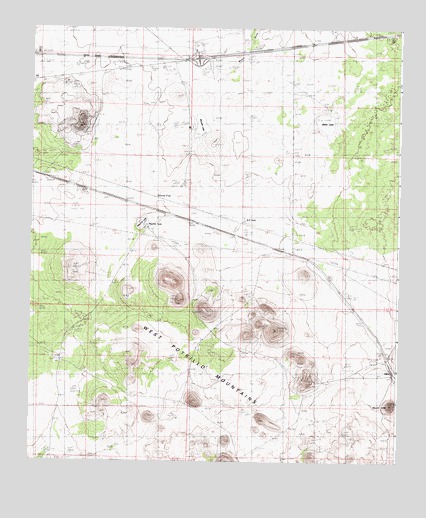
Mount Aden, NM USGS Topographic Map
Click on map above to begin viewing in our Map Viewer.

This topographic map contains these locations and features:
Feature Name Type Latitude Longitude GNIS ID View Map
AdenPopulated PlaceN32.1529°W107.1275°899493View Map
Aden MountainSummitN32.1415°W107.1272°885562View Map
Aden Post Office (historical)Post OfficeN32.1529°W107.1275°938052View Map
Allen RanchLocaleN32.2289°W107.2003°886373View Map
Biggs WellsWellN32.1259°W107.2433°886374View Map
Brass RanchLocaleN32.2487°W107.1478°886710View Map
Burris E Station Airport (historical)AirportN32.2469°W107.1924°936970View Map
ChappelPopulated PlaceN32.1918°W107.1847°920576View Map
Dalry LakeLakeN32.2262°W107.1497°901218View Map
Lazy E Bar Water WellWellN32.1962°W107.2400°927238View Map
Longview SchoolSchoolN32.2468°W107.1525°891318View Map
Mason DrawValleyN32.2254°W107.1928°891668View Map
Mauries LakeLakeN32.1938°W107.2123°901182View Map
Mauries TankReservoirN32.1930°W107.2111°900695View Map
Muzzle LakeLakeN32.2220°W107.1931°892359View Map
New Pipeline TubWellN32.2270°W107.1489°892454View Map
O D RanchLocaleN32.1551°W107.2420°892775View Map
R R TankReservoirN32.1945°W107.1777°893595View Map
West Line WellWellN32.2323°W107.1772°896387View Map
White FlatFlatN32.2006°W107.2092°896492View Map

Note: Coordinates in the location and feature list above are referenced to NAD83 datum.


Copyright (C) 2008-2025 Ryan Niemi / Sunset Dynamics ... All Rights Reserved