TopoQuest Logo
Do you find TopoQuest useful?
Help keep TopoQuest running and adding new maps/features by donating!
Bitcoin:  19c7KJd3qBynnjoSw5npx9KScwjBe4ifkT
Litecoin:  LXs6TkuXGGXo1vDsWCkWVdjQX94eUKd6ui
Home View Maps Find Maps Find Places Resources & Links


Lazy E Ranch, New Mexico Topographic Map

USGS Map Title: Lazy E Ranch, NM
USGS Map MRC: 32107C3
DRG (GeoTIFF) Download: o32107c3.tif


Neighboring USGS Topographic Map Quads:


  Good Sight Peak, NM  
32107D4
 

  Good Sight Peak NE, NM  
32107D3
 

  Magdalena Peak, NM  
32107D2
 

  Myndus, NM  
32107C4
 

  Lazy E Ranch, NM  
32107C3
 

  Magdalena Gap, NM  
32107C2
 

  Akela, NM  
32107B4
 

  Cambray, NM  
32107B3
 

  Mount Aden, NM  
32107B2


Map MRC Location:

N33°
W108°
N33°
W107°
H8 H7 H6 H5 H4 H3 H2 H1
G8 G7 G6 G5 G4 G3 G2 G1
F8 F7 F6 F5 F4 F3 F2 F1
E8 E7 E6 E5 E4 E3 E2 E1
D8 D7 D6 D5 D4 D3 D2 D1
C8 C7 C6 C5 C4 C3 C2 C1
B8 B7 B6 B5 B4 B3 B2 B1
A8 A7 A6 A5 A4 A3 A2 A1
N32°
W108°
N32°
W107°

Lazy E Ranch, NM USGS 1:24K Topographic Map Preview:
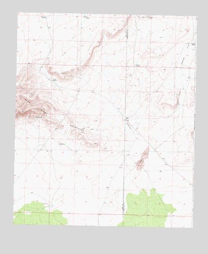
Lazy E Ranch, NM USGS Topographic Map
Click on map above to begin viewing in our Map Viewer.

This topographic map contains these locations and features:
Feature Name Type Latitude Longitude GNIS ID View Map
01584 Water WellWellN32.3351°W107.3495°922423View Map
01587 Water WellWellN32.2979°W107.3406°922511View Map
01589 Water WellWellN32.3129°W107.3584°930175View Map
01590 Water WellWellN32.3129°W107.3584°930174View Map
01591 Water WellWellN32.2931°W107.3511°925442View Map
01680 Water WellWellN32.3115°W107.2995°930173View Map
06130 Water WellWellN32.2931°W107.3503°925441View Map
06131 Water WellWellN32.3148°W107.3584°925449View Map
Apache FlatsFlatN32.3520°W107.2578°885830View Map
Apache TankReservoirN32.3665°W107.2503°901120View Map
Apache TankReservoirN32.3582°W107.2507°885844View Map
Burris 'E' Ranch Airport (historical)AirportN32.3125°W107.2975°936971View Map
Dog Town WindmillLocaleN32.2976°W107.3403°888433View Map
Hood Wind Mill Water WellWellN32.3731°W107.3275°923258View Map
Hood WindmillLocaleN32.3731°W107.3275°890121View Map
Lazy E RanchLocaleN32.3134°W107.2978°890999View Map
Matamoros WindmillLocaleN32.3720°W107.3553°891675View Map
Middle WindmillLocaleN32.3451°W107.2922°892013View Map
Middle Windmill Water WellWellN32.3445°W107.2925°919325View Map
Mountain WindmillLocaleN32.3131°W107.3578°892292View Map
Number 1205 Water WellWellN32.3726°W107.3275°923257View Map
Suman WindmillLocaleN32.3351°W107.3495°895425View Map

Note: Coordinates in the location and feature list above are referenced to NAD83 datum.


Copyright (C) 2008-2024 Ryan Niemi / Sunset Dynamics ... All Rights Reserved