TopoQuest Logo
Do you find TopoQuest useful?
Help keep TopoQuest running and adding new maps/features by donating!
Bitcoin:  19c7KJd3qBynnjoSw5npx9KScwjBe4ifkT
Litecoin:  LXs6TkuXGGXo1vDsWCkWVdjQX94eUKd6ui
Home View Maps Find Maps Find Places Resources & Links


Mount Hagan, Oregon Topographic Map

USGS Map Title: Mount Hagan, OR
USGS Map MRC: 44122B4
DRG (GeoTIFF) Download: o44122b4.tif


Neighboring USGS Topographic Map Quads:


  Farmers Butte, OR  
44122C5
 

  Swamp Mountain, OR  
44122C4
 

  Tidbits Mountain, OR  
44122C3
 

  Vida, OR  
44122B5
 

  Mount Hagan, OR  
44122B4
 

  Blue River, OR  
44122B3
 

  Goat Point, OR  
44122A5
 

  Nimrod, OR  
44122A4
 

  Harvey Mountain, OR  
44122A3


Map MRC Location:

N45°
W123°
N45°
W122°
H8 H7 H6 H5 H4 H3 H2 H1
G8 G7 G6 G5 G4 G3 G2 G1
F8 F7 F6 F5 F4 F3 F2 F1
E8 E7 E6 E5 E4 E3 E2 E1
D8 D7 D6 D5 D4 D3 D2 D1
C8 C7 C6 C5 C4 C3 C2 C1
B8 B7 B6 B5 B4 B3 B2 B1
A8 A7 A6 A5 A4 A3 A2 A1
N44°
W123°
N44°
W122°

Mount Hagan, OR USGS 1:24K Topographic Map Preview:
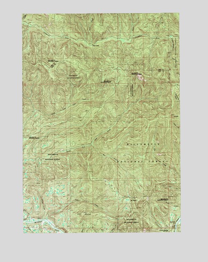
Mount Hagan, OR USGS Topographic Map
Click on map above to begin viewing in our Map Viewer.

This topographic map contains these locations and features:
Feature Name Type Latitude Longitude GNIS ID View Map
Bear CreekStreamN44.1326°W122.4834°1117355View Map
Elk MountainSummitN44.1912°W122.3831°1136252View Map
Finn RockPopulated PlaceN44.1290°W122.3828°1120718View Map
Finn Rock Landing Boat RampLocaleN44.1285°W122.3797°2668462View Map
Finn Rock Post Office (historical)Post OfficeN44.1290°W122.3828°1165250View Map
Finn Rock Safety Rest Area (historical)LocaleN44.1304°W122.3817°1162257View Map
H J Morton County ParkParkN44.1262°W122.3817°1130790View Map
Hagan Block Research Natural AreaForestN44.1748°W122.4178°1167111View Map
Jimbo MountainSummitN44.1357°W122.4523°1136422View Map
King CampLocaleN44.2321°W122.4479°1122739View Map
King CreekStreamN44.2329°W122.4523°1122746View Map
Little Bear CreekStreamN44.1304°W122.4970°1123129View Map
Mount HaganSummitN44.1426°W122.4098°1136349View Map
North Fork Calapooia RiverStreamN44.2346°W122.4170°1124756View Map
Rail CreekStreamN44.1318°W122.4953°1125777View Map
Rough CreekStreamN44.1332°W122.4856°1126317View Map
United States CreekStreamN44.2212°W122.3801°1128426View Map
Wet GulchValleyN44.1748°W122.4456°1167046View Map

Note: Coordinates in the location and feature list above are referenced to NAD83 datum.


Copyright (C) 2008-2024 Ryan Niemi / Sunset Dynamics ... All Rights Reserved