TopoQuest Logo
Do you find TopoQuest useful?
Help keep TopoQuest running and adding new maps/features by donating!
Bitcoin:  19c7KJd3qBynnjoSw5npx9KScwjBe4ifkT
Litecoin:  LXs6TkuXGGXo1vDsWCkWVdjQX94eUKd6ui
Home View Maps Find Maps Find Places Resources & Links


Nimrod, Oregon Topographic Map

USGS Map Title: Nimrod, OR
USGS Map MRC: 44122A4
DRG (GeoTIFF) Download: o44122a4.tif


Neighboring USGS Topographic Map Quads:


  Vida, OR  
44122B5
 

  Mount Hagan, OR  
44122B4
 

  Blue River, OR  
44122B3
 

  Goat Point, OR  
44122A5
 

  Nimrod, OR  
44122A4
 

  Harvey Mountain, OR  
44122A3
 

  Saddleblanket Mountain, OR  
43122H5
 

  Sinker Mountain, OR  
43122H4
 

  Sardine Butte, OR  
43122H3


Map MRC Location:

N45°
W123°
N45°
W122°
H8 H7 H6 H5 H4 H3 H2 H1
G8 G7 G6 G5 G4 G3 G2 G1
F8 F7 F6 F5 F4 F3 F2 F1
E8 E7 E6 E5 E4 E3 E2 E1
D8 D7 D6 D5 D4 D3 D2 D1
C8 C7 C6 C5 C4 C3 C2 C1
B8 B7 B6 B5 B4 B3 B2 B1
A8 A7 A6 A5 A4 A3 A2 A1
N44°
W123°
N44°
W122°

Nimrod, OR USGS 1:24K Topographic Map Preview:
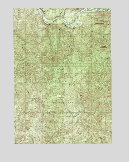
Nimrod, OR USGS Topographic Map
Click on map above to begin viewing in our Map Viewer.

This topographic map contains these locations and features:
Feature Name Type Latitude Longitude GNIS ID View Map
East Fork Deer CreekStreamN44.0896°W122.4253°1120305View Map
Ennis CreekStreamN44.1110°W122.4231°1120508View Map
Fawn RockPillarN44.0506°W122.3950°1120650View Map
Gibraltar MountainSummitN44.0144°W122.4848°1121119View Map
Holman Guard StationLocaleN44.1115°W122.4340°1121925View Map
Maple CreekStreamN44.1162°W122.4401°1123740View Map
Mason CreekStreamN44.1207°W122.4645°1123826View Map
McKenzie Fire and Rescue Station 5 Nimrod StationBuildingN44.1115°W122.4327°2577143View Map
McMullins LandingLocaleN44.1221°W122.3915°1136940View Map
NimrodPopulated PlaceN44.1137°W122.4237°1124687View Map
Nimrod ButteSummitN44.0444°W122.4172°1136574View Map
Pernot CreekStreamN44.0101°W122.4476°1125305View Map
Pernot MountainSummitN44.0464°W122.4832°1136623View Map
Quartz CreekStreamN44.1237°W122.3837°1148084View Map
Quartz Creek Picnic AreaParkN44.1235°W122.3803°1162256View Map
Rennie LandingLocaleN44.1246°W122.4695°1125949View Map
Rennie Landing Boat RampLocaleN44.1243°W122.4681°2668367View Map
Shepard's Landing Pole SlideLocaleN44.1232°W122.4019°2668418View Map
Silver CreekStreamN44.1165°W122.4437°1126962View Map
Silver Creek LandingLocaleN44.1165°W122.4428°1162259View Map
Silver Creek Landing Boat RampLocaleN44.1162°W122.4428°2668140View Map
Symbol RidgeRidgeN44.0332°W122.3901°1167047View Map
West Fork Deer CreekStreamN44.0896°W122.4253°1128845View Map
Williams RidgeRidgeN44.0068°W122.4109°1167045View Map

Note: Coordinates in the location and feature list above are referenced to NAD83 datum.


Copyright (C) 2008-2025 Ryan Niemi / Sunset Dynamics ... All Rights Reserved