TopoQuest Logo
Do you find TopoQuest useful?
Help keep TopoQuest running and adding new maps/features by donating!
Bitcoin:  19c7KJd3qBynnjoSw5npx9KScwjBe4ifkT
Litecoin:  LXs6TkuXGGXo1vDsWCkWVdjQX94eUKd6ui
Home View Maps Find Maps Find Places Resources & Links


Mount Hilgard, California Topographic Map

USGS Map Title: Mount Hilgard, CA
USGS Map MRC: 37118C7
DRG (GeoTIFF) Download: o37118c7.tif


Neighboring USGS Topographic Map Quads:


  Graveyard Peak, CA  
37118D8
 

  Mount Abbot, CA  
37118D7
 

  Mount Morgan, CA  
37118D6
 

  Florence Lake, CA  
37118C8
 

  Mount Hilgard, CA  
37118C7
 

  Mount Tom, CA  
37118C6
 

  Ward Mountain, CA  
37118B8
 

  Mount Henry, CA  
37118B7
 

  Mount Darwin, CA  
37118B6


Map MRC Location:

N38°
W119°
N38°
W118°
H8 H7 H6 H5 H4 H3 H2 H1
G8 G7 G6 G5 G4 G3 G2 G1
F8 F7 F6 F5 F4 F3 F2 F1
E8 E7 E6 E5 E4 E3 E2 E1
D8 D7 D6 D5 D4 D3 D2 D1
C8 C7 C6 C5 C4 C3 C2 C1
B8 B7 B6 B5 B4 B3 B2 B1
A8 A7 A6 A5 A4 A3 A2 A1
N37°
W119°
N37°
W118°

Mount Hilgard, CA USGS 1:24K Topographic Map Preview:
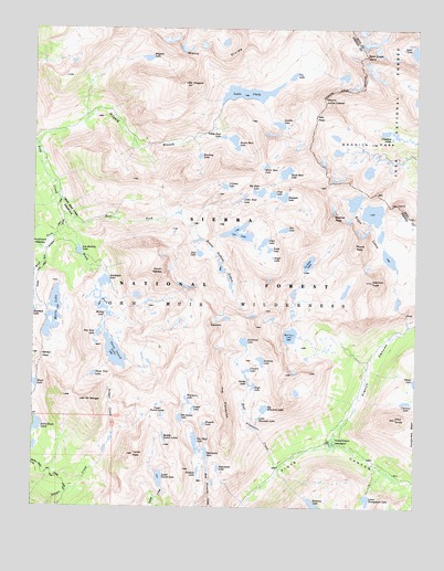
Mount Hilgard, CA USGS Topographic Map
Click on map above to begin viewing in our Map Viewer.

This topographic map contains these locations and features:
Feature Name Type Latitude Longitude GNIS ID View Map
Aweetasal LakeLakeN37.2932°W118.8071°266393View Map
Bear Creek SpireSummitN37.3680°W118.7676°256653View Map
Bear Paw LakeLakeN37.3311°W118.7945°256746View Map
Beartrap LakeLakeN37.3416°W118.8220°256752View Map
Big Bear LakeLakeN37.3323°W118.8024°256882View Map
Big Chief LakeLakeN37.2668°W118.8225°256905View Map
Big Moccasin LakeLakeN37.2758°W118.8003°256973View Map
Black Bear LakeLakeN37.3374°W118.7937°257097View Map
Brown Bear LakeLakeN37.3455°W118.8108°257479View Map
Chalfant LakesLakeN37.3480°W118.7615°258179View Map
Chevaux LakeLakeN37.2776°W118.7543°1667320View Map
Claw LakeLakeN37.3191°W118.8010°258421View Map
Coronet LakeLakeN37.3337°W118.8139°258726View Map
Council LakeLakeN37.2857°W118.8061°258782View Map
Croneys CampLocaleN37.3466°W118.8718°276247View Map
Den LakeLakeN37.3225°W118.7943°259275View Map
East Fork Bear CreekStreamN37.3266°W118.8660°259709View Map
East Pinnacles CreekStreamN37.2591°W118.7957°259768View Map
Feather PeakSummitN37.3258°W118.7779°1667331View Map
Flat Note LakeLakeN37.2951°W118.8545°260192View Map
French CanyonValleyN37.2663°W118.7784°260371View Map
GeminiSummitN37.2969°W118.8165°260515View Map
Granite ParkBasinN37.3435°W118.7701°260759View Map
Gruff LakeLakeN37.3153°W118.7979°260976View Map
Hilgard LakeLakeN37.3671°W118.8395°261350View Map
Hoopal LakeLakeN37.2718°W118.8196°261446View Map
Hutchinson MeadowFlatN37.2666°W118.7846°261662View Map
Italy PassGapN37.3524°W118.7837°261841View Map
Jawbone LakeLakeN37.2883°W118.8013°261905View Map
Jumble LakeLakeN37.3500°W118.7962°262038View Map
Lake ItalyLakeN37.3580°W118.8063°261842View Map
Little Bear LakeLakeN37.3302°W118.8087°262530View Map
Little Moccasin LakeLakeN37.2731°W118.8022°262674View Map
Lou Beverly LakeLakeN37.3167°W118.8612°262968View Map
Lower Honeymoon LakeLakeN37.2521°W118.7665°263016View Map
Lower Turret LakeLakeN37.2575°W118.8343°263049View Map
Marie LakeLakeN37.2964°W118.8698°263209View Map
Medley LakeLakeN37.3019°W118.8521°263439View Map
Merriam LakeLakeN37.2948°W118.7919°263459View Map
Merriam PeakSummitN37.3088°W118.7651°263460View Map
Middle Turret LakesLakeN37.2681°W118.8329°263551View Map
Mono DivideRidgeN37.3713°W118.8343°263747View Map
Mount HilgardSummitN37.3604°W118.8271°261351View Map
Mount Julius CaesarSummitN37.3566°W118.7818°262037View Map
Mount SengerSummitN37.2778°W118.8586°265993View Map
Negit LakeLakeN37.2816°W118.8037°264025View Map
Old Squaw LakeLakeN37.2733°W118.8276°264336View Map
Paoha LakeLakeN37.2824°W118.8096°264496View Map
Pemmican LakeLakeN37.2603°W118.8151°264631View Map
Pendant LakeLakeN37.2613°W118.8208°264632View Map
Pilot KnobSummitN37.2735°W118.7573°264735View Map
Rosemarie MeadowFlatN37.3191°W118.8729°265578View Map
Royce LakesLakeN37.3269°W118.7652°265638View Map
Royce PeakSummitN37.3180°W118.7710°265639View Map
Sallie Keyes LakesLakeN37.2713°W118.8743°265750View Map
Sandpiper LakeLakeN37.3088°W118.8529°265817View Map
Selden PassGapN37.2897°W118.8723°265989View Map
Seven GablesSummitN37.3113°W118.8337°232819View Map
Seven Gables LakesLakeN37.3125°W118.8147°266009View Map
Sharp Note LakeLakeN37.2846°W118.8561°266047View Map
South Fork Bear CreekStreamN37.3269°W118.8660°267424View Map
Spearpoint LakeLakeN37.2636°W118.8190°267560View Map
Spire LakeLakeN37.3689°W118.7518°267572View Map
Stub LakeLakeN37.3162°W118.8218°267816View Map
Teddy Bear LakeLakeN37.3466°W118.8145°268116View Map
Tether LakeLakeN37.2756°W118.8236°268159View Map
The PinnaclesRidgeN37.2760°W118.8129°268204View Map
Three Island LakeLakeN37.2901°W118.8492°268255View Map
Toe LakeLakeN37.3625°W118.7917°268316View Map
Tooth LakeLakeN37.3173°W118.7989°268356View Map
Turret PeakSummitN37.2635°W118.8421°1660045View Map
Upper Bear Creek MeadowsFlatN37.3277°W118.8648°1667374View Map
Upper Turret LakesLakeN37.2766°W118.8354°268643View Map
Ursa LakeLakeN37.3318°W118.7981°268650View Map
Vee LakeLakeN37.3218°W118.8100°268679View Map
Wampum LakeLakeN37.2778°W118.8252°268771View Map
West Fork Bear CreekStreamN37.3266°W118.8660°268883View Map
White Bear LakeLakeN37.3391°W118.8005°268985View Map

Note: Coordinates in the location and feature list above are referenced to NAD83 datum.


Copyright (C) 2008-2024 Ryan Niemi / Sunset Dynamics ... All Rights Reserved