TopoQuest Logo
Do you find TopoQuest useful?
Help keep TopoQuest running and adding new maps/features by donating!
Bitcoin:  19c7KJd3qBynnjoSw5npx9KScwjBe4ifkT
Litecoin:  LXs6TkuXGGXo1vDsWCkWVdjQX94eUKd6ui
Home View Maps Find Maps Find Places Resources & Links


Mount Morgan, California Topographic Map

USGS Map Title: Mount Morgan, CA
USGS Map MRC: 37118D6
DRG (GeoTIFF) Download: o37118d6.tif


Neighboring USGS Topographic Map Quads:


  Convict Lake, CA  
37118E7
 

  Toms Place, CA  
37118E6
 

  Casa Diablo Mountain, CA  
37118E5
 

  Mount Abbot, CA  
37118D7
 

  Mount Morgan, CA  
37118D6
 

  Rovana, CA  
37118D5
 

  Mount Hilgard, CA  
37118C7
 

  Mount Tom, CA  
37118C6
 

  Tungsten Hills, CA  
37118C5


Map MRC Location:

N38°
W119°
N38°
W118°
H8 H7 H6 H5 H4 H3 H2 H1
G8 G7 G6 G5 G4 G3 G2 G1
F8 F7 F6 F5 F4 F3 F2 F1
E8 E7 E6 E5 E4 E3 E2 E1
D8 D7 D6 D5 D4 D3 D2 D1
C8 C7 C6 C5 C4 C3 C2 C1
B8 B7 B6 B5 B4 B3 B2 B1
A8 A7 A6 A5 A4 A3 A2 A1
N37°
W119°
N37°
W118°

Mount Morgan, CA USGS 1:24K Topographic Map Preview:
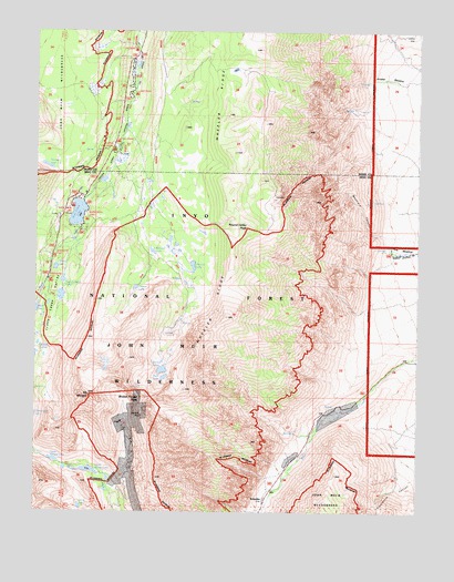
Mount Morgan, CA USGS Topographic Map
Click on map above to begin viewing in our Map Viewer.

This topographic map contains these locations and features:
Feature Name Type Latitude Longitude GNIS ID View Map
Adamson MineMineN37.3980°W118.7232°256117View Map
Ainslee MeadowFlatN37.4880°W118.6360°1667382View Map
Broken Finger PeakSummitN37.4055°W118.7176°252187View Map
Buck LakeLakeN37.4099°W118.7086°257567View Map
Dorothy LakeLakeN37.4389°W118.6994°259492View Map
East Fork CampgroundLocaleN37.4835°W118.7185°275766View Map
East Fork Rock CreekStreamN37.4752°W118.7221°259748View Map
Eastern Brook LakesLakeN37.4312°W118.7425°259776View Map
Finch LakeLakeN37.3763°W118.7360°260106View Map
Francis LakeLakeN37.4332°W118.7181°260333View Map
Hidden LakesLakeN37.4186°W118.7499°261306View Map
Kenneth LakeLakeN37.4427°W118.7128°262138View Map
Lake Inlet CampgroundLocaleN37.4491°W118.7368°1667231View Map
Lake Outlet CampgroundLocaleN37.4566°W118.7362°1667232View Map
Little Lakes ValleyValleyN37.4499°W118.7379°262655View Map
Lower Morgan LakeLakeN37.3856°W118.7329°263034View Map
Mayfield CanyonValleyN37.4469°W118.6373°1667236View Map
Mono Pass TrailheadLocaleN37.4351°W118.7472°2547664View Map
Mosquito FlatFlatN37.4360°W118.7468°1667239View Map
Mosquito Flat CampgroundLocaleN37.4298°W118.7499°275764View Map
Mount MorganSummitN37.4055°W118.7340°263830View Map
Palisade CampgroundLocaleN37.4944°W118.7193°275765View Map
Patricia LakeLakeN37.4649°W118.7473°1667383View Map
Pine Creek MineMineN37.3927°W118.7198°264749View Map
Pine Grove CampgroundLocaleN37.4710°W118.7240°275767View Map
Rock Creek Boating SiteLocaleN37.4560°W118.7382°2547689View Map
Rock Creek LakeLakeN37.4525°W118.7372°265501View Map
Rock Creek Lake CampgroundLocaleN37.4538°W118.7390°1664838View Map
Rock Creek Lake Picnic SiteLocaleN37.4517°W118.7348°2547690View Map
Rock Creek Lake ResortBuildingN37.4576°W118.7347°2547691View Map
Rock Creek Pack StationBuildingN37.4522°W118.7427°2547692View Map
Rock Creek Picnic SiteLocaleN37.4567°W118.7362°2547693View Map
Round Valley PeakSummitN37.4488°W118.6818°265628View Map
Round Valley Peak ProspectMineN37.4485°W118.6721°1682058View Map
ScheelitePopulated PlaceN37.3780°W118.6768°265908View Map
Serene LakeLakeN37.4384°W118.7443°266001View Map
Tamarack LakesLakeN37.4118°W118.7093°268084View Map
Tamarack Lakes TrailheadLocaleN37.4517°W118.7344°2547570View Map
Upper Morgan LakeLakeN37.3885°W118.7447°268628View Map
Wells MeadowFlatN37.4433°W118.6329°268850View Map
Wheeler RidgeRidgeN37.4052°W118.7332°268958View Map

Note: Coordinates in the location and feature list above are referenced to NAD83 datum.


Copyright (C) 2008-2025 Ryan Niemi / Sunset Dynamics ... All Rights Reserved