TopoQuest Logo
Do you find TopoQuest useful?
Help keep TopoQuest running and adding new maps/features by donating!
Bitcoin:  19c7KJd3qBynnjoSw5npx9KScwjBe4ifkT
Litecoin:  LXs6TkuXGGXo1vDsWCkWVdjQX94eUKd6ui
Home View Maps Find Maps Find Places Resources & Links


Mount Hughes, Arizona Topographic Map

USGS Map Title: Mount Hughes, AZ
USGS Map MRC: 31110E6
DRG (GeoTIFF) Download: o31110e6.tif


Neighboring USGS Topographic Map Quads:


  Mount Wrightson, AZ  
31110F7
 

  Sonoita, AZ  
31110F6
 

  Elgin, AZ  
31110F5
 

  Patagonia, AZ  
31110E7
 

  Mount Hughes, AZ  
31110E6
 

  O'Donnell Canyon, AZ  
31110E5
 

  Cumero Canyon, AZ  
31110D7
 

  Harshaw, AZ  
31110D6
 

  Canelo Pass, AZ  
31110D5


Map MRC Location:

N32°
W111°
N32°
W110°
H8 H7 H6 H5 H4 H3 H2 H1
G8 G7 G6 G5 G4 G3 G2 G1
F8 F7 F6 F5 F4 F3 F2 F1
E8 E7 E6 E5 E4 E3 E2 E1
D8 D7 D6 D5 D4 D3 D2 D1
C8 C7 C6 C5 C4 C3 C2 C1
B8 B7 B6 B5 B4 B3 B2 B1
A8 A7 A6 A5 A4 A3 A2 A1
N31°
W111°
N31°
W110°

Mount Hughes, AZ USGS 1:24K Topographic Map Preview:
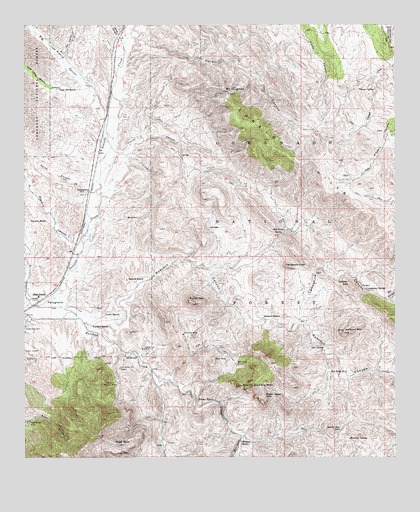
Mount Hughes, AZ USGS Topographic Map
Click on map above to begin viewing in our Map Viewer.

This topographic map contains these locations and features:
Feature Name Type Latitude Longitude GNIS ID View Map
Ashburn (historical)LocaleN31.6206°W110.7176°36530View Map
Ashburn MountainSummitN31.5365°W110.6423°25808View Map
Aztec Group MinesMineN31.5101°W110.7490°25851View Map
Bat Cave TankReservoirN31.5270°W110.6792°26032View Map
Bergier RanchLocaleN31.5054°W110.6768°26228View Map
Bergier Trick TankReservoirN31.5251°W110.6537°2680382View Map
Bible SpringSpringN31.5317°W110.6953°2680378View Map
Big Casa Blanca CanyonValleyN31.5959°W110.7243°26249View Map
Box CanyonValleyN31.5459°W110.6290°26680View Map
Candelerio PeakSummitN31.5551°W110.6612°27245View Map
Casa Blanca (historical)LocaleN31.6001°W110.7173°40525View Map
Christmas Gift MineMineN31.5259°W110.7179°27618View Map
Copper MountainSummitN31.5495°W110.6409°27925View Map
Corral CanyonValleyN31.5881°W110.7195°27974View Map
Cottonwood SpringSpringN31.5481°W110.6354°28030View Map
Cottonwood SpringSpringN31.5431°W110.6519°2680383View Map
Cottonwood Spring Number TwoSpringN31.5486°W110.6356°2680373View Map
CrittendenLocaleN31.5770°W110.7290°28174View Map
Dark CanyonValleyN31.6218°W110.7134°28277View Map
Dry CanyonValleyN31.6168°W110.7368°28618View Map
East TankReservoirN31.5284°W110.6820°28788View Map
East WellWellN31.5299°W110.6813°2680377View Map
Elevation Group MinesMineN31.5212°W110.7234°28851View Map
Fortune RanchLocaleN31.5381°W110.7276°29126View Map
Gate Horizontal WellWellN31.5308°W110.6494°2680376View Map
Gate SpringSpringN31.5315°W110.6496°29276View Map
Gunther TankReservoirN31.5112°W110.7072°36652View Map
Harshaw CreekStreamN31.5434°W110.7454°29769View Map
Hells Canyon DamDamN31.5161°W110.6619°2680372View Map
Holding Pasture Trick TankReservoirN31.5504°W110.6754°2680381View Map
Indian Head MountainSummitN31.5176°W110.6690°30343View Map
Kennedy SpringSpringN31.5055°W110.6414°30741View Map
Kunde MountainSummitN31.5451°W110.6934°30813View Map
Lampshire CanyonValleyN31.5412°W110.6579°30862View Map
Lazy RR RanchLocaleN31.6068°W110.7326°30915View Map
Lewis RanchLocaleN31.5412°W110.7181°30960View Map
Lion DamDamN31.5478°W110.6553°2680375View Map
Little Casa Blanca CanyonValleyN31.6076°W110.7315°31046View Map
Meadow SpringSpringN31.5008°W110.6525°2680369View Map
Mount HughesSummitN31.6054°W110.6812°30271View Map
North Saddle MountainSummitN31.5209°W110.6790°32394View Map
Papago SpringSpringN31.6068°W110.6326°32664View Map
Patagonia DivisionCivilN31.5653°W110.6437°1934966View Map
Patagonia Elementary SchoolSchoolN31.5396°W110.7491°2544787View Map
Patagonia Ranger StationLocaleN31.5459°W110.7481°36772View Map
Patagonia Union High SchoolSchoolN31.5462°W110.7456°36773View Map
Red Bank WellWellN31.5245°W110.6418°33425View Map
Red MountainSummitN31.5043°W110.7187°33478View Map
Redrock CanyonValleyN31.5429°W110.7356°33539View Map
Redrock RanchLocaleN31.5406°W110.6698°33541View Map
Redrock WellWellN31.5400°W110.6536°2680379View Map
Saddle Mountain TankReservoirN31.5079°W110.6440°33929View Map
Saddle SpringSpringN31.5081°W110.6558°2680368View Map
Sansimon MineMineN31.5359°W110.6970°34062View Map
Santa Cruz MineMineN31.5315°W110.7098°34065View Map
Seibold RanchLocaleN31.5518°W110.7104°34258View Map
Smith CanyonValleyN31.5804°W110.7287°34548View Map
South WellWellN31.5036°W110.7044°2680380View Map
Stevens CanyonValleyN31.5606°W110.7343°34836View Map
Stevens RanchLocaleN31.5681°W110.7429°34838View Map
Town of PatagoniaCivilN31.5436°W110.7477°2413118View Map
Turner RanchLocaleN31.5170°W110.6859°35589View Map
Turtle SpringSpringN31.5575°W110.6356°2680374View Map
Weiland Harshaw StorageReservoirN31.5064°W110.6944°2680371View Map
Weiland Harshaw WellWellN31.5089°W110.6816°2680370View Map
Wood CanyonValleyN31.6209°W110.7173°36364View Map

Note: Coordinates in the location and feature list above are referenced to NAD83 datum.


Copyright (C) 2008-2024 Ryan Niemi / Sunset Dynamics ... All Rights Reserved