TopoQuest Logo
Do you find TopoQuest useful?
Help keep TopoQuest running and adding new maps/features by donating!
Bitcoin:  19c7KJd3qBynnjoSw5npx9KScwjBe4ifkT
Litecoin:  LXs6TkuXGGXo1vDsWCkWVdjQX94eUKd6ui
Home View Maps Find Maps Find Places Resources & Links


Mount Pend Oreille, Idaho Topographic Map

USGS Map Title: Mount Pend Oreille, ID
USGS Map MRC: 48116D2
DRG (GeoTIFF) Download: o48116d2.tif


Neighboring USGS Topographic Map Quads:


  Twentymile Creek, ID  
48116E3
 

  Clifty Mountain, ID  
48116E2
 

  Leonia, ID  
48116E1
 

  Wylie Knob, ID  
48116D3
 

  Mount Pend Oreille, ID  
48116D2
 

  Smith Mountain, ID  
48116D1
 

  Trout Peak, ID  
48116C3
 

  Trestle Peak, ID  
48116C2
 

  Benning Mountain, ID  
48116C1


Map MRC Location:

N49°
W117°
N49°
W116°
H8 H7 H6 H5 H4 H3 H2 H1
G8 G7 G6 G5 G4 G3 G2 G1
F8 F7 F6 F5 F4 F3 F2 F1
E8 E7 E6 E5 E4 E3 E2 E1
D8 D7 D6 D5 D4 D3 D2 D1
C8 C7 C6 C5 C4 C3 C2 C1
B8 B7 B6 B5 B4 B3 B2 B1
A8 A7 A6 A5 A4 A3 A2 A1
N48°
W117°
N48°
W116°

Mount Pend Oreille, ID USGS 1:24K Topographic Map Preview:
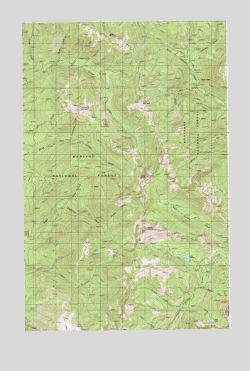
Mount Pend Oreille, ID USGS Topographic Map
Click on map above to begin viewing in our Map Viewer.

This topographic map contains these locations and features:
Feature Name Type Latitude Longitude GNIS ID View Map
Calder MountainSummitN48.4924°W116.1918°378699View Map
Candle CreekStreamN48.4174°W116.2027°398605View Map
Chess CreekStreamN48.4249°W116.2268°398606View Map
Chute CreekStreamN48.4835°W116.2302°379342View Map
Dead Man CreekStreamN48.4724°W116.1413°393836View Map
Dougherty MineMineN48.4124°W116.1430°398603View Map
Emerson CreekStreamN48.4827°W116.1499°400429View Map
Gem CreekStreamN48.3835°W116.1552°382227View Map
Gem LakeLakeN48.3784°W116.1366°382231View Map
Gordon CreekStreamN48.3816°W116.1577°382455View Map
Hemlock TrailTrailN48.4888°W116.2149°383094View Map
Lake DarlingLakeN48.4042°W116.1519°380250View Map
Mount Pend OreilleSummitN48.4155°W116.1763°388331View Map
Mount WillardSummitN48.4366°W116.1757°393453View Map
North Fork TrailTrailN48.4605°W116.1738°387803View Map
Plank CreekStreamN48.4810°W116.2369°388595View Map
Purdy MountainSummitN48.4669°W116.1780°388931View Map
Smith CabinLocaleN48.4763°W116.1438°390653View Map
Strawberry CreekStreamN48.4522°W116.2216°398607View Map
Strawberry MountainSummitN48.4649°W116.2157°391532View Map
Summit CreekStreamN48.3919°W116.1432°391619View Map

Note: Coordinates in the location and feature list above are referenced to NAD83 datum.


Copyright (C) 2008-2025 Ryan Niemi / Sunset Dynamics ... All Rights Reserved