TopoQuest Logo
Do you find TopoQuest useful?
Help keep TopoQuest running and adding new maps/features by donating!
Bitcoin:  19c7KJd3qBynnjoSw5npx9KScwjBe4ifkT
Litecoin:  LXs6TkuXGGXo1vDsWCkWVdjQX94eUKd6ui
Home View Maps Find Maps Find Places Resources & Links


Clifty Mountain, Idaho Topographic Map

USGS Map Title: Clifty Mountain, ID
USGS Map MRC: 48116E2
DRG (GeoTIFF) Download: o48116e2.tif


Neighboring USGS Topographic Map Quads:


  Bonners Ferry, ID  
48116F3
 

  Moyie Springs, ID  
48116F2
 

  Curley Creek, ID  
48116F1
 

  Twentymile Creek, ID  
48116E3
 

  Clifty Mountain, ID  
48116E2
 

  Leonia, ID  
48116E1
 

  Wylie Knob, ID  
48116D3
 

  Mount Pend Oreille, ID  
48116D2
 

  Smith Mountain, ID  
48116D1


Map MRC Location:

N49°
W117°
N49°
W116°
H8 H7 H6 H5 H4 H3 H2 H1
G8 G7 G6 G5 G4 G3 G2 G1
F8 F7 F6 F5 F4 F3 F2 F1
E8 E7 E6 E5 E4 E3 E2 E1
D8 D7 D6 D5 D4 D3 D2 D1
C8 C7 C6 C5 C4 C3 C2 C1
B8 B7 B6 B5 B4 B3 B2 B1
A8 A7 A6 A5 A4 A3 A2 A1
N48°
W117°
N48°
W116°

Clifty Mountain, ID USGS 1:24K Topographic Map Preview:
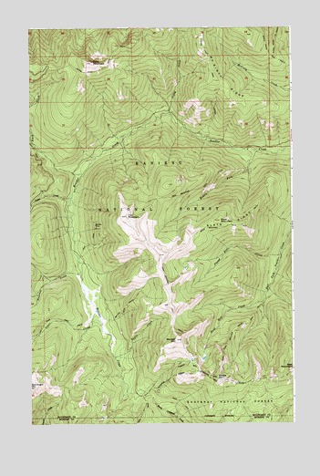
Clifty Mountain, ID USGS Topographic Map
Click on map above to begin viewing in our Map Viewer.

This topographic map contains these locations and features:
Feature Name Type Latitude Longitude GNIS ID View Map
Black CreekStreamN48.5833°W116.2469°377740View Map
Boulder MineMineN48.5627°W116.2202°378105View Map
Boulder MountainSummitN48.5263°W116.1810°378107View Map
Buck MountainSummitN48.5641°W116.1605°378383View Map
Buck Mountain TrailTrailN48.5605°W116.1710°378385View Map
Cabin CreekStreamN48.5716°W116.2307°378657View Map
Clifty CreekStreamN48.5977°W116.1832°379440View Map
Clifty MountainSummitN48.6141°W116.2202°379441View Map
Divide LakeLakeN48.5200°W116.1736°394197View Map
Dobson Creek TrailTrailN48.6185°W116.1680°380657View Map
East Fork Boulder Creek TrailTrailN48.5347°W116.1430°381061View Map
Found Girl CreekStreamN48.5533°W116.1316°381953View Map
Gable Creek TrailTrailN48.6147°W116.1319°382143View Map
Gin CreekStreamN48.5299°W116.2232°394196View Map
Hunt Girl CreekStreamN48.5388°W116.1396°383557View Map
Hunt Girl Creek Research Natural AreaParkN48.5316°W116.1638°394198View Map
Iron MountainSummitN48.5655°W116.2046°383763View Map
Iron Mountain TrailTrailN48.5505°W116.1882°383765View Map
Katka Peak TrailTrailN48.6185°W116.2088°384105View Map
Kelly Pass TrailTrailN48.5333°W116.2385°384151View Map
McGinty RidgeRidgeN48.6066°W116.1582°386620View Map
Middle Fork Boulder CreekStreamN48.5580°W116.1913°386800View Map
Middle MountainSummitN48.5147°W116.1619°386867View Map
Pinochle CreekStreamN48.5480°W116.2263°388540View Map
Poker CreekStreamN48.5358°W116.2191°388658View Map
Pouch CreekStreamN48.5908°W116.2052°394204View Map
Pulp CreekStreamN48.5991°W116.1832°394199View Map
Rummy CreekStreamN48.5355°W116.2194°393873View Map
Slate RidgeRidgeN48.5633°W116.1524°390569View Map
Smythe TrailTrailN48.5366°W116.2049°390722View Map
Treble CreekStreamN48.5210°W116.2105°392373View Map

Note: Coordinates in the location and feature list above are referenced to NAD83 datum.


Copyright (C) 2008-2024 Ryan Niemi / Sunset Dynamics ... All Rights Reserved