TopoQuest Logo
Do you find TopoQuest useful?
Help keep TopoQuest running and adding new maps/features by donating!
Bitcoin:  19c7KJd3qBynnjoSw5npx9KScwjBe4ifkT
Litecoin:  LXs6TkuXGGXo1vDsWCkWVdjQX94eUKd6ui
Home View Maps Find Maps Find Places Resources & Links


Mount Pleasant, Illinois Topographic Map

USGS Map Title: Mount Pleasant, IL
USGS Map MRC: 37089D1
DRG (GeoTIFF) Download: o37089d1.tif


Neighboring USGS Topographic Map Quads:


  Makanda, IL  
37089E2
 

  Lick Creek, IL  
37089E1
 

  Goreville, IL  
37088E8
 

  Anna, IL  
37089D2
 

  Mount Pleasant, IL  
37089D1
 

  Vienna, IL  
37088D8
 

  Dongola, IL  
37089C2
 

  Cypress, IL  
37089C1
 

  Karnak, IL  
37088C8


Map MRC Location:

N38°
W90°
N38°
W89°
H8 H7 H6 H5 H4 H3 H2 H1
G8 G7 G6 G5 G4 G3 G2 G1
F8 F7 F6 F5 F4 F3 F2 F1
E8 E7 E6 E5 E4 E3 E2 E1
D8 D7 D6 D5 D4 D3 D2 D1
C8 C7 C6 C5 C4 C3 C2 C1
B8 B7 B6 B5 B4 B3 B2 B1
A8 A7 A6 A5 A4 A3 A2 A1
N37°
W90°
N37°
W89°

Mount Pleasant, IL USGS 1:24K Topographic Map Preview:
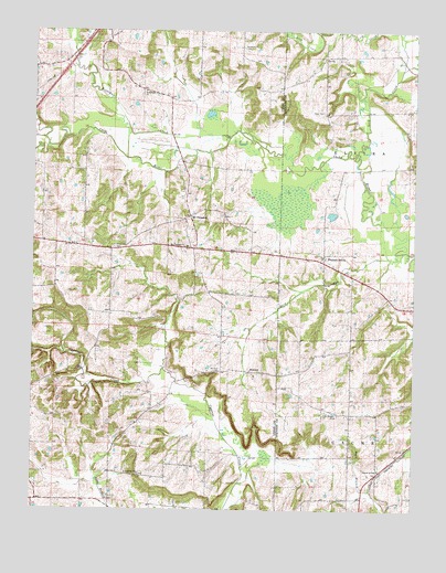
Mount Pleasant, IL USGS Topographic Map
Click on map above to begin viewing in our Map Viewer.

This topographic map contains these locations and features:
Feature Name Type Latitude Longitude GNIS ID View Map
Allen CemeteryCemeteryN37.4792°W89.0301°403420View Map
Bradshaw CreekStreamN37.4726°W89.0612°404784View Map
Buck BranchStreamN37.4967°W89.0045°405087View Map
Buck RunStreamN37.4426°W89.0040°405103View Map
Church of GodChurchN37.3856°W89.0112°406114View Map
ElviraPopulated PlaceN37.4934°W89.0295°422667View Map
Elvira School (historical)SchoolN37.4920°W89.0306°1815855View Map
Friendship ChurchChurchN37.3845°W89.0895°408762View Map
Goddard CemeteryCemeteryN37.4959°W89.0565°409105View Map
Karraker School (historical)SchoolN37.3781°W89.1170°1725709View Map
Lick CreekStreamN37.4676°W89.0190°412050View Map
McGinnis CemeteryCemeteryN37.4437°W89.0987°413269View Map
MoscowPopulated PlaceN37.4114°W89.0526°423004View Map
Mount Pisgah CemeteryCemeteryN37.4000°W89.0242°414036View Map
Mount PleasantPopulated PlaceN37.4520°W89.0737°414041View Map
Mount Pleasant ChurchChurchN37.4437°W89.0754°414047View Map
Mount Zion CemeteryCemeteryN37.4112°W89.0653°414111View Map
New Hope ChurchChurchN37.4842°W89.0887°414417View Map
Newton School (historical)SchoolN37.4820°W89.0801°1725724View Map
Penrod School (historical)SchoolN37.3959°W89.0801°1725726View Map
Pisgah School (historical)SchoolN37.4003°W89.0201°1815887View Map
Pleasant GrovePopulated PlaceN37.4409°W89.0298°423071View Map
Stokes Election PrecinctCivilN37.4299°W89.1007°1928650View Map
Union Church (historical)ChurchN37.4976°W89.0567°1725742View Map

Note: Coordinates in the location and feature list above are referenced to NAD83 datum.


Copyright (C) 2008-2024 Ryan Niemi / Sunset Dynamics ... All Rights Reserved