TopoQuest Logo
Do you find TopoQuest useful?
Help keep TopoQuest running and adding new maps/features by donating!
Bitcoin:  19c7KJd3qBynnjoSw5npx9KScwjBe4ifkT
Litecoin:  LXs6TkuXGGXo1vDsWCkWVdjQX94eUKd6ui
Home View Maps Find Maps Find Places Resources & Links


Cypress, Illinois Topographic Map

USGS Map Title: Cypress, IL
USGS Map MRC: 37089C1
DRG (GeoTIFF) Download: o37089c1.tif


Neighboring USGS Topographic Map Quads:


  Anna, IL  
37089D2
 

  Mount Pleasant, IL  
37089D1
 

  Vienna, IL  
37088D8
 

  Dongola, IL  
37089C2
 

  Cypress, IL  
37089C1
 

  Karnak, IL  
37088C8
 

  Pulaski, IL  
37089B2
 

  Olmsted, IL  
37089B1
 

  Bandana, KY  
37088B8


Map MRC Location:

N38°
W90°
N38°
W89°
H8 H7 H6 H5 H4 H3 H2 H1
G8 G7 G6 G5 G4 G3 G2 G1
F8 F7 F6 F5 F4 F3 F2 F1
E8 E7 E6 E5 E4 E3 E2 E1
D8 D7 D6 D5 D4 D3 D2 D1
C8 C7 C6 C5 C4 C3 C2 C1
B8 B7 B6 B5 B4 B3 B2 B1
A8 A7 A6 A5 A4 A3 A2 A1
N37°
W90°
N37°
W89°

Cypress, IL USGS 1:24K Topographic Map Preview:
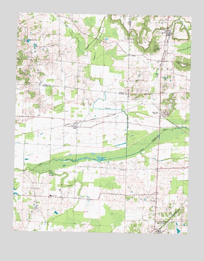
Cypress, IL USGS Topographic Map
Click on map above to begin viewing in our Map Viewer.

This topographic map contains these locations and features:
Feature Name Type Latitude Longitude GNIS ID View Map
Adds BranchStreamN37.3509°W89.0751°403358View Map
Bethany ChurchChurchN37.3612°W89.0456°404246View Map
Cache ChapelChurchN37.2745°W89.1112°405329View Map
Cache Chapel CemeteryCemeteryN37.2748°W89.1112°1820618View Map
Cache Election PrecinctCivilN37.3673°W89.0055°1928456View Map
Cedar Grove School (historical)SchoolN37.3745°W89.0440°1815836View Map
Century High SchoolSchoolN37.2703°W89.0987°405914View Map
Chapel School (historical)SchoolN37.3442°W89.0412°1815838View Map
CypressPopulated PlaceN37.3651°W89.0181°406917View Map
Cypress CreekStreamN37.2942°W89.0451°406918View Map
Cypress Creek Post Office (historical)Post OfficeN37.3742°W89.0212°1815841View Map
Cypress Elementary SchoolSchoolN37.3648°W89.0206°1815842View Map
Cypress Post OfficePost OfficeN37.3643°W89.0161°2788436View Map
Cypress Volunteer Fire DepartmentBuildingN37.3651°W89.0158°2640877View Map
Dongola District 1 Election PrecinctCivilN37.3605°W89.1042°1928472View Map
Forestview CemeteryCemeteryN37.2687°W89.0231°408532View Map
Forestview School (historical)SchoolN37.2723°W89.0234°1725633View Map
Friendship School (historical)SchoolN37.2595°W89.1045°1725634View Map
Grand ChainPopulated PlaceN37.2517°W89.0234°422272View Map
Grand Chain Election PrecinctCivilN37.2525°W89.0131°1928509View Map
Grand Chain Masonic CemeteryCemeteryN37.2539°W89.0145°1820619View Map
Grand Chain Post OfficePost OfficeN37.2516°W89.0210°2788735View Map
Grand Chain Volunteer Fire DepartmentBuildingN37.2502°W89.0199°2640705View Map
Hogans BottomsFlatN37.3570°W89.0676°410360View Map
Joppa JunctionPopulated PlaceN37.3298°W89.0315°422852View Map
Limekiln SloughStreamN37.2845°W89.1123°412099View Map
Luther ChapelChurchN37.3378°W89.0378°412748View Map
Maple Valley School (historical)SchoolN37.3248°W89.1076°1725636View Map
Masonic CemeteryCemeteryN37.3534°W89.0178°1815872View Map
Misenheimer School (historical)SchoolN37.3514°W89.0948°1725722View Map
Morgan PondLakeN37.3590°W89.1170°413820View Map
Mount Olive ChurchChurchN37.3517°W89.0945°414011View Map
Mount Zion ChurchChurchN37.3401°W89.1192°414117View Map
New Grand ChainPopulated PlaceN37.2520°W89.0212°414399View Map
New Zion ChurchChurchN37.2862°W89.0451°414475View Map
PerksPopulated PlaceN37.3098°W89.0809°415554View Map
Perks Election PrecinctCivilN37.2982°W89.0897°1928588View Map
Perks Post OfficePost OfficeN37.3101°W89.0829°1820625View Map
Rainbow ArchArchN37.3634°W89.0278°1679009View Map
Round BluffCliffN37.3559°W89.0251°416979View Map
Section Eight Woods Nature PreserveParkN37.3067°W89.0120°1820627View Map
Shawnee Community CollegeSchoolN37.2709°W89.0326°1820628View Map
Shawnee Community College HeliportAirportN37.2709°W89.0328°427876View Map
Turner BluffCliffN37.3481°W89.0053°419945View Map
Ulrich LakeReservoirN37.2519°W89.0065°1690916View Map
Ulrich Lake DamDamN37.2517°W89.0051°1690915View Map
Village of CypressCivilN37.3655°W89.0187°2398666View Map
Village of New Grand ChainCivilN37.2552°W89.0165°2399463View Map
White HillPopulated PlaceN37.3192°W89.0215°421043View Map

Note: Coordinates in the location and feature list above are referenced to NAD83 datum.


Copyright (C) 2008-2024 Ryan Niemi / Sunset Dynamics ... All Rights Reserved