TopoQuest Logo
Do you find TopoQuest useful?
Help keep TopoQuest running and adding new maps/features by donating!
Bitcoin:  19c7KJd3qBynnjoSw5npx9KScwjBe4ifkT
Litecoin:  LXs6TkuXGGXo1vDsWCkWVdjQX94eUKd6ui
Home View Maps Find Maps Find Places Resources & Links


Mount Powell, Utah Topographic Map

USGS Map Title: Mount Powell, UT
USGS Map MRC: 40110G4
DRG (GeoTIFF) Download: o40110g4.tif


Neighboring USGS Topographic Map Quads:


  Lyman Lake, UT  
40110H5
 

  Bridger Lake, UT  
40110H4
 

  Gilbert Peak NE, UT  
40110H3
 

  Mount Lovenia, UT  
40110G5
 

  Mount Powell, UT  
40110G4
 

  Kings Peak, UT  
40110G3
 

  Oweep Creek, UT  
40110F5
 

  Garfield Basin, UT  
40110F4
 

  Mount Emmons, UT  
40110F3


Map MRC Location:

N41°
W111°
N41°
W110°
H8 H7 H6 H5 H4 H3 H2 H1
G8 G7 G6 G5 G4 G3 G2 G1
F8 F7 F6 F5 F4 F3 F2 F1
E8 E7 E6 E5 E4 E3 E2 E1
D8 D7 D6 D5 D4 D3 D2 D1
C8 C7 C6 C5 C4 C3 C2 C1
B8 B7 B6 B5 B4 B3 B2 B1
A8 A7 A6 A5 A4 A3 A2 A1
N40°
W111°
N40°
W110°

Mount Powell, UT USGS 1:24K Topographic Map Preview:
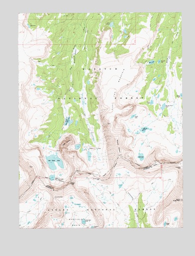
Mount Powell, UT USGS Topographic Map
Click on map above to begin viewing in our Map Viewer.

This topographic map contains these locations and features:
Feature Name Type Latitude Longitude GNIS ID View Map
Anderson PassGapN40.7849°W110.3774°1438219View Map
Bald LakeLakeN40.8675°W110.4925°1438353View Map
Bear LakeLakeN40.8461°W110.3990°1438481View Map
Broadbent MeadowFlatN40.8502°W110.4571°1439144View Map
Castle LakeLakeN40.8147°W110.4135°1439514View Map
Cliff LakeLakeN40.7912°W110.4075°1439812View Map
Dollar LakeLakeN40.8269°W110.3762°1440515View Map
East Red Castle LakeLakeN40.7973°W110.4558°1454732View Map
Elkhorn CrossingLocaleN40.8524°W110.3843°1450115View Map
Flat Top MountainSummitN40.8224°W110.4282°1441139View Map
Grass LakeLakeN40.8227°W110.3992°1441428View Map
Henrys Fork LakeLakeN40.8202°W110.3902°1441715View Map
Irland LakeLakeN40.8188°W110.4060°1450116View Map
Kings LakeLakeN40.7521°W110.3896°1442328View Map
Lake BlanchardLakeN40.8070°W110.4050°1438901View Map
Lake HessieLakeN40.8681°W110.4294°1441724View Map
Lower Red Castle LakeLakeN40.8121°W110.4629°1443021View Map
Mount PowellSummitN40.7958°W110.4249°1444622View Map
North Star LakeLakeN40.7539°W110.4516°1443979View Map
Porcupine PassGapN40.7677°W110.4738°1444584View Map
Red CastleSummitN40.8005°W110.4616°1444781View Map
Red Castle LakeLakeN40.7856°W110.4734°1444782View Map
Sawmill LakeLakeN40.8464°W110.3932°1445354View Map
Smiths Fork PassGapN40.7786°W110.4385°1445714View Map
Smiths Fork Pass LakeLakeN40.7919°W110.4470°1454899View Map
South Kings PeakSummitN40.7659°W110.3779°1445899View Map
Upper Red Castle LakeLakeN40.7794°W110.4753°1446878View Map
Wilson PeakSummitN40.7758°W110.4616°1454618View Map

Note: Coordinates in the location and feature list above are referenced to NAD83 datum.


Copyright (C) 2008-2024 Ryan Niemi / Sunset Dynamics ... All Rights Reserved