TopoQuest Logo
Do you find TopoQuest useful?
Help keep TopoQuest running and adding new maps/features by donating!
Bitcoin:  19c7KJd3qBynnjoSw5npx9KScwjBe4ifkT
Litecoin:  LXs6TkuXGGXo1vDsWCkWVdjQX94eUKd6ui
Home View Maps Find Maps Find Places Resources & Links


Beeville East, Texas Topographic Map

USGS Map Title: Beeville East, TX
USGS Map MRC: 28097D6
DRG (GeoTIFF) Download: o28097d6.tif


Neighboring USGS Topographic Map Quads:


  Tuleta, TX  
28097E7
 

  Lazy F Ranch, TX  
28097E6
 

  Berclair, TX  
28097E5
 

  Beeville West, TX  
28097D7
 

  Beeville East, TX  
28097D6
 

  Skidmore NE, TX  
28097D5
 

  Clareville, TX  
28097C7
 

  Skidmore, TX  
28097C6
 

  Burkes Ridge, TX  
28097C5


Map MRC Location:

N29°
W98°
N29°
W97°
H8 H7 H6 H5 H4 H3 H2 H1
G8 G7 G6 G5 G4 G3 G2 G1
F8 F7 F6 F5 F4 F3 F2 F1
E8 E7 E6 E5 E4 E3 E2 E1
D8 D7 D6 D5 D4 D3 D2 D1
C8 C7 C6 C5 C4 C3 C2 C1
B8 B7 B6 B5 B4 B3 B2 B1
A8 A7 A6 A5 A4 A3 A2 A1
N28°
W98°
N28°
W97°

Beeville East, TX USGS 1:24K Topographic Map Preview:
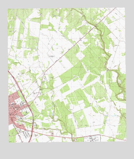
Beeville East, TX USGS Topographic Map
Click on map above to begin viewing in our Map Viewer.

This topographic map contains these locations and features:
Feature Name Type Latitude Longitude GNIS ID View Map
1st, 2nd, and 3rd Street Area ColoniaPopulated PlaceN28.4333°W97.7114°2010295View Map
Ann Burke ParkParkN28.3994°W97.7422°2028896View Map
Bee CountyCivilN28.4174°W97.7412°1383798View Map
Bee County Constable's Office Precinct 3BuildingN28.4064°W97.7303°2739353View Map
Bee County Constable's Office Precincts 1 and 4BuildingN28.4015°W97.7485°2739495View Map
Bee County CourthouseBuildingN28.4022°W97.7486°2030599View Map
Bee County Sheriff's OfficeBuildingN28.4064°W97.7303°2335099View Map
BeevillePopulated PlaceN28.4008°W97.7483°1330346View Map
Beeville City ParkParkN28.3986°W97.7386°2028833View Map
Beeville DivisionCivilN28.3937°W97.6870°1938523View Map
Beeville Memorial ParkCemeteryN28.4253°W97.7178°1330347View Map
Beeville Post OfficePost OfficeN28.4026°W97.7488°2731773View Map
Beeville School District Learning Resource CenterSchoolN28.4031°W97.7491°2434556View Map
Bible Baptist ChurchChurchN28.4047°W97.7444°2016504View Map
CHRISTUS Spohn Hospital - BeevilleHospitalN28.4075°W97.7315°2015614View Map
Church of Christ East SideChurchN28.4014°W97.7397°2016508View Map
City of BeevilleCivilN28.4059°W97.7494°2409812View Map
Conoly Alternative SchoolSchoolN28.4028°W97.7500°2002961View Map
El Buen Pastor Baptist ChurchChurchN28.4014°W97.7442°2016505View Map
Evergreen CemeteryCemeteryN28.4067°W97.7422°1335571View Map
Gleenwood CemeteryCemeteryN28.4106°W97.7369°1336573View Map
Hidden Acres ColoniaPopulated PlaceN28.4403°W97.7172°2010297View Map
KIBL-AM (Beeville)TowerN28.3858°W97.7286°1385500View Map
KIBL-FM (Beeville)TowerN28.3858°W97.7286°1385774View Map
Madderra - Flournoy Elementary SchoolSchoolN28.4095°W97.7467°2002964View Map
Old Houston Highway ColoniaPopulated PlaceN28.4192°W97.7242°2010300View Map
Our Lady of Victory Number 2 CemeteryCemeteryN28.4222°W97.7217°1343350View Map
Poesta ParkParkN28.3975°W97.7347°2029602View Map
Praeger BuildingBuildingN28.4019°W97.7492°2031706View Map
Saint Joseph CemeteryCemeteryN28.4119°W97.7342°1345960View Map
Saint Mary Academy Charter SchoolSchoolN28.4074°W97.7446°2434497View Map
Saint Philip's Episcopal SchoolSchoolN28.4037°W97.7456°2434460View Map
Saint Philips Episcopal ChurchChurchN28.4031°W97.7461°2016509View Map
Saint Rose CemeteryCemeteryN28.4117°W97.7347°1346115View Map
Seventh Day Adventist ChurchChurchN28.4114°W97.7450°2016514View Map
Skidmore Fire DepartmentBuildingN28.4040°W97.7322°2334297View Map
Talpacate CreekStreamN28.3844°W97.6869°1348213View Map
Texas A and M University Agricultural Research StationSchoolN28.4569°W97.7072°1348398View Map
Texas Department of Criminal Justice Garza East Transfer FacilityBuildingN28.3785°W97.6590°2738591View Map
Texas Department of Criminal Justice Garza West Transfer FacilityBuildingN28.3777°W97.6668°2738592View Map
Thomas Jefferson Intermediate SchoolSchoolN28.4112°W97.7458°2002975View Map
Thomas Jefferson Junior High SchoolSchoolN28.4114°W97.7456°1348483View Map
Tyler Elementary SchoolSchoolN28.4107°W97.7472°2002868View Map
United Pentecostal Church Christ TempleChurchN28.4025°W97.7419°2016512View Map

Note: Coordinates in the location and feature list above are referenced to NAD83 datum.


Copyright (C) 2008-2025 Ryan Niemi / Sunset Dynamics ... All Rights Reserved