TopoQuest Logo
Do you find TopoQuest useful?
Help keep TopoQuest running and adding new maps/features by donating!
Bitcoin:  19c7KJd3qBynnjoSw5npx9KScwjBe4ifkT
Litecoin:  LXs6TkuXGGXo1vDsWCkWVdjQX94eUKd6ui
Home View Maps Find Maps Find Places Resources & Links


Mount Rose NW, Nevada Topographic Map

USGS Map Title: Mount Rose NW, NV
USGS Map MRC: 39119D8
DRG (GeoTIFF) Download: o39119d8.tif


Neighboring USGS Topographic Map Quads:


  Dog Valley, CA  
39120E1
 

  Verdi, NV  
39119E8
 

  Reno, NV  
39119E7
 

  Boca, CA  
39120D1
 

  Mount Rose NW, NV  
39119D8
 

  Mount Rose NE, NV  
39119D7
 

  Martis Peak, CA  
39120C1
 

  Mount Rose, NV  
39119C8
 

  Washoe City, NV  
39119C7


Map MRC Location:

N40°
W120°
N40°
W119°
H8 H7 H6 H5 H4 H3 H2 H1
G8 G7 G6 G5 G4 G3 G2 G1
F8 F7 F6 F5 F4 F3 F2 F1
E8 E7 E6 E5 E4 E3 E2 E1
D8 D7 D6 D5 D4 D3 D2 D1
C8 C7 C6 C5 C4 C3 C2 C1
B8 B7 B6 B5 B4 B3 B2 B1
A8 A7 A6 A5 A4 A3 A2 A1
N39°
W120°
N39°
W119°

Mount Rose NW, NV USGS 1:24K Topographic Map Preview:
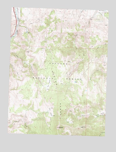
Mount Rose NW, NV USGS Topographic Map
Click on map above to begin viewing in our Map Viewer.

This topographic map contains these locations and features:
Feature Name Type Latitude Longitude GNIS ID View Map
Alpine Walk PeakSummitN39.3832°W119.9082°862643View Map
Big MeadowsFlatN39.4257°W119.9505°858898View Map
Bronco (historical)Populated PlaceN39.3980°W119.9783°848232View Map
Bronco Post Office (historical)Post OfficeN39.3980°W119.9783°864600View Map
Caldwells Mill (historical)LocaleN39.3930°W119.8891°847685View Map
Cone PeakSummitN39.4563°W119.9799°859317View Map
Davis MeadowFlatN39.3977°W119.9471°859461View Map
Dutch Louie FlatsBasinN39.4494°W119.8766°864240View Map
Essex (historical)LocaleN39.4946°W119.9919°847682View Map
FleishPopulated PlaceN39.4813°W119.9938°859725View Map
Fleish Post Office (historical)Post OfficeN39.4813°W119.9938°864497View Map
Fuller LakeLakeN39.4759°W119.9804°859775View Map
Hunter LakeLakeN39.4279°W119.9167°860075View Map
Marmol (historical)Populated PlaceN39.4738°W119.9933°847698View Map
Marmol Post Office (historical)Post OfficeN39.4738°W119.9933°864498View Map
Mt. Rose WildernessReserveN39.3773°W119.9327°2035210View Map
Reno Southwest DivisionCivilN39.4093°W119.9023°1937467View Map
Snowflower MountainSummitN39.3821°W119.9357°862647View Map
Thomas MeadowsFlatN39.3971°W119.8832°861719View Map
Verdi TownshipCivilN39.4671°W119.9499°857647View Map

Note: Coordinates in the location and feature list above are referenced to NAD83 datum.


Copyright (C) 2008-2025 Ryan Niemi / Sunset Dynamics ... All Rights Reserved