TopoQuest Logo
Do you find TopoQuest useful?
Help keep TopoQuest running and adding new maps/features by donating!
Bitcoin:  19c7KJd3qBynnjoSw5npx9KScwjBe4ifkT
Litecoin:  LXs6TkuXGGXo1vDsWCkWVdjQX94eUKd6ui
Home View Maps Find Maps Find Places Resources & Links


Mount Signal, California Topographic Map

USGS Map Title: Mount Signal, CA
USGS Map MRC: 32115F6
DRG (GeoTIFF) Download: o32115f6.tif


Neighboring USGS Topographic Map Quads:


  Plaster City, CA  
32115G7
 

  Seeley, CA  
32115G6
 

  El Centro, CA  
32115G5
 

  Yuha Basin, CA  
32115F7
 

  Mount Signal, CA  
32115F6
 

  Heber, CA  
32115F5


Map MRC Location:

N33°
W116°
N33°
W115°
H8 H7 H6 H5 H4 H3 H2 H1
G8 G7 G6 G5 G4 G3 G2 G1
F8 F7 F6 F5 F4 F3 F2 F1
E8 E7 E6 E5 E4 E3 E2 E1
D8 D7 D6 D5 D4 D3 D2 D1
C8 C7 C6 C5 C4 C3 C2 C1
B8 B7 B6 B5 B4 B3 B2 B1
A8 A7 A6 A5 A4 A3 A2 A1
N32°
W116°
N32°
W115°

Mount Signal, CA USGS 1:24K Topographic Map Preview:
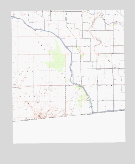
Mount Signal, CA USGS Topographic Map
Click on map above to begin viewing in our Map Viewer.

This topographic map contains these locations and features:
Feature Name Type Latitude Longitude GNIS ID View Map
All American Drain ThirteenCanalN32.6601°W115.6381°255256View Map
Brockman DrainCanalN32.6945°W115.6500°239705View Map
Carpenter DrainCanalN32.6792°W115.6489°240260View Map
Dixie Drain Three-ACanalN32.7392°W115.7233°254026View Map
Dixie Drain Three-BCanalN32.7353°W115.7308°254027View Map
Elder Lateral ThreeCanalN32.7453°W115.6400°254106View Map
Fern SidemainCanalN32.7328°W115.7214°242216View Map
Fig DrainCanalN32.7389°W115.6994°242237View Map
Fig Drain OneCanalN32.7159°W115.6900°242238View Map
Greeson Drain ThreeCanalN32.7159°W115.6636°243028View Map
Greeson WashStreamN32.7451°W115.6508°243029View Map
Martin DrainCanalN32.7234°W115.6697°245565View Map
Mount SignalPopulated PlaceN32.6784°W115.6392°1661068View Map
Mount Signal DrainCanalN32.6906°W115.6608°246274View Map
Mount Signal Drain FourCanalN32.6603°W115.6625°255647View Map
Mount Signal Drain OneCanalN32.6873°W115.6744°255645View Map
Mount Signal Drain One-ACanalN32.6953°W115.6853°246275View Map
Mount Signal Drain ThreeCanalN32.6606°W115.6639°255646View Map
Mount Signal SchoolSchoolN32.6951°W115.6386°246276View Map
Pinto WashStreamN32.7081°W115.7156°247544View Map
Walnut CanalCanalN32.6570°W115.6561°251144View Map
Wells DrainCanalN32.6828°W115.6381°251298View Map
Wistaria Lateral EightCanalN32.7378°W115.6472°255887View Map
Wistaria Lateral SevenCanalN32.7164°W115.6375°255886View Map
Wistaria Lateral SixCanalN32.7092°W115.6325°255885View Map
Woodbine CanalCanalN32.6795°W115.6331°251778View Map
Woodbine Lateral EightCanalN32.6987°W115.6483°255894View Map
Woodbine Lateral FourCanalN32.6645°W115.6431°255892View Map
Woodbine Lateral SevenCanalN32.6798°W115.6536°255893View Map
Woodbine Lateral ThreeCanalN32.6639°W115.6383°255891View Map
Wormwood CanalCanalN32.7353°W115.6722°251815View Map
Wormwood DrainCanalN32.7453°W115.6894°251816View Map
Wormwood Lateral FourCanalN32.7162°W115.6808°255897View Map
Wormwood Lateral NineCanalN32.7381°W115.6669°255899View Map
Wormwood Lateral SevenCanalN32.7381°W115.6900°255898View Map
Wormwood Lateral Three-ACanalN32.7087°W115.6786°255896View Map
Wulfs CrossingLocaleN32.7370°W115.6375°251828View Map

Note: Coordinates in the location and feature list above are referenced to NAD83 datum.


Copyright (C) 2008-2025 Ryan Niemi / Sunset Dynamics ... All Rights Reserved