TopoQuest Logo
Do you find TopoQuest useful?
Help keep TopoQuest running and adding new maps/features by donating!
Bitcoin:  19c7KJd3qBynnjoSw5npx9KScwjBe4ifkT
Litecoin:  LXs6TkuXGGXo1vDsWCkWVdjQX94eUKd6ui
Home View Maps Find Maps Find Places Resources & Links


Heber, California Topographic Map

USGS Map Title: Heber, CA
USGS Map MRC: 32115F5
DRG (GeoTIFF) Download: o32115f5.tif


Neighboring USGS Topographic Map Quads:


  Seeley, CA  
32115G6
 

  El Centro, CA  
32115G5
 

  Holtville West, CA  
32115G4
 

  Mount Signal, CA  
32115F6
 

  Heber, CA  
32115F5
 

  Calexico, CA  
32115F4


Map MRC Location:

N33°
W116°
N33°
W115°
H8 H7 H6 H5 H4 H3 H2 H1
G8 G7 G6 G5 G4 G3 G2 G1
F8 F7 F6 F5 F4 F3 F2 F1
E8 E7 E6 E5 E4 E3 E2 E1
D8 D7 D6 D5 D4 D3 D2 D1
C8 C7 C6 C5 C4 C3 C2 C1
B8 B7 B6 B5 B4 B3 B2 B1
A8 A7 A6 A5 A4 A3 A2 A1
N32°
W116°
N32°
W115°

Heber, CA USGS 1:24K Topographic Map Preview:
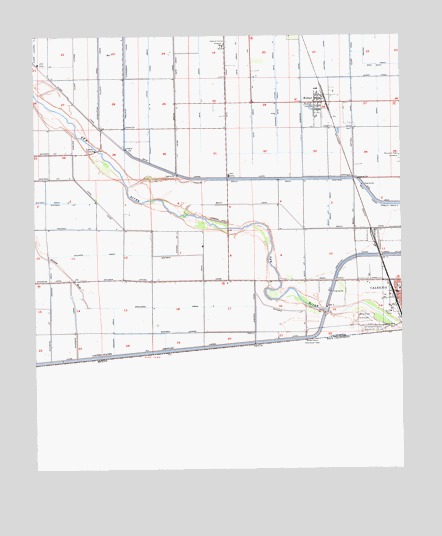
Heber, CA USGS Topographic Map
Click on map above to begin viewing in our Map Viewer.

This topographic map contains these locations and features:
Feature Name Type Latitude Longitude GNIS ID View Map
Alder Lateral Five ACanalN32.7420°W115.5003°255252View Map
Beech CanalCanalN32.6987°W115.5389°239155View Map
Beech DrainCanalN32.7084°W115.5478°239156View Map
Beech Lateral OneCanalN32.6978°W115.5169°255350View Map
Beech Lateral TwoCanalN32.6976°W115.5253°255351View Map
Birch CanalCanalN32.6798°W115.5186°239334View Map
Birch Lateral ThreeCanalN32.6823°W115.5336°255357View Map
Brockman Drain TwoCanalN32.6720°W115.5775°255373View Map
Calexico Fire Department Station 2BuildingN32.6742°W115.5162°2664524View Map
Calexico International AirportAirportN32.6675°W115.5156°1653300View Map
Calexico Mall Shopping CenterLocaleN32.6662°W115.5017°1868210View Map
Calexico Post OfficePost OfficeN32.6794°W115.5030°1868211View Map
Central DrainCanalN32.7417°W115.5128°240415View Map
Daffodil CanalCanalN32.7445°W115.5258°241215View Map
Date Drain ThreeCanalN32.7459°W115.5433°254003View Map
Date Drain Three-ACanalN32.7253°W115.5508°254004View Map
Dogwood Lateral TwoCanalN32.7301°W115.5425°254033View Map
Dogwood Side MainCanalN32.7067°W115.5131°241532View Map
Elder Lateral OneCanalN32.7389°W115.6119°254100View Map
Greeson DrainCanalN32.6648°W115.5989°243026View Map
Greeson Drain TwoCanalN32.6792°W115.6206°243027View Map
HeberPopulated PlaceN32.7309°W115.5297°1660738View Map
Heber Census Designated PlaceCensusN32.7318°W115.5204°2408367View Map
Heber Elementary SchoolSchoolN32.7256°W115.5297°1868222View Map
Heber Junior High SchoolSchoolN32.7251°W115.5297°1868224View Map
Heber ParkParkN32.6778°W115.5017°1868225View Map
Heber Post OfficePost OfficeN32.7305°W115.5281°1868226View Map
Imperial County Fire Department Station 2BuildingN32.7288°W115.5339°1868223View Map
Imperial County HospitalHospitalN32.7470°W115.5611°1660789View Map
Imperial County Sheriff's OfficeBuildingN32.7482°W115.5634°2756217View Map
International Country ClubLocaleN32.6648°W115.5117°1654673View Map
Johnson Brothers Airport (historical)AirportN32.6734°W115.5597°1653299View Map
KICO-AM (Calexico)TowerN32.6995°W115.5036°1664853View Map
Legion ParkParkN32.6709°W115.5050°1868230View Map
Lotus CanalCanalN32.7392°W115.5858°245229View Map
Lotus DrainCanalN32.7370°W115.5867°245230View Map
Lyons CrossingLocaleN32.7173°W115.6042°1660967View Map
Mountain View CemeteryCemeteryN32.7153°W115.5005°246302View Map
Rodriguez ParkParkN32.6767°W115.5061°1868237View Map
Strout DrainCanalN32.7214°W115.5081°249990View Map
Vincent Memorial High SchoolSchoolN32.6776°W115.5061°1868241View Map
Wistaria CanalCanalN32.7114°W115.6125°251744View Map
Wistaria DrainCanalN32.6876°W115.6050°255878View Map
Wistaria Drain FiveCanalN32.7026°W115.6206°255879View Map
Wistaria Lateral FiveCanalN32.7020°W115.6214°255884View Map
Wistaria Lateral FourCanalN32.6948°W115.6097°255883View Map
Wistaria Lateral OneCanalN32.6648°W115.5758°255880View Map
Wistaria Lateral P TwoCanalN32.6703°W115.5389°255888View Map
Wistaria Lateral ThreeCanalN32.6906°W115.5767°255882View Map
Wistaria Lateral TwoCanalN32.6801°W115.5950°255881View Map
Woodbine Lateral TwoCanalN32.6723°W115.6231°255890View Map

Note: Coordinates in the location and feature list above are referenced to NAD83 datum.


Copyright (C) 2008-2025 Ryan Niemi / Sunset Dynamics ... All Rights Reserved