TopoQuest Logo
Do you find TopoQuest useful?
Help keep TopoQuest running and adding new maps/features by donating!
Bitcoin:  19c7KJd3qBynnjoSw5npx9KScwjBe4ifkT
Litecoin:  LXs6TkuXGGXo1vDsWCkWVdjQX94eUKd6ui
Home View Maps Find Maps Find Places Resources & Links


Mountain, Wisconsin Topographic Map

USGS Map Title: Mountain, WI
USGS Map MRC: 45088B4
DRG (GeoTIFF) Download: o45088b4.tif


Neighboring USGS Topographic Map Quads:


  Townsend, WI  
45088C5
 

  Wheeler Lake, WI  
45088C4
 

  Thunder Mountain, WI  
45088C3
 

  Shadow Lake, WI  
45088B5
 

  Mountain, WI  
45088B4
 

  Shay Lake, WI  
45088B3
 

  Fredenberg Lake, WI  
45088A5
 

  Breed, WI  
45088A4
 

  Hickory Corners, WI  
45088A3


Map MRC Location:

N46°
W89°
N46°
W88°
H8 H7 H6 H5 H4 H3 H2 H1
G8 G7 G6 G5 G4 G3 G2 G1
F8 F7 F6 F5 F4 F3 F2 F1
E8 E7 E6 E5 E4 E3 E2 E1
D8 D7 D6 D5 D4 D3 D2 D1
C8 C7 C6 C5 C4 C3 C2 C1
B8 B7 B6 B5 B4 B3 B2 B1
A8 A7 A6 A5 A4 A3 A2 A1
N45°
W89°
N45°
W88°

Mountain, WI USGS 1:24K Topographic Map Preview:
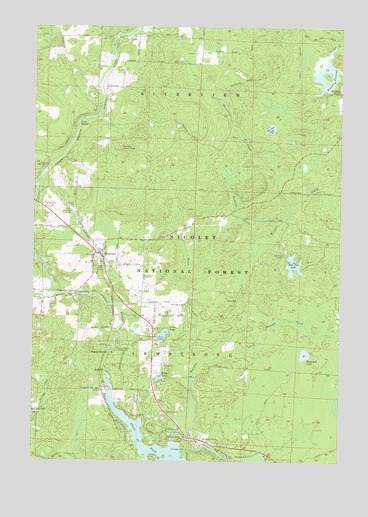
Mountain, WI USGS Topographic Map
Click on map above to begin viewing in our Map Viewer.

This topographic map contains these locations and features:
Feature Name Type Latitude Longitude GNIS ID View Map
Bagley RapidsRapidsN45.1561°W88.4695°1578681View Map
Bagley Rapids CampgroundLocaleN45.1589°W88.4659°1578682View Map
Baldwin CreekStreamN45.1853°W88.4112°1578687View Map
Bear Paw CampLocaleN45.1844°W88.3984°1578723View Map
Bear Paw LakeLakeN45.1814°W88.3941°1578724View Map
Bowman Airport (historical)AirportN45.1703°W88.4398°1580941View Map
Chute 1865c371 DamDamN45.1308°W88.4434°1791970View Map
Chute PondReservoirN45.1286°W88.4492°1579006View Map
Green LakeLakeN45.1612°W88.4471°1579362View Map
Green Lake Picnic AreaLocaleN45.1616°W88.4493°1580942View Map
Grindle DamDamN45.2316°W88.3818°1792835View Map
Hagar MountainSummitN45.2042°W88.4086°2081913View Map
Hagar Mountain State Natural AreaParkN45.2008°W88.4103°2081914View Map
Hines CreekStreamN45.1469°W88.4357°1579460View Map
Little Waupee CreekStreamN45.1544°W88.4270°1579723View Map
Loon RapidsRapidsN45.2219°W88.4823°1579756View Map
Macauley CreekStreamN45.1989°W88.3965°1579796View Map
Midget LakeLakeN45.1490°W88.4482°1579868View Map
MountainPopulated PlaceN45.1847°W88.4737°1579932View Map
Mountain Ambulance ServiceBuildingN45.1938°W88.4875°2698337View Map
Mountain Census Designated PlaceCensusN45.1863°W88.4681°2586534View Map
Mountain Fire DepartmentBuildingN45.1785°W88.4695°2696797View Map
Mountain Lookout TowerTowerN45.2155°W88.4651°1581290View Map
Oconton County Park CampgroundLocaleN45.1336°W88.4448°1581143View Map
Riverview TownhallBuildingN45.2469°W88.4751°1844006View Map
Saint Michael ChapelChurchN45.1316°W88.4301°1580328View Map
Sunrise LakeLakeN45.2208°W88.4039°1580558View Map
Town CreekStreamN45.1703°W88.4679°1580633View Map
Town of MountainCivilN45.1593°W88.4337°1582716View Map
Town of RiverviewCivilN45.2462°W88.4323°1584044View Map
Waupee CreekStreamN45.1314°W88.4343°1580731View Map
Waupee FlowageChannelN45.2350°W88.3790°1580732View Map
Waupee Flowage 8ReservoirN45.2316°W88.3818°1792836View Map
Westphall LakeLakeN45.1559°W88.3891°1580764View Map

Note: Coordinates in the location and feature list above are referenced to NAD83 datum.


Copyright (C) 2008-2024 Ryan Niemi / Sunset Dynamics ... All Rights Reserved