TopoQuest Logo
Do you find TopoQuest useful?
Help keep TopoQuest running and adding new maps/features by donating!
Bitcoin:  19c7KJd3qBynnjoSw5npx9KScwjBe4ifkT
Litecoin:  LXs6TkuXGGXo1vDsWCkWVdjQX94eUKd6ui
Home View Maps Find Maps Find Places Resources & Links


Mountain Dell, Utah Topographic Map

USGS Map Title: Mountain Dell, UT
USGS Map MRC: 40111G6
DRG (GeoTIFF) Download: o40111g6.tif


Neighboring USGS Topographic Map Quads:


  Bountiful Peak, UT  
40111H7
 

  Porterville, UT  
40111H6
 

  East Canyon Reservoir, UT  
40111H5
 

  Fort Douglas, UT  
40111G7
 

  Mountain Dell, UT  
40111G6
 

  Big Dutch Hollow, UT  
40111G5
 

  Sugar House, UT  
40111F7
 

  Mount Aire, UT  
40111F6
 

  Park City West, UT  
40111F5


Map MRC Location:

N41°
W112°
N41°
W111°
H8 H7 H6 H5 H4 H3 H2 H1
G8 G7 G6 G5 G4 G3 G2 G1
F8 F7 F6 F5 F4 F3 F2 F1
E8 E7 E6 E5 E4 E3 E2 E1
D8 D7 D6 D5 D4 D3 D2 D1
C8 C7 C6 C5 C4 C3 C2 C1
B8 B7 B6 B5 B4 B3 B2 B1
A8 A7 A6 A5 A4 A3 A2 A1
N40°
W112°
N40°
W111°

Mountain Dell, UT USGS 1:24K Topographic Map Preview:
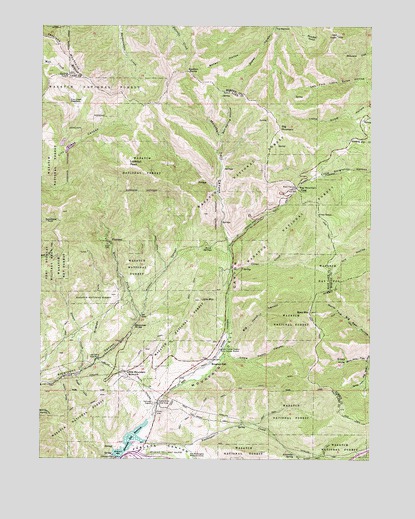
Mountain Dell, UT USGS Topographic Map
Click on map above to begin viewing in our Map Viewer.

This topographic map contains these locations and features:
Feature Name Type Latitude Longitude GNIS ID View Map
Alexander CreekStreamN40.7536°W111.6958°1438149View Map
Alexander SpringSpringN40.7512°W111.6542°1438150View Map
Bald MountainSummitN40.7922°W111.6485°1438360View Map
Big Hatch CanyonValleyN40.7822°W111.6788°1438674View Map
Big MountainSummitN40.8452°W111.6605°1438707View Map
Big Mountain PassGapN40.8286°W111.6538°1438708View Map
Birch SpringsSpringN40.8111°W111.6860°1438815View Map
Boiler HollowValleyN40.8699°W111.6672°1438991View Map
Box Spring HollowValleyN40.8433°W111.6830°1439086View Map
Brigham ForkValleyN40.7783°W111.7305°1439110View Map
Burr ForkValleyN40.7913°W111.7133°1439368View Map
Camp GrantLocaleN40.7666°W111.7060°1439443View Map
City Creek MeadowsFlatN40.8530°W111.7408°1439758View Map
Clear CreekStreamN40.8044°W111.6788°1439792View Map
Emigration Canyon Census Designated PlaceCensusN40.7894°W111.7411°2584765View Map
Ephraim Hanks Station Pony Express MarkerLocaleN40.7813°W111.6830°1440947View Map
Freeze CreekStreamN40.7755°W111.7352°1441229View Map
George Washington Memorial GroveWoodsN40.7505°W111.6919°1441303View Map
Glory HoleBasinN40.7786°W111.6369°1441338View Map
Glory Hole ForkValleyN40.7791°W111.6274°1441339View Map
Henderson SpringSpringN40.7885°W111.7150°1441703View Map
Kelvin GroveValleyN40.7724°W111.7433°1442299View Map
Killyon CanyonValleyN40.7924°W111.7124°1442318View Map
KillyonsPopulated PlaceN40.7930°W111.7127°1454278View Map
Last CampLocaleN40.7788°W111.7288°1442446View Map
Little Dell ReservoirReservoirN40.7735°W111.6937°2747003View Map
Little Hatch CanyonValleyN40.7797°W111.6802°1442723View Map
Little MountainSummitN40.7958°W111.6905°1442749View Map
Little MountainPopulated PlaceN40.7833°W111.7213°1454279View Map
Little Mountain Canyon CondominiumPopulated PlaceN40.7841°W111.7208°1449790View Map
Little Mountain SummitLocaleN40.7749°W111.7185°1442750View Map
Lookout PeakSummitN40.8347°W111.7174°1442946View Map
Maple CityPopulated PlaceN40.7716°W111.7358°1454280View Map
Maple GroveValleyN40.7738°W111.7374°1443166View Map
MargarethePopulated PlaceN40.8263°W111.7347°1454281View Map
Mountain DellLocaleN40.7774°W111.6869°1443634View Map
Mountain Dell CanyonValleyN40.7616°W111.7094°1443635View Map
Mountain Dell DamDamN40.7505°W111.7224°1447949View Map
Mountain Dell Golf CourseLocaleN40.7513°W111.7030°1454479View Map
Mountain Dell ParkPopulated PlaceN40.8036°W111.6799°1454282View Map
Mountain Dell ReservoirReservoirN40.7554°W111.7164°1447948View Map
Mountain Top ParkPopulated PlaceN40.8027°W111.7058°1454283View Map
PinecrestPopulated PlaceN40.8127°W111.7249°1444418View Map
Swallow RocksPillarN40.8613°W111.6938°1446270View Map
The GrovesPopulated PlaceN40.8183°W111.7260°1454369View Map
The NarrowsGapN40.8741°W111.6624°1446477View Map
The Sheep TrailTrailN40.7577°W111.6627°1446502View Map
Township of Emigration CanyonCivilN40.7863°W111.7417°2708943View Map

Note: Coordinates in the location and feature list above are referenced to NAD83 datum.


Copyright (C) 2008-2025 Ryan Niemi / Sunset Dynamics ... All Rights Reserved