TopoQuest Logo
Do you find TopoQuest useful?
Help keep TopoQuest running and adding new maps/features by donating!
Bitcoin:  19c7KJd3qBynnjoSw5npx9KScwjBe4ifkT
Litecoin:  LXs6TkuXGGXo1vDsWCkWVdjQX94eUKd6ui
Home View Maps Find Maps Find Places Resources & Links


Porterville, Utah Topographic Map

USGS Map Title: Porterville, UT
USGS Map MRC: 40111H6
DRG (GeoTIFF) Download: o40111h6.tif


Neighboring USGS Topographic Map Quads:


  Peterson, UT  
41111A7
 

  Morgan, UT  
41111A6
 

  Devils Slide, UT  
41111A5
 

  Bountiful Peak, UT  
40111H7
 

  Porterville, UT  
40111H6
 

  East Canyon Reservoir, UT  
40111H5
 

  Fort Douglas, UT  
40111G7
 

  Mountain Dell, UT  
40111G6
 

  Big Dutch Hollow, UT  
40111G5


Map MRC Location:

N41°
W112°
N41°
W111°
H8 H7 H6 H5 H4 H3 H2 H1
G8 G7 G6 G5 G4 G3 G2 G1
F8 F7 F6 F5 F4 F3 F2 F1
E8 E7 E6 E5 E4 E3 E2 E1
D8 D7 D6 D5 D4 D3 D2 D1
C8 C7 C6 C5 C4 C3 C2 C1
B8 B7 B6 B5 B4 B3 B2 B1
A8 A7 A6 A5 A4 A3 A2 A1
N40°
W112°
N40°
W111°

Porterville, UT USGS 1:24K Topographic Map Preview:
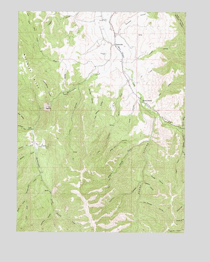
Porterville, UT USGS Topographic Map
Click on map above to begin viewing in our Map Viewer.

This topographic map contains these locations and features:
Feature Name Type Latitude Longitude GNIS ID View Map
Arthurs ForkStreamN40.9333°W111.7383°1438273View Map
Beaver CanyonValleyN40.9324°W111.6277°1438512View Map
Beaver CreekStreamN40.9249°W111.7372°1438524View Map
Blue Bell HollowValleyN40.8811°W111.6602°1438925View Map
Cataract CanyonValleyN40.8861°W111.7235°1439536View Map
Cottonwood CanyonValleyN40.9502°W111.7249°1439994View Map
East CanyonValleyN40.9727°W111.6705°1440770View Map
Farrells CreekStreamN40.8869°W111.7230°1441014View Map
Field of Dreams AirportAirportN40.9729°W111.7080°2770359View Map
Hardscrabble CreekStreamN40.9772°W111.6738°1441587View Map
Henholt CanyonValleyN40.9041°W111.6574°1441705View Map
Horseshoe CanyonValleyN40.9033°W111.6566°1441908View Map
Joe Durrant HollowValleyN40.8922°W111.6605°1442155View Map
Jones HollowValleyN40.9527°W111.6585°1442213View Map
Lake CanyonValleyN40.9605°W111.6685°1442395View Map
Left Fork Beaver CanyonValleyN40.9211°W111.6277°1442487View Map
Left Fork Shingle Mill CreekStreamN40.8930°W111.7435°1442528View Map
Mahogany RidgeRidgeN40.9749°W111.7444°1443095View Map
Morgan South DivisionCivilN40.9461°W111.6765°1939394View Map
Norwood CanyonValleyN40.9869°W111.6760°1444000View Map
Pine CanyonValleyN40.9297°W111.6519°1444360View Map
Pole HollowValleyN40.9555°W111.7124°1444554View Map
PortervillePopulated PlaceN40.9813°W111.6783°1444594View Map
Porterville CemeteryCemeteryN40.9767°W111.6853°1444595View Map
Priest HollowValleyN40.9713°W111.6674°1444645View Map
Redrock CanyonValleyN40.9347°W111.6274°1444844View Map
Richville Diversion DamDamN40.9947°W111.6855°1444894View Map
Right Fork Beaver CanyonValleyN40.9211°W111.6277°1444908View Map
Right Fork Shingle Mill CreekStreamN40.8930°W111.7435°1444955View Map
Right Hand Fork Sheep CanyonValleyN40.9266°W111.6527°1444978View Map
Sheep CanyonValleyN40.9411°W111.6469°1445485View Map
Shingle Mill CreekStreamN40.9077°W111.7330°1445537View Map
Spring HollowValleyN40.9594°W111.6991°1446040View Map
The Church of Jesus Christ of Latter Day SaintsChurchN40.9861°W111.6783°1449557View Map
The GulchValleyN40.9458°W111.6502°1446458View Map
The NarrowsGapN40.9452°W111.7252°1446479View Map
Tom Adams HollowValleyN40.9508°W111.6766°1446633View Map
Trough HollowValleyN40.9083°W111.6566°1446731View Map
Tucker HollowValleyN40.9574°W111.7055°1446754View Map
Walton CreekStreamN40.9219°W111.7352°1446973View Map
Whites CrossingPopulated PlaceN40.9497°W111.6577°1447294View Map
Woods CreekStreamN40.9619°W111.6663°1447519View Map

Note: Coordinates in the location and feature list above are referenced to NAD83 datum.


Copyright (C) 2008-2024 Ryan Niemi / Sunset Dynamics ... All Rights Reserved