TopoQuest Logo
Do you find TopoQuest useful?
Help keep TopoQuest running and adding new maps/features by donating!
Bitcoin:  19c7KJd3qBynnjoSw5npx9KScwjBe4ifkT
Litecoin:  LXs6TkuXGGXo1vDsWCkWVdjQX94eUKd6ui
Home View Maps Find Maps Find Places Resources & Links


Mountain View, Wyoming Topographic Map

USGS Map Title: Mountain View, WY
USGS Map MRC: 41110C3
DRG (GeoTIFF) Download: o41110c3.tif


Neighboring USGS Topographic Map Quads:


  Carter, WY  
41110D4
 

  Austin Reservoir, WY  
41110D3
 

  Millersville, WY  
41110D2
 

  Fort Bridger, WY  
41110C4
 

  Mountain View, WY  
41110C3
 

  Turtle Hill, WY  
41110C2
 

  Robertson, WY  
41110B4
 

  Leavitt Bench, WY  
41110B3
 

  Reed Reservoir, WY  
41110B2


Map MRC Location:

N42°
W111°
N42°
W110°
H8 H7 H6 H5 H4 H3 H2 H1
G8 G7 G6 G5 G4 G3 G2 G1
F8 F7 F6 F5 F4 F3 F2 F1
E8 E7 E6 E5 E4 E3 E2 E1
D8 D7 D6 D5 D4 D3 D2 D1
C8 C7 C6 C5 C4 C3 C2 C1
B8 B7 B6 B5 B4 B3 B2 B1
A8 A7 A6 A5 A4 A3 A2 A1
N41°
W111°
N41°
W110°

Mountain View, WY USGS 1:24K Topographic Map Preview:
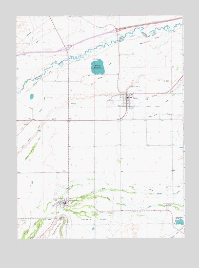
Mountain View, WY USGS Topographic Map
Click on map above to begin viewing in our Map Viewer.

This topographic map contains these locations and features:
Feature Name Type Latitude Longitude GNIS ID View Map
Blacks Fork CanalCanalN41.3238°W110.3196°1585634View Map
Bridger Valley DivisionCivilN41.2955°W110.3263°1939691View Map
Cliff Graham Reservoir Number ThreeReservoirN41.2589°W110.2540°1605230View Map
Clifford F Graham DamDamN41.2583°W110.2507°1607867View Map
Fort Bridger CanalCanalN41.3291°W110.3365°1588632View Map
Fort Bridger SchoolSchoolN41.2688°W110.3399°1795656View Map
KBVZ-FM (Fort Bridger)TowerN41.2622°W110.3415°1608919View Map
LymanPopulated PlaceN41.3275°W110.2929°1609117View Map
Lyman City CemeteryCemeteryN41.3351°W110.2876°2774423View Map
Lyman DrawValleyN41.3661°W110.2504°1591135View Map
Lyman High SchoolSchoolN41.3275°W110.2929°1795658View Map
Lyman Middle SchoolSchoolN41.3275°W110.2929°1795659View Map
Lyman Police DepartmentBuildingN41.3262°W110.2925°2752616View Map
Lyman Post OfficePost OfficeN41.3272°W110.2932°2767905View Map
Lyman SchoolSchoolN41.3275°W110.2929°1795660View Map
Meeks CreekStreamN41.2666°W110.2785°1591456View Map
Mountain ViewPopulated PlaceN41.2688°W110.3399°1591810View Map
Mountain View Fire DepartmentBuildingN41.2731°W110.3357°2673465View Map
Mountain View High SchoolSchoolN41.2688°W110.3399°1795654View Map
Mountain View Middle SchoolSchoolN41.2688°W110.3399°1795655View Map
Mountain View Police DepartmentBuildingN41.2707°W110.3421°2752665View Map
Mountain View Post OfficePost OfficeN41.2736°W110.3360°2768547View Map
Mountain View SchoolSchoolN41.2688°W110.3399°1795657View Map
North CreekStreamN41.2744°W110.2638°1592128View Map
Paterson Lake DamDamN41.3500°W110.3140°1607939View Map
Smiths ForkStreamN41.2605°W110.3571°1596905View Map
Town of LymanCivilN41.3274°W110.2978°2412928View Map
Town of Mountain ViewCivilN41.2723°W110.3341°2413023View Map
Twin Buttes CanalCanalN41.3163°W110.3674°1595781View Map
Uinta County Emergency Medical Services LymanBuildingN41.3229°W110.2934°2673543View Map
Uinta County Fire Protection LymanBuildingN41.3259°W110.2923°2673416View Map
Uinta County Sheriff's Office Mountain ViewBuildingN41.2634°W110.3455°2752663View Map
UriePopulated PlaceN41.3161°W110.3363°1595889View Map
Urie Census Designated PlaceCensusN41.3089°W110.3352°2585085View Map
Urie SchoolSchoolN41.3275°W110.2929°1795661View Map

Note: Coordinates in the location and feature list above are referenced to NAD83 datum.


Copyright (C) 2008-2025 Ryan Niemi / Sunset Dynamics ... All Rights Reserved