TopoQuest Logo
Do you find TopoQuest useful?
Help keep TopoQuest running and adding new maps/features by donating!
Bitcoin:  19c7KJd3qBynnjoSw5npx9KScwjBe4ifkT
Litecoin:  LXs6TkuXGGXo1vDsWCkWVdjQX94eUKd6ui
Home View Maps Find Maps Find Places Resources & Links


Robertson, Wyoming Topographic Map

USGS Map Title: Robertson, WY
USGS Map MRC: 41110B4
DRG (GeoTIFF) Download: o41110b4.tif


Neighboring USGS Topographic Map Quads:


  Leroy, WY  
41110C5
 

  Fort Bridger, WY  
41110C4
 

  Mountain View, WY  
41110C3
 

  Hague Creek, WY  
41110B5
 

  Robertson, WY  
41110B4
 

  Leavitt Bench, WY  
41110B3
 

  Meeks Cabin Reservoir, WY  
41110A5
 

  Buck Fever Ridge, WY  
41110A4
 

  Table Mountain, WY  
41110A3


Map MRC Location:

N42°
W111°
N42°
W110°
H8 H7 H6 H5 H4 H3 H2 H1
G8 G7 G6 G5 G4 G3 G2 G1
F8 F7 F6 F5 F4 F3 F2 F1
E8 E7 E6 E5 E4 E3 E2 E1
D8 D7 D6 D5 D4 D3 D2 D1
C8 C7 C6 C5 C4 C3 C2 C1
B8 B7 B6 B5 B4 B3 B2 B1
A8 A7 A6 A5 A4 A3 A2 A1
N41°
W111°
N41°
W110°

Robertson, WY USGS 1:24K Topographic Map Preview:
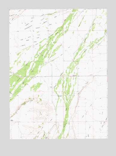
Robertson, WY USGS Topographic Map
Click on map above to begin viewing in our Map Viewer.

This topographic map contains these locations and features:
Feature Name Type Latitude Longitude GNIS ID View Map
Botero DitchCanalN41.1508°W110.4015°1585795View Map
Brewster DrawValleyN41.2377°W110.4313°1585896View Map
Bugas DrawValleyN41.2258°W110.4474°1586080View Map
Bugas Spring CreekStreamN41.2261°W110.4443°1586081View Map
Cap White RidgeRidgeN41.1599°W110.4749°1586357View Map
Cold SpringSpringN41.1257°W110.4527°1586874View Map
Dans NippleSummitN41.1433°W110.4993°1587349View Map
Davis and Company DitchCanalN41.1772°W110.4032°1587364View Map
Evans CreekStreamN41.2333°W110.4329°1588339View Map
Haystack DrawValleyN41.2436°W110.4593°1589435View Map
Ingersoll WashValleyN41.2194°W110.4607°1589928View Map
Johnson CemeteryCemeteryN41.1750°W110.4457°1590155View Map
Jones CreekStreamN41.2219°W110.3946°1590216View Map
Lambs Supply DitchCanalN41.2105°W110.4277°1590493View Map
Nebraska FlatFlatN41.2366°W110.4663°1591970View Map
Perry DrawValleyN41.2247°W110.3774°1592677View Map
Pine GroveAreaN41.1852°W110.4891°1592775View Map
Pine Grove CanalCanalN41.2419°W110.4952°1592776View Map
RobertsonPopulated PlaceN41.1852°W110.4132°1593527View Map
Robertson Census Designated PlaceCensusN41.1816°W110.4274°2409191View Map
Robertson Post OfficePost OfficeN41.1855°W110.4173°2768550View Map
Steves DrawValleyN41.2477°W110.4204°1595044View Map
Willow CreekStreamN41.1999°W110.4182°1604540View Map
Yellow Hollow CreekStreamN41.1369°W110.4563°1604309View Map

Note: Coordinates in the location and feature list above are referenced to NAD83 datum.


Copyright (C) 2008-2024 Ryan Niemi / Sunset Dynamics ... All Rights Reserved