TopoQuest Logo
Do you find TopoQuest useful?
Help keep TopoQuest running and adding new maps/features by donating!
Bitcoin:  19c7KJd3qBynnjoSw5npx9KScwjBe4ifkT
Litecoin:  LXs6TkuXGGXo1vDsWCkWVdjQX94eUKd6ui
Home View Maps Find Maps Find Places Resources & Links


Mountainair, New Mexico Topographic Map

USGS Map Title: Mountainair, NM
USGS Map MRC: 34106E2
DRG (GeoTIFF) Download: o34106e2.tif


Neighboring USGS Topographic Map Quads:


  Torreon, NM  
34106F3
 

  Ewing, NM  
34106F2
 

  Mountainair NE, NM  
34106F1
 

  Punta de Agua, NM  
34106E3
 

  Mountainair, NM  
34106E2
 

  Willard, NM  
34106E1
 

  Abo, NM  
34106D3
 

  Mesa Draw, NM  
34106D2
 

  Round Top, NM  
34106D1


Map MRC Location:

N35°
W107°
N35°
W106°
H8 H7 H6 H5 H4 H3 H2 H1
G8 G7 G6 G5 G4 G3 G2 G1
F8 F7 F6 F5 F4 F3 F2 F1
E8 E7 E6 E5 E4 E3 E2 E1
D8 D7 D6 D5 D4 D3 D2 D1
C8 C7 C6 C5 C4 C3 C2 C1
B8 B7 B6 B5 B4 B3 B2 B1
A8 A7 A6 A5 A4 A3 A2 A1
N34°
W107°
N34°
W106°

Mountainair, NM USGS 1:24K Topographic Map Preview:
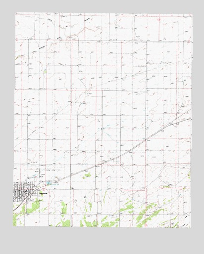
Mountainair, NM USGS Topographic Map
Click on map above to begin viewing in our Map Viewer.

This topographic map contains these locations and features:
Feature Name Type Latitude Longitude GNIS ID View Map
10239 Water WellWellN34.6231°W106.2272°928560View Map
Assembly of God ChurchChurchN34.5203°W106.2411°915339View Map
AT and SF RR Depot in MountainairBuildingN34.5203°W106.2411°933347View Map
BronchoPopulated PlaceN34.5590°W106.1364°898523View Map
Bullington Ranch (historical)LocaleN34.5387°W106.1775°886911View Map
Church of the NazareneChurchN34.5203°W106.2411°914452View Map
First Baptist ChurchChurchN34.5203°W106.2411°920934View Map
Hinman RanchLocaleN34.6120°W106.2081°890030View Map
Jacks PitMineN34.6239°W106.2228°915648View Map
Mesteno DrawValleyN34.6178°W106.2039°885494View Map
Moiuntainair Christian CenterChurchN34.5203°W106.2411°914468View Map
MountainairPopulated PlaceN34.5203°W106.2411°892293View Map
Mountainair Civic LibraryBuildingN34.5150°W106.2431°929349View Map
Mountainair Elementary SchoolSchoolN34.5206°W106.2457°933831View Map
Mountainair Historical MarkerParkN34.5203°W106.2411°932321View Map
Mountainair Municipal AirportAirportN34.5337°W106.2236°936985View Map
Mountainair Municipal AuditoriumBuildingN34.5203°W106.2411°935822View Map
Mountainair PitMineN34.5378°W106.2378°915650View Map
Mountainair Police DepartmentBuildingN34.5213°W106.2434°2722531View Map
Mountainair Post OfficePost OfficeN34.5206°W106.2429°938206View Map
Mountainair Rodeo GroundLocaleN34.5178°W106.2322°2375431View Map
Mountainair Volunteer Fire DepartmentBuildingN34.5228°W106.2402°2657821View Map
Mountainair Weather StationLocaleN34.5203°W106.2411°931785View Map
New Beginnings Christian SchoolSchoolN34.5203°W106.2411°934202View Map
Number 2 Water WellWellN34.6192°W106.2403°928559View Map
Saint Alice ChurchChurchN34.5203°W106.2411°920943View Map
Salinas National Monument Headquarters and Visitor CenterBuildingN34.5197°W106.2422°2516777View Map
Salinas Pueblo Missions National Monument Visitor CenterLocaleN34.5200°W106.2422°2375432View Map
Spangler WindmillLocaleN34.5776°W106.1997°895216View Map
Test 4 Water WellWellN34.5576°W106.1889°927050View Map
Town of MountainairCivilN34.5198°W106.2432°2413025View Map

Note: Coordinates in the location and feature list above are referenced to NAD83 datum.


Copyright (C) 2008-2025 Ryan Niemi / Sunset Dynamics ... All Rights Reserved